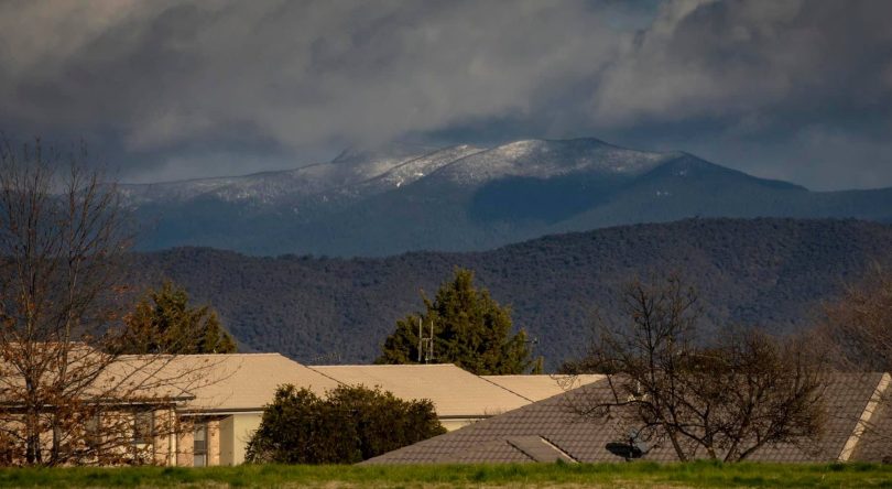
Mount Tidbinbilla dressed in snow on Friday morning. Photo: Paul Bainton.
Will it or won’t it actually snow? The Bureau of Meteorology says it’s the best chance yet this year … depending on where you are.
“Widespread snow will spread across much of NSW late on Friday and early Saturday, falling in places like Orange, Crookwell, the Barrington Tops, Blue Mountains and many other towns and communities across the southern and central tablelands of NSW,” said Bureau meteorologist Dean Narramore.
He said the snowfalls will be heaviest on the western side of the Great Dividing Range and snow will settle on the ground in large areas above 600 metres altitude.
“This will lead to numerous road closures and dangerous and hazardous driving conditions,” he said.
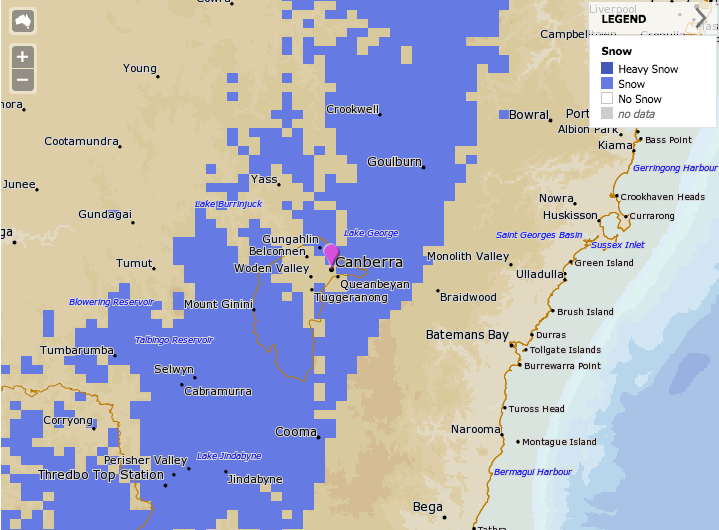
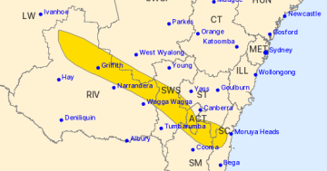
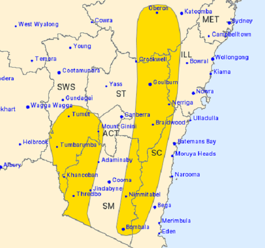
The Bureau of Meteorology forecast for snow over the Canberra area on Saturday morning. Image: BOM Met Eye
The weather system has been brewing over the past few days, with a series of low-pressure systems that have originated in the Antarctic.
Weatherzone meteorologist Ben Domensino used a somewhat less technical term of an “Antarctic blob” for the weather system.
An 'Antarctic blob' will pass over southeastern Australia between now and Sunday, causing widespread low-level snow in multiple states on multiple days. pic.twitter.com/A3BetLW6bX
— Ben Domensino (@Ben_Domensino) August 20, 2020
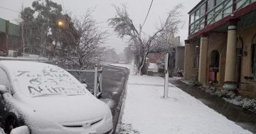
On Friday morning (21 August) there have been reports of light dustings of snow in the southern parts of Canberra and the Cotter, but Sally Dean, posting to the ACT Weather Chasers and Photographers’ Facebook page, noted that snow/sleet was falling at Corin but it was way too wet to settle.
“Wind brutal and bringing it in sideways. Would not recommend going up if you want photos,” Ms Dean advised.
The official forecast for the ACT on Saturday is a maximum temperature of just seven degrees Celsius and cloudy with a high chance of showers, most likely in the morning and afternoon and snow falling above 600 metres.
There is also the chance of a thunderstorm in the late morning and afternoon. Winds will be west to northwesterly 25 to 40 km/h. A sheep graziers warning is still current.
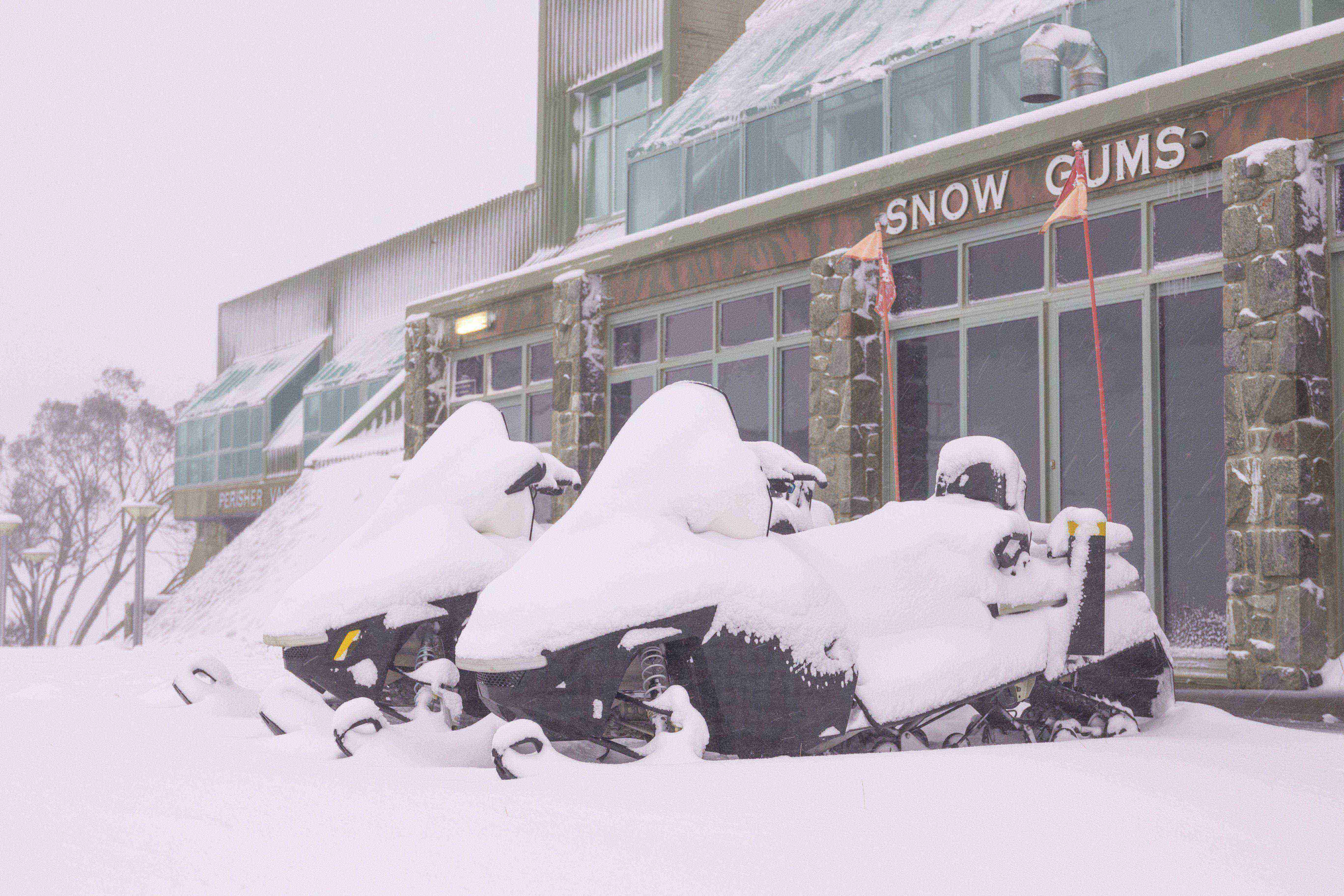
In the Snowy Mountains, the snowfields at Thredbo and Perisher have already reported big snowfalls of 25 to 40 cm over the past two days, with a further 50 to 100 cm expected to fall by the end of the weekend.
Thredbo Resort also posted the video below on Friday morning (21 August).
Another 15cm overnight ❄️ Storm total now over 35cm 👍 Village Vibes this morning ❤️
Posted by Thredbo Resort on Thursday, August 20, 2020
There have also been a number of road closures due to the wet and hazardous driving conditions.
As at 11:00 am this morning, the Snowy Mountains Highway is affected in both directions near Miles Franklin Drive due to a landslide. Motorists are being advised to reduce speed and exercise caution.
South of Canberra, the Mt Franklin Road is closed at Snowgum Carpark due to wet and slippery conditions.
Angle Crossing Road near Michelago is closed in both directions.
Naas Road at the Namadgi Visitors Centre also remains closed due to the summer’s bushfires.
Check Live Traffic for up-to-date information on road closures in NSW, and City Services for road closures in the ACT.
Original Article published by Michael Weaver on The RiotACT.