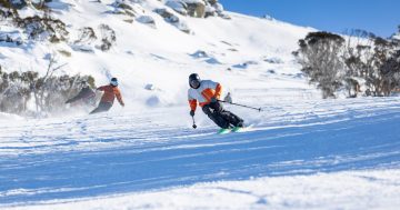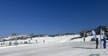
The recent snowfall is welcome news for Thredbo Resort, which is opening for skiing and snowboarding tomorrow (20 June). Photo: Thredbo.
As we get closer to the shortest day of the year, it’s fair to say winter is definitely in full swing.
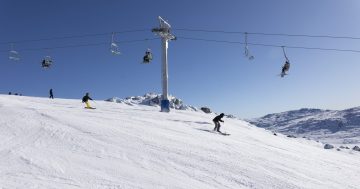
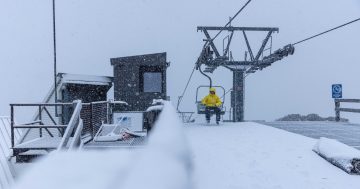
A cold front crossing the south-east of the country has already brought snow to the Alpine regions and the Snowy Mountains, with Weatherzone’s Anthony Sharwood writing on Monday (19 June) that “it’s absolutely chucking down the snow in the Australian Alps on Monday morning, with the heaviest stuff still to come this afternoon”.
“The heavy blobs of moisture on the radar, plus the follow-up of even colder air surging from the southwest makes this a weather system with serious snow potential,” he wrote.
Mr Sharwood said the light snowfall in the Snowys is intensifying, and this could be a blessing for the country’s resorts as they prepare for the school holidays.
“For all mainland ski resorts, this dump of white gold could not be more perfectly timed. After a disappointing almost snow-free June long weekend, a cold front a couple of days ago painted the slopes white with about 10 cm of snow … But this Monday’s snowfall is the real deal,” he wrote.
The recent snowfall was welcome news for Thredbo Resort, which is opening for skiing and snowboarding from tomorrow (20 June).
“The storm delivered the goods this weekend! Snow started falling all the way down to the village on Sunday morning, and it hasn’t stopped since,” Thredbo said.
“With the blizzard continuing today and blue skies expected to return tomorrow, we couldn’t be more excited to get on the slopes! And the forecast is even better … Experts are calling for up to 40 cm in the next week!”
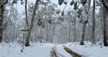
Further north, if you haven’t already, it’s time to unpack the parkas and thermals as a cold front sweeps over the Capital region, with temperatures set to be some of the lowest in 2023 so far.
The Bureau of Meteorology forecasts a low of -3 degrees Celcius on Tuesday (20 June) and a low of -4 degrees Celcius on Wednesday (21 June). On both Tuesday and Wednesday, the high is forecast at 11 degrees Celcius.
Weatherzone meteorologist Jessica Miskelly told Region “there’s a decent chance” temperatures could get lower than that, particularly on Wednesday morning.
“It could get down to -5 or -6 that morning,” she said.
It’s expected to warm up slightly at the end of the week, with a low of -1 degree forecast on Thursday and 2 degrees on Friday and a high chance of showers.
However, BOM meteorologist Helen Reid said that these conditions are “not particularly unusual” for this time of year.
“It’s not out of the ordinary, really,” she said.
Last June, the record low temperature was -6 degrees Celcius, and Ms Reid said the record low recorded at Canberra Airport is -7 degrees.
So, while it isn’t a record, she said this week’s temperatures might be worthy of an “honourable mention” and that Canberrans will definitely be feeling the chill.
“People will notice it,” she said, adding that while we will certainly be feeling cold, we will at least have the picturesque sight of snow on the mountaintops to enjoy.
“The bottom line is, make sure you’ve got some warm clothes!”
Original Article published by Lizzie Waymouth on Riotact.