The experts are predicting more snow in the coming days – just in time for a school holiday getaway. Photo: Thredbo Resort/Facebook.
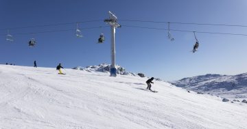
Powderhounds are looking forward to an epic weekend, with Mother Nature set to deliver a massive dump of snow in time for the school holidays.
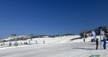
Experts are predicting about a metre and a half of snow on the higher peaks, more than doubling the natural snow depth currently on the ground.
Weatherzone metrologist Jess Miskelly said the conditions were the result of multiple cold fronts moving across NSW.
“The snow season has kicked off now, and this weekend looks particularly good if you’re keen on snow,” she said.
“When we get those double-barrel fronts, that really enhances the snow.
“The first round cools off the temperatures and then the second helps to get rid of any moisture – there’s no prefrontal rain, it just comes straight down as snow.”
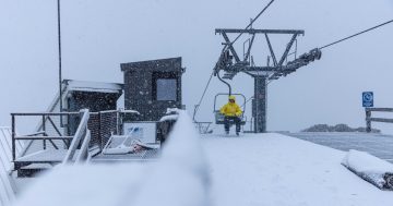
The Snowy Mountains were expected to see “decent” snowfall from Thursday to Saturday, she said.
“I’d be looking at 80 cm to a metre around some of the higher peaks overall, particularly in the New South Wales Snowys,” Ms Miskelly said.
“But in general, we’re expecting around a metre and a half of snow for the higher peaks in NSW and a little bit less for the Victorian resorts over the several days.”
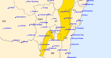
A Bureau of Meteorology spokesperson also told Region that parts of the ski fields were likely to see more than half a metre of snowfall.
Temperatures would feel “well below” zero on the ski fields, they added.
Ms Miskelly said that while early June saw little snowfall, there was more on the ground now.
“The snow season has been a bit late to get going, but now it depends on what year you compare it to,” she said.
“The latest measurement was a few days ago, and natural depth was around 110 centimetres, which is pretty much the same as it was this time last year.
“Overall, it’s not been a particularly unusual season, other than it being a bit late.”
A blizzard was also possible on Saturday, she said.
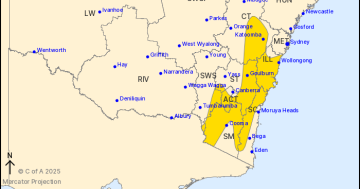
Ms Miskelly said Weatherzone was also not predicting much snow for other areas of the state, such as the Southern Tablelands and the Blue Mountains.
“All of the moisture is expected to fall west of the ranges and south towards the alpine region, but we are going to get the winds further north,” she said.
“This has been a feature of this year, actually, where we’re getting a lot of cold fronts that are delivering snow but they’re not penetrating a long way north in NSW.”
The bureau spokesperson said the winds were likely to peak on Saturday before easing on Sunday.
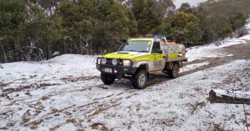
Ms Miskelly said people should be careful if they were heading out to the snow over the next few days.
“Pay attention to the Bureau of Meteorology severe weather warnings, because there’s almost certainly going to be one issued for Saturday, if not before,” she said.
“There’ll likely be blizzards on Saturday, at least, and people should be careful.
“If you are driving to the snow, be careful if you’re going through those winds because that can be a bit dodgy as well.”