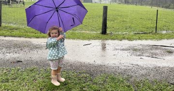
Up to 200 mm could fall on Moruya tomorrow. Photo: Kim Treasure.
UPDATED 4 pm: NSW SES Senior Manager State Operations Chief Superintendent Dallas Burnes said they expect the worst of the weather will fall within the next 24 to 48 hours.
“We’re expecting sustained rainfall across large parts of the state, and we are concerned about the potential of riverine and flash flooding,” he said.
“We’ve prepositioned assets to the areas we are most concerned about, and we’ve reached out to our interagency partners to prepare their teams should they need to stand up and assist us in our response.”
According to the NSW SES, rainfall of up to 50 mm is expected to fall today, and localised falls of up to 200 mm are possible across the South Coast, particularly at Moruya, on Wednesday (28 November).
BOM Senior Meteorologist Jonathan How said damaging winds above 90 km/h are also possible south of Moruya Heads on Wednesday, “as that low [pressure system] progresses east, rain picks up across the NSW South Coast, and then intensifies as the system continues to move out into the Tasmania Sea”.
“Conditions will ease late Thursday and into Friday,” he said.
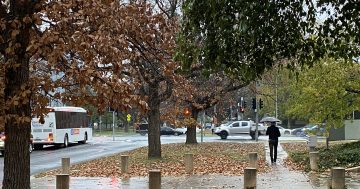
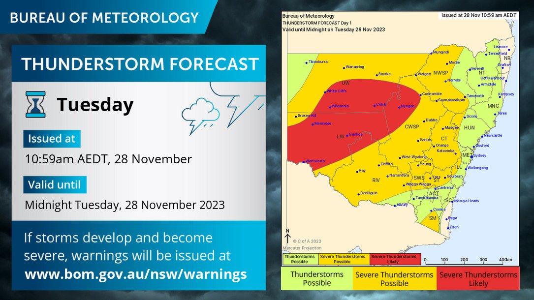
12:45 pm: Summer might be just around the corner, but that doesn’t mean this week will come with clear blue skies.
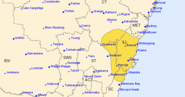
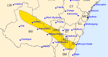
The Bureau of Meteorology issued a Flood Watch shortly after 11:30 am on Tuesday (28 November).
“A broad low pressure system is expected to bring widespread rainfall across parts of the NSW coast south of Sydney and inland Central West, with severe thunderstorms and locally heavy falls for the next few days,” the Bureau said.
“This rainfall may cause flooding along rivers in parts of the NSW Illawarra Coast, South Coastal Rivers, and parts of the Inland Central West Rivers and South West Rivers.”
Catchments likely to be affected include Moruya, Deua, Tuross, Tumut, Upper Murrumbidgee River (to Burrinjuck Dam and Cooma Creek), Queanbeyan, Molonglo and Snowy Rivers, which are predicted to face minor flooding.
The Bega River is expected to experience minor to moderate flooding.
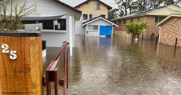
According to the NSW State Emergency Service (SES), the flooding is expected to begin from Wednesday (29 November).
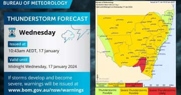
Severe thunderstorms are likely or possible across large parts of NSW and the ACT. Photo: Bureau of Meteorology Australian Capital Territory/Twitter.
Thunderstorms, including severe storms, are likely or possible for large areas of NSW and the ACT, the Bureau said.
The wet weather will be welcomed on the South Coast, where a prolonged dry spell has seen the proposed introduction of water restrictions and prompted fears of another tough bushfire season.
It will be less welcome in parts of the region where harvest has already begun, particularly with the potential for storm cells to cause severe damage to crops.
To prepare for potential flooding, the SES has advised that people should:
- Review their emergency plan for their home or business
- Plan for a possible evacuation, including what items to take
- Consider alternative travel arrangements for road and bridge closures, and if there is water over roads
- Follow signs about road closures and instructions from emergency service
- Do not drive, walk or swim in flood water
- Avoid storm drains and pipes, ditches, ravines, creeks, and rivers
- Raise assets (including waste and chemical containers) above expected flood heights
- Make sure other people are aware of the flooding risk
For emergency help in floods and storms, the public can contact their local SES Unit on 132 500, or call 000 in an emergency.