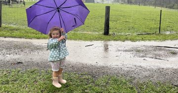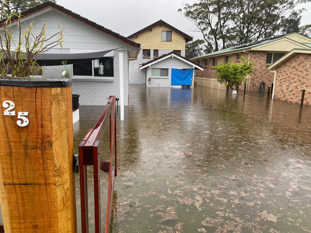
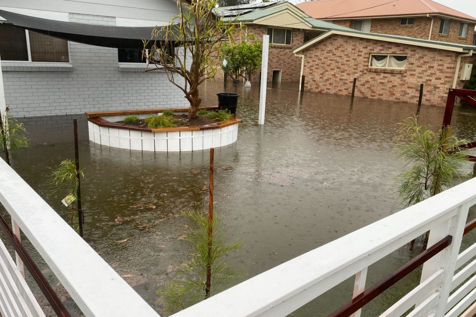
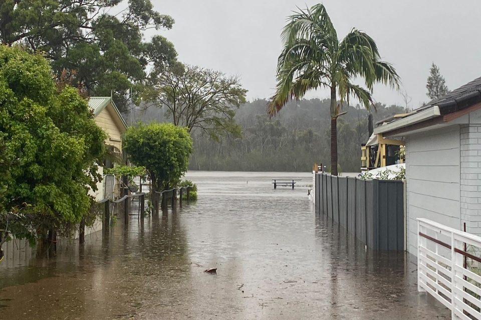
Homes around Lake Conjola are being impacted by flooding, with more rain on the way. Photo: Supplied.
Storms are rolling their way east across NSW, with heavy “locally intense” rain expected throughout the day on top of the falls already saturating the water table overnight.
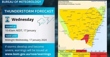
The Bureau of Meteorology (BoM) has issued a severe thunderstorm warning across much of the Riverina, Southern Tablelands, South West Slopes and Illawarra, with heavy rainfall building in the southeast and locally intense around Jervis Bay.
“Severe thunderstorms are likely to produce heavy, locally intense rainfall that may lead to dangerous and life-threatening flash flooding and damaging winds over the next several hours in parts of the Illawarra district. Locations which may be affected include Huskisson,” the BoM said.
Damaging winds and flash flooding are also possible in areas such as Wollongong, Nowra, Goulburn, Yass, Wagga Wagga and Griffith.
It comes as an upper-level low-pressure system situated over western NSW has been maintaining unstable conditions overnight. Slow-moving thunderstorm clusters are expected to continue to develop in a very moist airmass as a result, with “isolated instances” of damaging wind gusts still possible with the strongest storms.
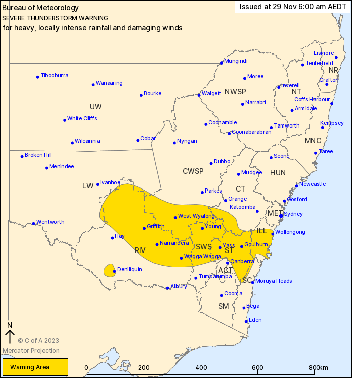
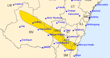
A severe thunderstorm warning has been issued for large parts of southern NSW. Photo: BoM.
A separate severe weather warning has been issued for the South Coast, where a second low-pressure centre is expected to develop near the coastline this morning.
“Rich moisture drawn to the south of this low will lead to persistent rain areas over southeastern New South Wales with some embedded heavier showers and thunderstorms,” the BoM stated.
“Strong winds may also develop just to the south of the coastal low.”
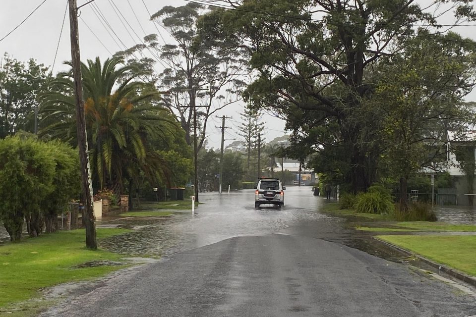
The heavy rainfall which could lead to flash flooding is already impacting northern parts of the Illawarra and South Coast, and that’s expected to spread to southern parts of the South Coast and parts of the Snowy Mountains throughout the morning.
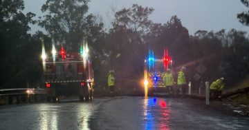
Lake Conjola is already flooding, impacting homes in the area, with a Watch and Act issued for the area.
People have been urged to keep out of floodwaters, with NSW SES already conducting two flood rescues this morning.
One incident was at South Nowra where two people were rescued from their car, while people were rescued from a home at Wrights Beach at St Georges Basin.
Six-hourly rainfall totals of 60 to 120 mm are likely, with isolated intense falls of up to 160 mm possible for areas such as Batemans Bay, Eden, Bega, Narooma and Merimbula.
Across six hours Vincentia has already recorded 154 mm of rain, while 123 mm was tipped out of the gauge at Greenwell Point.
24-hourly totals of 100 to 150 mm are also likely, with isolated falls over 250 mm possible, particularly for parts of the South Coast south of Moruya.
Damaging winds are also possible along the coastal fringe south of Moruya Heads.
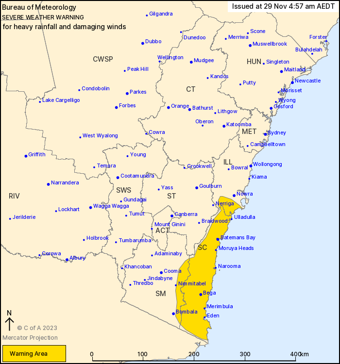
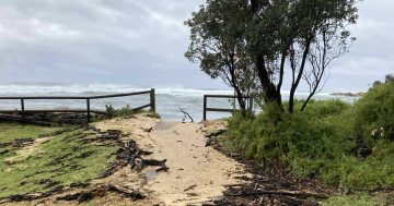
A separate severe weather warning for heavy rain and damaging winds has been issued for the South Coast. Photo: BoM.
Localised warnings will be issued if intense storms develop.
The State Emergency Service advises people should:
- Move vehicles under cover or away from trees
- Secure or put away loose items around your house, yard and balcony
- Keep at least 8 metres away from fallen power lines or objects that may be energised, such as fences
- Trees that have been damaged by fire are likely to be more unstable and more likely to fall
- Report fallen power lines to either Ausgrid (131 388), Endeavour Energy (131 003), Essential Energy (132 080) or Evoenergy (131 093) as shown on your power bill
- Don’t drive, ride or walk through floodwater
- Keep clear of creeks and storm drains
- If you are trapped by flash flooding, seek refuge in the highest available place and ring 000 if you need rescue
- Be aware that run-off from rainfall in fire affected areas may behave differently and be more rapid. It may also contain debris such as ash, soil, trees and rocks
- After bushfires, heavy rain and the loss of foliage can make the ground soft and heavy, leading to a greater chance of landslides
- Stay vigilant and monitor conditions. Note that the landscape may have changed following bushfires.
For emergency help in floods and storms, ring your local SES Unit on 132 500.