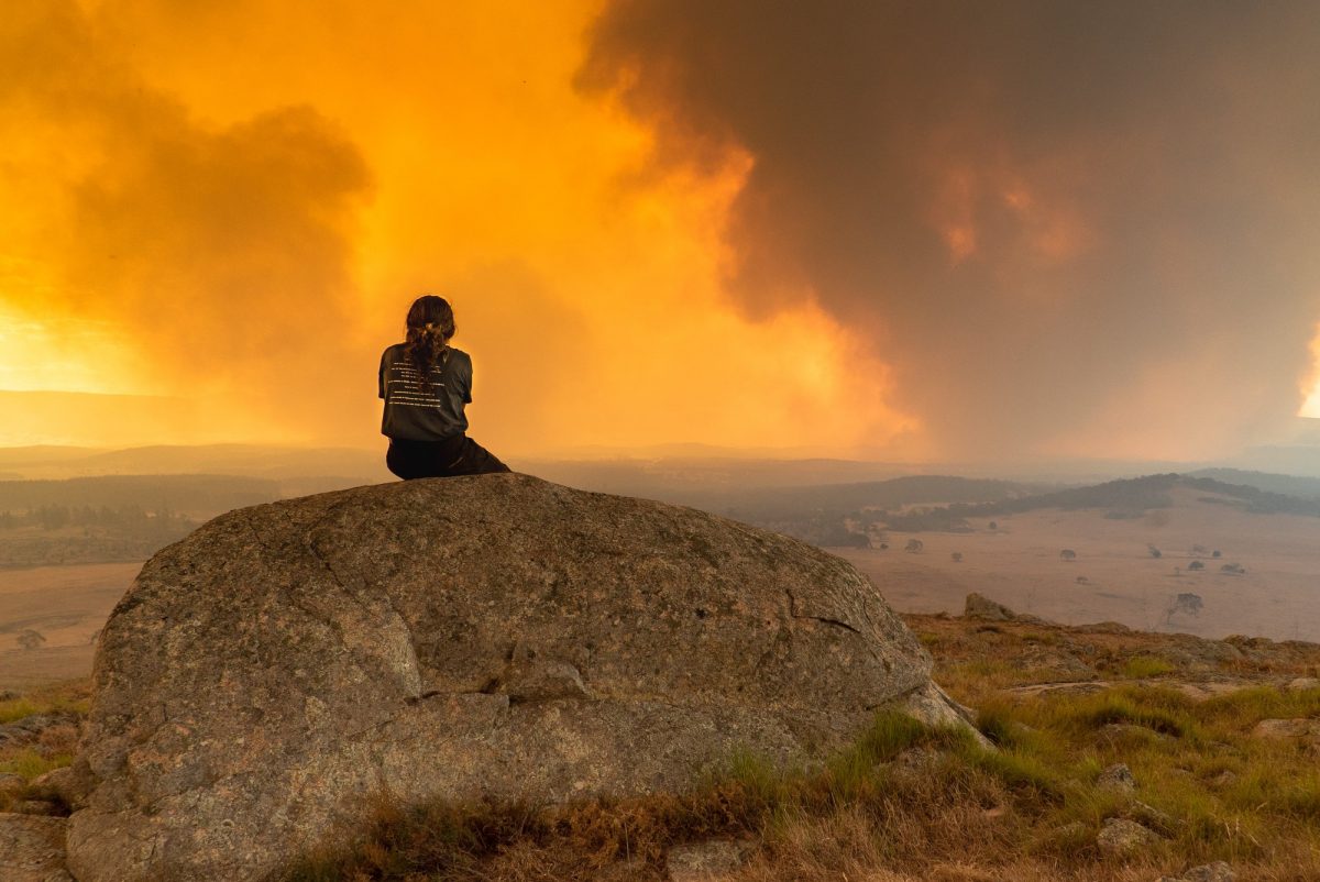
Smoke from the North Black Range Palerang fire west of Braidwood during the Black Summer (2019-20) bushfires. Photo: Jarrah Knowles.
An increase in extreme heat waves, intense heavy rainfall, longer fire seasons and sea level rise: that’s what’s been highlighted in the latest State of the Climate report.
The biennial paper released by the Bureau of Meteorology and CSIRO warned Australians would experience “ongoing changes” to the country’s weather and climate, particularly in the southern and eastern regions.
Australia’s climate has warmed by 1.47 degrees on average since national records began in 1910, while sea surface temperatures have gone up on average by 1.05 degrees since 1900.
“[We’re projected to experience a] continued decrease, on average, in cool season rainfall across many regions of southern and eastern Australia, which will likely lead to more time in drought, but with ongoing climate variability that will give rise to short-duration heavy-rainfall events,” the report stated.
“[There’s also a] continued increase in the number of dangerous fire weather days and a longer fire season for southern and eastern Australia.”
ACT Climate Change Council chair Professor Mark Howden put it in layman’s terms:
“For this part of the world, there’s not a lot of joy,” he said.
“The difference between wet and dry years is set to increase, with wetter wet years and harder, more problematic droughts.”
He said the paper showed a continuation of what had been shown in previous reports, which was that climate variability continued to increase.
This was driven in part by climate factors such as La Nina, El Nino, the Indian Ocean Dipole and the Southern Ocean influences, but risk factors as a result of climate change also played a part.
“Whether it’s rainfall variability or temperature extremes, the combination of these things is driving more fire risk,” Prof Howden said.
“It’s that combination of very hot, very dry and also very windy conditions associated with cold front intensifying.”
The report found there’s been an increase in extreme fire weather, and a longer fire season, in large parts of the country since the 1950s.
Meanwhile there’s been a decrease for south-east Australia in April to October rainfall of about 10 per cent since the late 1990s, and snow depth, snow cover and the number of snow days have decreased in alpine regions since the late 1950s.
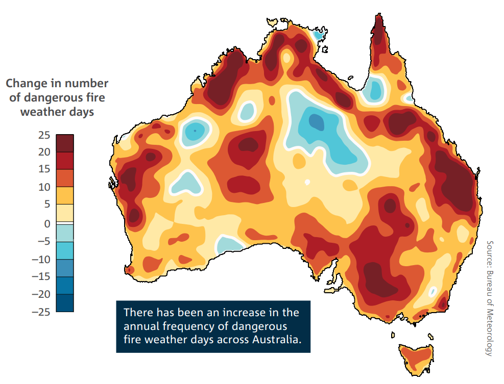
The change in the annual (July to June) number of days that the Forest Fire Danger Index exceeds the 90th percentile between the periods of July 1950 to June 1986 and July 1986 to June 2022. Photo: State of the Climate 2022.
There’s also a concerning trend around how dangerous our fire seasons are becoming.
“The frequency of dangerous fire weather days has increased significantly in recent decades across many regions of Australia, especially in the south and east,” the report said.
“There is a significant trend in some regions of southern Australia towards more days with weather that is conducive to extreme bushfires, which can in turn generate thunderstorms within smoke plumes.
“These fire-generated thunderstorms can lead to extremely dangerous fire conditions, such as during the Australian Black Summer fires (2019-20), the Canberra fires (2003) and the Victorian Black Saturday fires (2009).”
Prof Howden said this was concerning as this risk had “increased significantly”.
“These [fire storms] have gone from being something that wasn’t largely reported to now becoming a common occurrence, so that’s reason to be concerned,” he said.
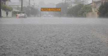
The report found heavy rainfall events – which occur in less than a day – are becoming more intense, with the duration of short (hourly) extreme rainfall events increasing in some regions by 10 per cent or more.
This was because the warmer the atmosphere, the more water it could hold.
“This relationship alone can increase moisture in the atmosphere by 7 per cent per degree of warming, all other things being equal,” the report stated.
“This can cause an increased likelihood of heavy rainfall events, even in parts of Australia where average rainfall is expected to decrease.”
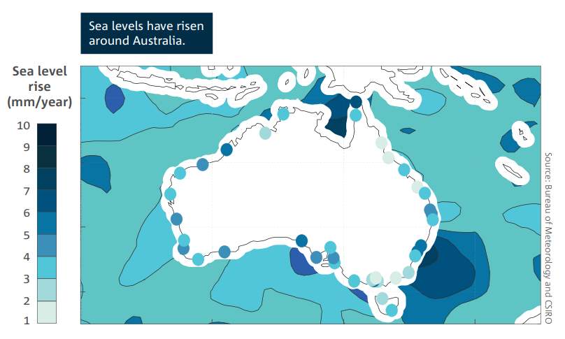
The rate of offshore sea level rise around Australia measured using satellite altimetry from 1993-2020. Photo: State of the Climate 2022.
Sea levels are also rising, which has increased the risk of inundation and damage to coastal infrastructure and communities.
Based on observations since 1993, the rates of sea level rise to the north and south-east of Australia have been “significantly higher” than the global average.
“We’re also seeing more wave energy, which means they are stronger and have more erosion power,” Prof Howden said.
But it shouldn’t be all gloom and doom.
Prof Howden pointed to the ACT’s efforts as a global leader in both climate policy and action to reduce greenhouse gases.
He also said we needed to start adapting to the changes we’re seeing.
“We need to stop building in problematic zones for fires and floods, build infrastructure suited to the environment and change social practices as the climate changes,” Prof Howden advised.
“We have to be worried, but we also have to be hopeful.”
Original Article published by Claire Fenwicke on Riotact.