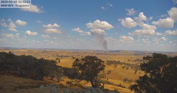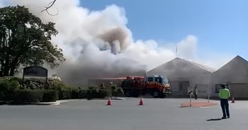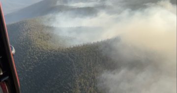
Pyrocumulous smoke clouds over Monga seen from Reidsdale. Photo: Caitlin Maher.
Prompted by severe weather conditions and the threat that fires will join up, a Section 44 state of emergency has been declared on the Far South Coast.
The state of emergency allows the NSW Rural Fire Service to bring in additional resources, and an incident controller oversees firefighting efforts across major fires in the area.
While the huge Currowan and Charley’s Forest Fires are creeping north towards the Southern Highlands towns of Wingello, Bundanoon and Kangaroo Valley, the southern flank of the fire has been renamed the Clyde Mountain Fire and is burning through the Monga National Park.
The Clyde Mountain Fire is now under the control of the Eurobodalla RFS. Marty Webster from the Eurobodalla RFS says “communities need to be prepared that we may not be able to hold them over coming days”.
On Monday morning the Bureau of Meteorology issued a Severe Weather Warning for damaging winds across the South East from a cold front.
For areas below 1900 metres, winds averaging 60 to 70 km/h with peak gusts in excess of 90 km/h are possible for the Snowy Mountains, and parts of the Australian Capital Territory, South Coast and Southern Highlands from late Monday night or early Tuesday morning.

A containment line in the Southern Monga National Park. Photo. Alex Nicol
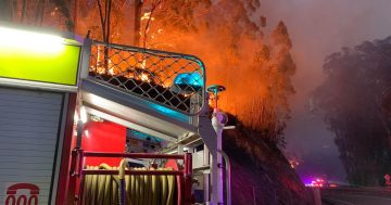
Overnight there was an increase in fire activity to the east of Tudor Valley Road, off the Kings Highway, and crews are working to extinguish hotspots and conduct property protection.
The fire is putting pressure on containment lines which have been bulldozed through Tudor Valley Road and up to Monga Lane. The containment line is being extended to the Sawyers Ridge Road above the Araluen Valley.
Residents in the Tudor Valley area have been warned that that “the front has a mind of its own and can send out embers anytime irrespective of the wind direction”.
The out of control Clyde Mountain Fire is burning to the south of the Kings Highway in the Clyde Mountain area and is more than 3,500 hectares in size. Marty Webster from the RFS says “this fire will burn north during the day in inaccessible country”.
Resident in the areas of Nelligen, Buckenbowra, Mogendoura and Runnyford, Batemans Bay, Mogo and villages to the east have been told to monitor conditions.
The Araluen Road, Deua River Valley Fire, burning approximately 10 km north-west of Moruya, is more than 100 hectares in size and is being controlled. The fire is burning in the Wandera State Forest and Monga National Park in the Deua River Valley.
Assisted by heavy plant machinery and waterbombing aircraft, crews are working to strengthen containment lines and slow the spread of the fire. In difficult terrain and bad weather conditions, the RFS is steering it around assets in some locations, rather than stopping it. Aircraft are available but extremely thick smoke has limited their use.
The RFS had hoped to hold it on Knowles Creek Fire Trail but the fire has already breached the trail this morning. These fires could impact coastal areas over coming days.
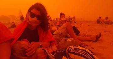
Low-lying areas around Batemans Bay and Moruya are likely to experience significant smoke. Ash was falling in Moruya on Monday morning.
People in the area of the Deua River Valley, Mogendoura and Buckenbowra are advised to monitor conditions and follow your bushfire survival plan, and know what you will do if the fire threatens.

Tourists in the smoke at Moruya. Photo: Alex Rea.
Further west, another bushfire is burning in the Badja Forest Road, Countegany area. The fire increased from 1,000 ha to 2739 ha in size overnight and is out of control.
The fire has crossed into the Wadbilliga National Park and is spreading to the east. The fire has crossed the Tuross River and is burning in terrain that is difficult to access. This fire has the potential to spread rapidly towards areas to the east.
If you are in the area of Yowrie, Wandella, Tinpot and Murrabrine, monitor the changing conditions. Activate your bushfire survival plan. Know what you will do if the fire threatens. If your plan is to leave, leaving early is the safest option.
If you are in the area of Cobargo, Verona and Upper Brogo, monitor the conditions. If your plan is to leave, leaving early is the safest option. Follow your bushfire survival plan and know what you will do if the fire threatens.

Looking south on the containment line adjacent to Princes Highway south of Batemans Bay. Photo: Alex Rea
Enormous containment lines have been bulldozed to protect towns and critical assets.
Temperatures in the high-30s and north-west winds at Braidwood, and slightly cooler temperatures with northeast winds on the coast, mean that the area will be affected by thick smoke until the southeasterly arrives on New Year’s Eve, bringing a new set of risks.
To stay up to date on bushfires in your area call the NSW RFS Bush Fire Information Line on 1800 679 737 or check the NSW RFS website. For road reports and updates visit Live Traffic NSW.
Use the Register.Find.Unite service to register your location, and find and reunite with family, friends and loved ones after an emergency.


