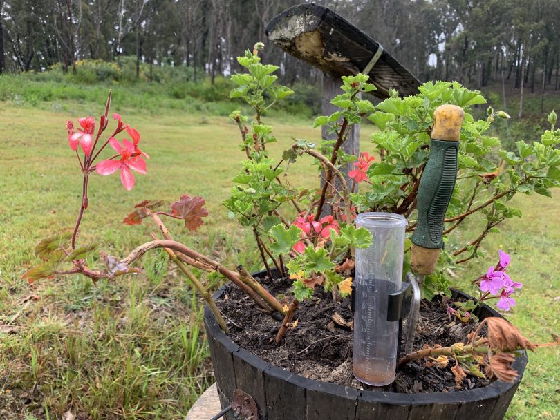
Not much rain’s in the gauges on the South Coast yet, but up to 15 mm is expected to fall on Sunday. Photo: Kim Treasure.
UPDATED 4 November, 12:45 pm: The Bureau of Meteorology (BOM) has updated its weather forecast for the next few days and a lot more rain is on its way. Some regions may even experience more rain in the next two days than they saw in all of October.
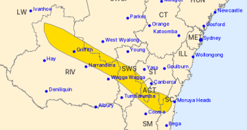
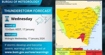
Widespread showers are expected across inland and southeast NSW today (4 November), with possibly severe thunderstorms heading towards inland NSW.
Southeast NSW is expected to receive further rain on Sunday and Monday.
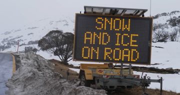
The Snowy Mountains will see most of its rain today, with 30 to 55 mm expected in the region. There will also be heavy rain on Sunday when 10 to 25 mm is forecast.
The Eurobodalla region can expect most of its rain on Sunday when 8 to 15 mm could fall.
Wagga Wagga will have a chance of thunderstorms today with 20 to 35 mm of rain expected in the region.
Rain can be expected consistently until Wednesday, with maximum temperatures in the mid-to-high 20s from Saturday.
On the Southern Tablelands, expect 15 to 25 mm today, up to 15 mm on Friday and as many as 20 mm on Sunday.

Long periods of rain are expected in some areas across NSW and the ACT. Photo: Sally Hopman.
3 November, 3:30 pm: With the fire season upon us and the bush starting to dry out, welcome rain is set to return to much of southern NSW tomorrow (4 November), with long periods of rainfall likely in southeast NSW and the ACT.
Showers and thunderstorms currently hitting western NSW are expected to begin heading east on Thursday, where they will likely stay through Monday.
The showers are expected to be reasonably frequent and could merge, creating long periods of rain. Rain totals are likely to be highly variable across the different parts of regional NSW and the ACT. Some areas are likely to experience large amounts of rain while others may have very little.
Severe thunderstorms are on the horizon throughout western NSW on Wednesday and Thursday, but are viewed as less likely as the rain heads to eastern NSW.
On Thursday, widespread showers are expected across inland and southeast NSW, with possibly severe thunderstorms heading towards inland NSW.
Southeast NSW is expected to receive further rain over Sunday and Monday.
The Snowy Mountains will see most of its rain on Thursday, with 20 to 35 mm expected in the region. There will also be heavy rain on Sunday when 10 to 20 mm is predicted.
The Eurobodalla region can expect most of its rain on Sunday when 6 to 15 mm could fall.
Wagga Wagga will have a chance of thunderstorms on Thursday with 20 to 35 mm of rain expected in the region. Rain can be expected consistently until Monday, with maximum temperatures in the high 20s from Saturday.
On the Southern Tablelands, expect 15 to 25 mm on Thursday, with rain consistently around the 10 mm range.