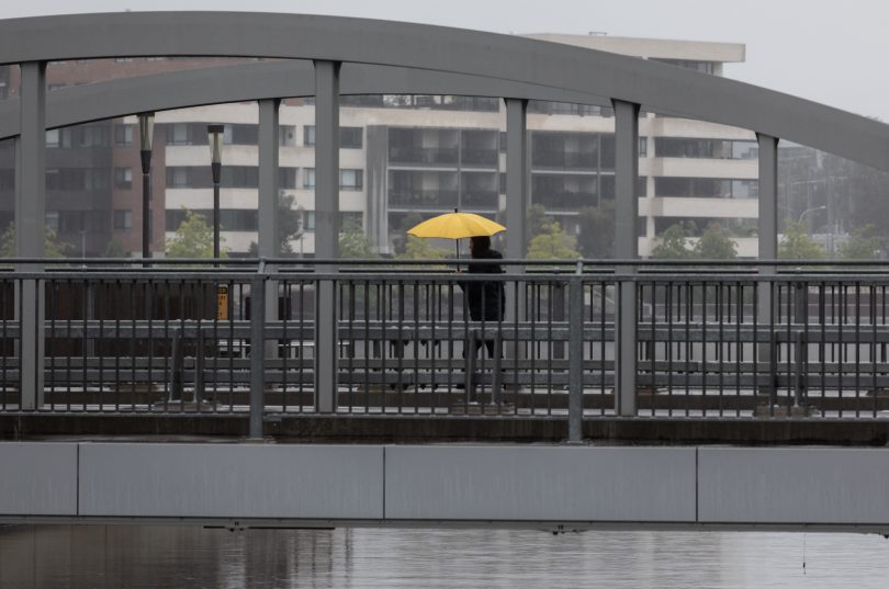
Hope you packed your umbrellas! Photo: Michelle Kroll.
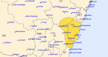
The weather system that’s causing havoc on the NSW Mid North Coast is drifting southwards today (22 May), bringing moderate to heavy falls to much of southern NSW and the ACT.
The focal point of the deep surface low-pressure trough, which has been largely stationary, will shift, reaching the Illawarra and South Coast areas by tomorrow.
Bureau of Meteorology senior meteorologist Dr Helen Reid said while the rainfall totals aren’t expected to be as devastating as up north, flash flooding is still a possibility.
“We’re still looking at that 50 millimetre range for much of the southern NSW and Canberra area, and some helpful rainfall for western parts of the ranges,” she said.
“Some of that rain could fall quite quickly, so there is the potential for flash flooding, but we’re not expecting the riverine flooding that’s being experienced further north.
“At this stage, while it will be wet, rainfall totals for the South Coast will not be as massive as we’ve seen so far for the Mid North Coast.”
Canberra and the Riverina area could see rainfall totals between 30 and 40 millimetres, while the Illawarra and South Coast areas could pick up 50 millimetres.
Rainfall is expected to ease for the Riverina on Friday (23 May). However, Canberra and the south-east slopes are forecast to receive between 40 and 50 millimetres of rain, and the coast is forecast to receive up to 70 millimetres.
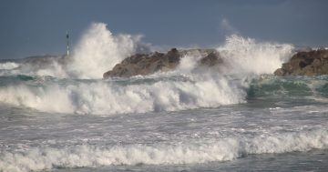
Winds, surf and swell are also increasing along the coast.
“Tomorrow we’re expecting hazardous surf to be a concern along the South Coast,” Dr Reid said.
“We are expecting the rain and wind to clear the South Coast later on Friday and into Saturday.”
A hazardous surf warning has been issued for the Illawarra, Batemans Bay and Eden coastal areas.
The system is expected to clear by Saturday (24 May). The focus will then shift to a strong cold front with a frigid airmass emerging from Antarctica.
Dr Reid said while there wasn’t as much rain expected in this system, it could bring a dusting of snow to the Alpine peaks.
“The Brindabellas might get a white blanket as well,” she said.
“You will feel the effects of the colder air and it will be windy.”
The freezing system is expected to hit southern NSW and Canberra on Monday (26 May), which leaves plenty of time for the situation to change.
“Watch this space”.
Original Article published by Claire Fenwicke on Region Canberra.