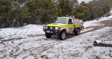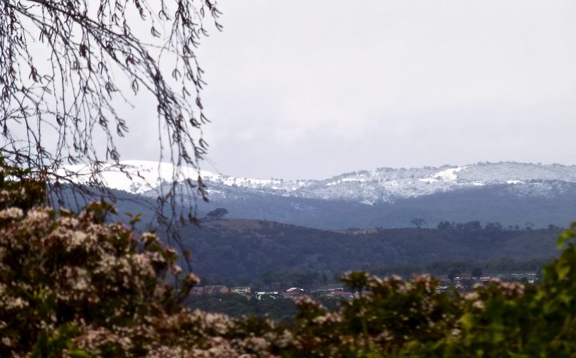
Mountain ranges to the east of Queanbeyan covered in snow last winter. Photo: Region Media.
It’s time to get the electric blanket and winter woollies ready as a cold, wintry blast brings the first dusting of snow to the Brindabella Range and Snowy Mountains this week.
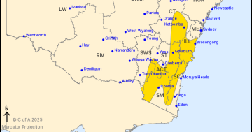
A strong cold front is currently south of the Bight and will reach NSW and the ACT today (29 April) before moving through central and eastern areas of NSW tomorrow.
This system is expected to bring widespread rain to the southern and central inland, followed by a significant wintry blast as a deep low develops near Tasmania.
By Sunday, the front and low should lose influence as they move to the east and are replaced by a new high-pressure system drifting across south-east Australia.
Bureau of Meteorology meteorologist Helen Kirkup told Region Media while it is too early to issue warnings, a severe weather warning for strong winds and a sheep graziers alert are likely to be issued today.
“It is a significant cold front which will bring strong winds, rainfall and the potential for snow after the front pushes through the region,” Ms Kirkup said.
As the cold airmass behind the front moves over the Snowy Mountains, the rain will tend to snow, most likely tomorrow afternoon in Victoria and Tasmania, and during the evening in NSW and the ACT. Winds are likely to be powerful as the front passes, with a high chance of blizzards for higher elevations.
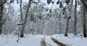
Snow is forecast to fall above 900 metres in the Snowy Mountains and the Brindabellas.
A flood watch for minor to moderate flooding has already been issued for the Tumut River.
Dust off your winter woolies! A rainband and strong front will cross southeast Oz, with potential for heavy rainfall and severe storms. Max temps will drop 8 to 14 degrees below the April average by Thursday. Wind, small hail and snow to low levels too ☔https://t.co/4eDbX7NqIF pic.twitter.com/YaDFUuJvHI
— Bureau of Meteorology, Australia (@BOM_au) April 28, 2020
Up to 25 mm of rain is forecast to fall in Canberra today, with a further 30 mm tomorrow before temperatures plummet as the first real blast of winter envelopes the region.
Canberrans will face a maximum of just 7 degrees Celsius on Friday with the possibility of small hail and northwesterly winds of between 25 and 35 km/h.
“West of the ranges, we should see more significant rainfalls of up to 50 mm and Mt Ginini is likely to catch quite a lot of that rain and the ACT will be in the typical rain shadow,” Ms Kirkup said.
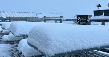
“Thursday’s rainfall will still be widespread, and we add to that the concept of snow on Thursday night and into Friday below the 1000 metre mark.”
Ms Kirkup said there should be some reasonable snowfalls in the Alpine areas and around Cabramurra, Mt Selwyn and Mt Ginini. A dusting of snow should be visible on the Brindabella Range on Friday morning.
“The rain will be ahead of the cold front and it’s going to be tricky to see how much snow there is, depending on how much moisture there is once it cools down. We may even see some snow in the Goulburn and Crookwell area.
“It’s quite a widespread blast of cold air and Canberra is looking to be very cold for the first day of the month of May. Once the rain has cleared, there will be some frosty temperatures over the weekend.
“Heaters usually go on after Anzac Day, so this is pretty much on schedule. We can definitely categorise this as the first blast of winter,” Ms Kirkup said.
Original Article published by Michael Weaver on The RiotACT.