Great weather for ducks. Even our feathered friends are looking to come inside to escape the cold snap. Photo: Kim Treasure.
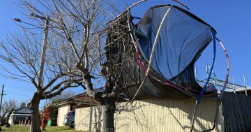
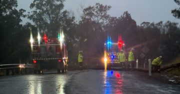
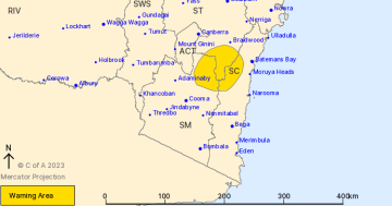
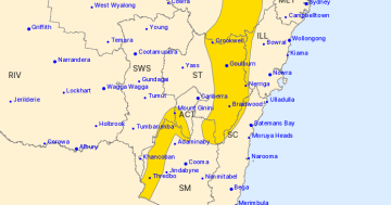
South Coast residents are battening down the hatches in the face of a strong cold front which is expected to generate near gale force winds and damaging surf this afternoon (24 August).
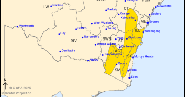
Winds averaging 60 to 70 km/h and peak gusts above 90 km/h are forecast along the coastal fringe from Sydney to the South Coast from the late afternoon onwards. On Wednesday morning, the winds are expected to gradually ease below gale or damaging wind thresholds as the low slowly tracks to the Tasman Sea.
The cold front, which has seen temperatures plummet from summer-like conditions over the weekend and Monday to less than 10 degrees on the South Coast today, is forecast to move offshore this afternoon. A transient low-pressure system will form within the front, deepening off central coastal waters late today and generating vigorous winds and sea over central and southern waters.
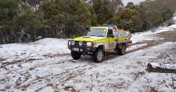
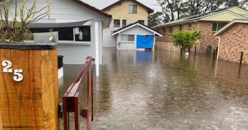
It brings with it much-needed rain for the region but also the potential to uproot trees already weakened by bushfires and drought.
Despite it being off-season, Surf Life Saving NSW club call-out teams, Duty Officers and surf rescue assets are on standby to respond to critical coastal incidents as the wild weather system whips up seas.
Waves are expected to reach five to six metres along the South Coast, leading to localised damage and coastal erosion.
The damaging surf is likely to continue through Wednesday, with surf zones exposed to the south and southeast at the highest risk. Beach conditions in these areas could be dangerous, and people are advised to stay well away from the surf and surf exposed areas.
Surf Life Saving NSW is urging the public to exercise caution when visiting the coastline, with the severe weather conditions expected to peak on Wednesday morning.
Conditions will be hazardous for any coastal activities.
“These conditions have the potential to cause high winds which can be dangerous for … surfing and swimming,” SLSNSW Director of Lifesaving Joel Wiseman said.
“With the current COVID environment, our resources aren’t committed to actively patrolling until mid-September, so if you take a risk and find yourself in trouble, there could be a delay in response in getting emergency services to the scene.
“People are strongly urged to check BeachSafe and understand your limitations if you do decide to take a risk.”
The State Emergency Service is also advising people to:
- Move vehicles under cover or away from trees.
- Secure or put away loose items around your house, yard and balcony.
- Keep at least eight metres away from fallen power lines or objects that may be energised, such as fences.
- Report fallen power lines to either Ausgrid (131 388), Endeavour Energy (131 003), Essential Energy (132 080) or Evoenergy (131 093) as shown on your power bill.
- Stay vigilant and monitor conditions. Note that the landscape may have changed following bushfires.
For emergency help in floods and storms, ring your local SES Unit on 132 500.