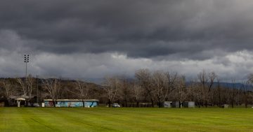
A wintry chill will be felt across much of southeast NSW and the ACT this weekend. Photo: Andre2013.
A wintry blast is on the way this weekend, sending temperatures across much of the Capital region and southeast NSW plummeting.
While Friday (16 May) is looking relatively mild, the Bureau of Meteorology has flagged a cold front moving across the country late in the day is expected to bring the “coldest weekend of the year – so far”.
“There’ll be a wintry blast coming through with this cold front, and it will definitely be felt by Australians in the country’s southeast as a very chilly weekend,” senior meteorologist Miriam Bradbury said.
“The daytime temperatures will drop to 2 to 5 degrees below the May average on Saturday and Sunday, as cold southerly winds move in behind the front.
“Moderate to fresh southerly winds behind the front will make the feels-like temperatures even more wintry.”
Canberra’s expected to go from a high of 18 degrees on Saturday (17 May) to just 13 on Sunday (18 May).
Towns at higher altitudes will be even colder, with Braidwood dropping from 15 degrees on Saturday to 10 degrees on Sunday, and Jindabyne expecting a top of just 6 degrees on Sunday.
It might be tempting to head to the coast to escape the cold, but it will see its own weather changes.
A coastal low-pressure trough is expected to develop and deepen on the NSW coast into Sunday.
“This will push showers, strong to possibly damaging winds and hazardous surf conditions onto the coast,” Ms Bradbury said.
“We may see a low-pressure system developing along that coastal trough, and the location, development and movement of this system will directly influence the rainfall totals and the impact along the coast, so it’s important to keep up to date with that situation.”
Rainfall totals above 15 millimetres are possible across much of the NSW coast, but localised totals could be higher.
The winds could also cause coastal erosion and dangerous driving conditions due to the possibility of falling tree limbs and other debris.
The temperature change won’t be as severe, though. Bermagui can expect a top of 19 degrees on Saturday before peaking at 15 degrees on Sunday.
Similar conditions are expected for Merimbula and Eden, while Wollongong’s high of 21 degrees on Saturday is expected to drop to 17 on Sunday.
The cold change also won’t be as severe on the western side of the ranges, with much of the Riverina staying in the mid to high teens throughout the weekend.
A high-pressure system will move in fairly quickly behind the cold front, stabilising conditions.
Original Article published by Claire Fenwicke on Region Canberra.