The Curraweela fire is believed to have started at around 11 am. Image: RFS Facebook.
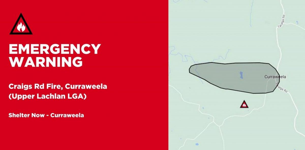
The Rural Fire Service (RFS) has deployed more than 80 firefighters and three aircraft, including a large air tanker (LAT), to a fire burning at an emergency level through grassland near Curraweela northeast of Canberra.
Believed to have started just after 11 am in hot temperatures, the fire was fanned by 50 km/h winds and reported to have expanded to an area of 254 hectares by 3 pm. It’s understood the fire has destroyed three structures, believed to be sheds, and was burning through grassland towards Jerrong Rd.
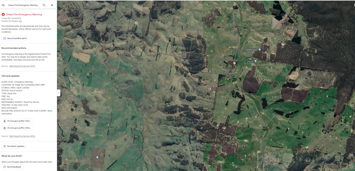
A satellite image of the Curraweela fire area, 35km NE of Crookwell. Image: Google Earth.
They added that at least three homes were under threat in the Taralga Road, Old Station Creek Road and Craigs Road area and that people living between Craigs Road and Jerrong Road had been told to shelter in place as it was too late to leave.
An RFS report issued at 3:45 pm said homes were being impacted in the area of Craigs Road and Taralga Road and that firefighters and aircraft were working to slow the easterly spread of the fire.
Original Article published by Andrew McLaughlin on Riotact.