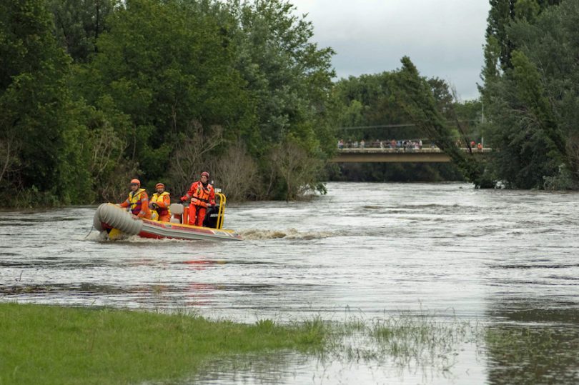
Emergency Services workers survey the scene along the Queanbeyan River during the flood of 2010. Photo courtesy Queanbeyan – City of Champions by Nichole Overall.
With two major river systems at Queanbeyan’s doorstep, the extent of a one in 100-year flood event is being assessed in an important step towards reducing the impacts of flooding in the area.
While rain patterns so far this year are leaving many wondering when the next decent falls will arrive, that sinking feeling of a significant flood is now part of a draft plan to define flooding patterns and flood levels in Queanbeyan under present-day conditions.
The Queanbeyan Floodplain Risk Management Study and Plan recommends a number of measures that will, over time, reduce the social, environmental and economic impacts of flooding in Queanbeyan.
Queanbeyan borders two significant river systems; the Queanbeyan River which runs through the centre of the city, and the Molonglo River which flows to the north and adjacent to Oaks Estate, one of the first areas to be affected by flooding in the area.
Queanbeyan-Palerang Regional Council (QPRC) Mayor Tim Overall said Council will hold a community information session on 27 August from 6:30 – 8:30 pm at the Riverside Clubhouse, 16 Carinya Street, Queanbeyan for residents interested in the plan.
“Many of us saw firsthand the damage and disruption caused by the most recent significant flood in Queanbeyan in 2010,” Mayor Overall told Region Media.
“Council is also acutely aware of the flood in the 1970s and the importance of planning to reduce the impact of floods and also planning for response measures when they do happen.”
The plan, jointly funded between QPRC and the Department of Planning, Industry and Environment, includes a review of the 2008 draft Flood Study and Plan of Queanbeyan, which was drafted but never finalised.
The plan shows the extent of flooding in a one in a 100-year storm along Queanbeyan and Molonglo Rivers, as well as the extent of the largest flood that could conceivably occur in Queanbeyan every 500 years.
The plan will also review the existing flood warning system.
There are also scenarios for a 10 per cent and 30 per cent increase in rainfall and the effect on flooding patterns, as well the potential impact of urbanisation on local catchment flooding patterns in the vicinity of the Queanbeyan CBD.
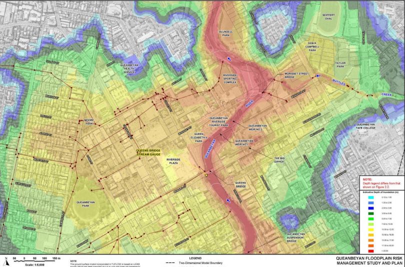
This model shows the extent and depths of a flood in Queanbeyan.
During the flood of December 2010, more than 100 millimetres of rain fell, with the Queanbeyan River peaking at 8.4 metres. The flood closed Queens Bridge in the city’s CBD and was significant enough to isolate Queanbeyan from the neighbouring towns of Bungendore, Captains Flat and Sutton.
The flood was described as being equivalent to a one-in-20 year event, with about 100 houses and businesses evacuated and power cut in a number of suburbs.
Significant floods also occurred in 1974 and 1976. According to the Queanbeyan and District Historical Museum Society, the 1976 flood saw the half-completed Googong Dam at risk of collapse with the potential to inundate low lying parts of Queanbeyan and Canberra. The Queanbeyan Cemetery is also reported to have flooded, with scores of bodies washed downstream, allegedly even into Lake Burley Griffin.
In 1974, the Queanbeyan River peaked at 8.88 metres during floods that inundated most of NSW. The same flood saw the Molonglo River gauge at Oaks Estate peak at 10.3 metres.
The Queanbeyan Museum shows the first significant flood after European settlement in Queanbeyan was in 1851. Two more floods followed in 1852 and again in 1861 and 1870. Further significant floods were recorded in 1891, 1910, 1922, 1925, 1952, 1974, 1975 and 1976. The most recent flood was a six-metre flood in June 2016.
The Queanbeyan Floodplain Risk Management Study and Plan is available for comment online at yourvoice.qprc.nsw.gov.au until 20 September.
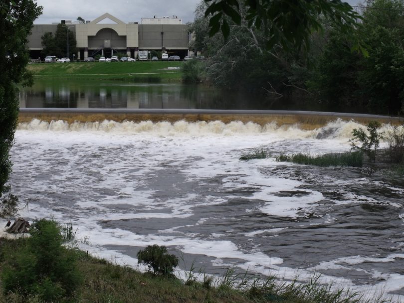
Floodwaters from the Queanbeyan River overflow across the Queanbeyan weir in 2010. Photo courtesy Queanbeyan – City of Champions by Nichole Overall.
Original Article published by Michael Weaver on The RiotACT.

