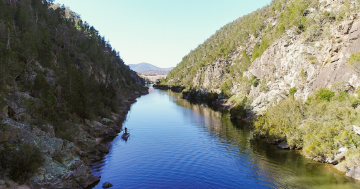
Cotter River has been a feature of life in the region for thousands of years. Photo: Marg Wade.
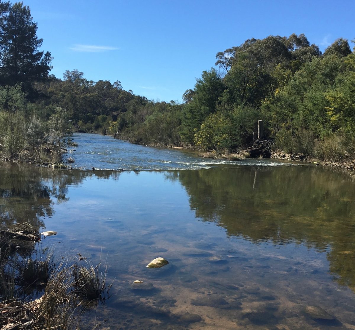
Spring is upon us. Time to enjoy the warmer weather and the recreational areas along the Murrumbidgee River Corridor. Flowing within the ACT is 66 km of the Murrumbidgee River from Angle Crossing in the south to Uriarra Crossing in the north, offering access to swimming areas, picnic facilities, nature reserves and walking trails. The area has long been popular with Canberrans.
Rich in Aboriginal history, the area was a vibrant food source and meeting place for the local traditional owners and a place of celebration. Each spring, bogong moths would travel their annual route from their breeding grounds in northern NSW and south-east Queensland to rest out the summer in the cool rock crevices in the Australian Alps.
Uriarra was a gathering site of local tribes, with hundreds of visitors coming for the bogong moth feasts. Highly nutritious and rich in energy, protein and fat, the nutty-tasting moths were enjoyed roasted or mashed into a ‘moth meat’. They were an important part of the Aboriginal diet.
During this time, marriages would take place, corroborees were held, along with the initiation of young men and trade. Sadly, moth numbers have dwindled over recent years. Many Canberrans would remember Parliament House being an attraction not only for tourists but also for countless swarms of moths because of its bright lights. Bogong moths are a key food source for the critically endangered mountain pygmy possum and other animals such as frogs and reptiles. The moth’s declining numbers are having a dramatic effect on their numbers, too.
Cotter River, within the Murrumbidgee River Corridor, is named after Garret Cotter, a convict who had been transported to the colony of NSW. In 1832, he was banished to “beyond the limits of location” after an altercation with a policeman following an allegation he stole a horse. Today, Cotter’s descendants are keen for the area to be renamed to reflect its Aboriginal heritage.
Our third Prime Minister, John Christian ‘Chris’ Watson, was a keen fisherman who frequented the waters of the Murrumbidgee River Corridor. In 1907, along with Queanbeyan newspaperman John Gale, he took a party of parliamentary mates on a fishing expedition. Here they talked and fished, espousing the benefits of choosing this area to establish the capital city of our newly federated nation. It could be said that the waters of the Murrumbidgee River Corridor turned the tide and influenced the selectors to choose Yass-Canberra as the location for the new Federal Capital Territory.
The Cotter River Catchment forms part of Canberra’s water supply. Cotter River holds three storage reservoirs – Corin, Bendora and Cotter. Much of the catchment runs through Namadgi National Park, so it is largely protected from pollutants associated with populated areas.
Even with its clean waters, the Cotter’s drinking water was blamed for a dysentery outbreak in 1953. Referred to as the ‘Canberra wog’, the outbreak was so significant that a Parliamentary Standing Committee conducted a public review in 1954.
It concluded that the illness had affected people living in Canberra’s hotels and hostels. The Director General of Health, Arthur Metcalfe, declared at the time, “Usually it is associated with a cook or an attendant who has been a bit careless in getting his motions mixed up with the customer’s food”. Oh dear.
The original concrete Cotter Dam built to provide Canberra’s water was completed in 1915. Its height was increased in 1951 to cater for a growing city, and again more recently between 2009 and 2013. This new 83-metre-high roller compacted concrete dam wall has increased the water capacity to almost 20 times the original size.
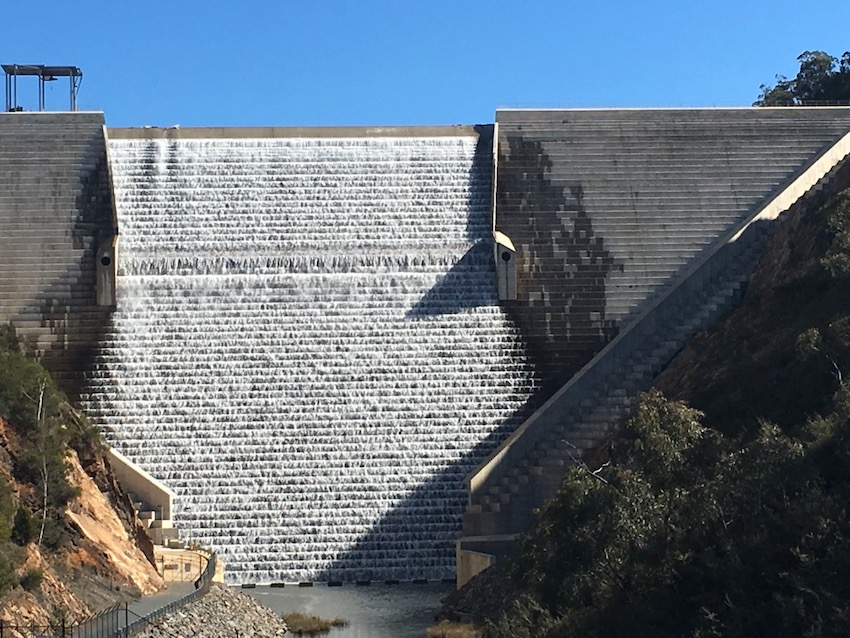
Water flowing over Cotter Dam in 2016. Photo: Marg Wade.
A camp was established at the Cotter River for workers building the original dam and the Cotter River Public School opened in a tent in 1914. A suspension bridge (known as the swing bridge), houses, a kiosk and the Cotter Pub (built in 1971) were all additions to the area.
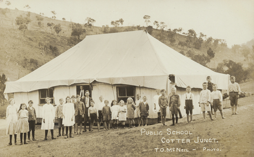
Cotter River Public School opened in a tent in 1914. Photo: Canberra & District Historical Society (23221).
In 1976, the Cotter River hosted Canberra’s very own back to nature, alternative thinking festival, ‘Confest’. Organised by former Deputy Prime Minister Dr Jim Cairns, his private secretary Junie Morosi and David Ditchburn, this festival of alternative thinking and consciousness-raising sought to find the true nature of man and woman. The festival attracted 10,000 people.
Today, the many areas of the Murrumbidgee River Corridor provide opportunities for picnics, swimming, sightseeing, bushwalking and camping. Mountain bikes are permitted on all the fire trails. Wildlife abounds, particularly in the early morning and late afternoon, and eagles and falcons soar overhead.
The Murrumbidgee River Corridor is rich in history and, with its beautiful waters, is bound to attract growing numbers of visitors as the weather starts to warm.
Visit Parks ACT to find out more.
Original Article published by Marg Wade on Riotact.