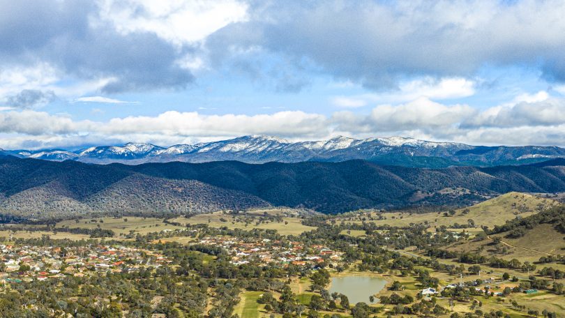
The snow-capped Brindabellas last weekend, taken from Kambah with the Murrumbidgee Golf Course in the foreground. Photo: Terry Cunningham.
Just in case you missed all the snow action last weekend, there is an encore performance being forecast, with more snow set to blanket the region on Sunday and Monday.
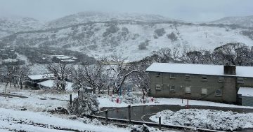
Last weekend saw many hit the road to get a glimpse of snow at such low levels, the road to Corin Forest near Canberra took on the feel of peak hour on Northbourne Avenue. AFL fans, including the young Bega Bombers, also shivered their way through a game to remember at Manuka Oval between Hawthorn and the GWS Giants.
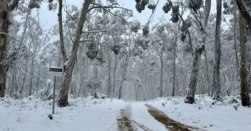
Others were lucky enough to have the snowfall at their back door, Oberon for example turned into a winter wonderland.
Veteran meteorologist Clem Davis told Region Media that there is a very strong chance this next cold weather system will bring more snow to the area on Sunday night and throughout Monday.
Showers are forecast to develop on Sunday afternoon and continue overnight possibly into Monday. Showers will fall as snow on the ranges with 10-20cms expected on the peaks. Some brief snow flurries will be possible in Canberra early Monday morning.
Across NSW, the cold front will move east across the interior on Sunday with strong cold westerly winds developing. A band of showers and isolated storms are forecast across southern areas which will eventually reach the central tablelands Sunday night.
The coldest air mass will arrive late Sunday night and will hang around until Monday, with Goulburn, Crookwell, Bathurst and Orange also expected to see strong snowfalls.
Mr Davis said a deep cold front will move across the Great Australian Bight over the weekend and with a cold southerly airstream following behind the front on Sunday and Monday.
“As the cold front moves through, a low-pressure centre is likely to develop east of Tasmania and if that deepens, it will significantly increase the winds over our region,” he said.

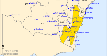
Another snow-producing cold air mass will pass through the region on Sunday and Monday. Image courtesy Higgins Storm Chasing.
“In July, we had high-pressure systems sitting over south-east Australia and these systems were predominantly sticking to the south. The present situation is that these high-pressure systems seem to be a bit further west, which is allowing the cold fronts and colder conditions to penetrate over south-east Australia.
“It’s getting a bit late in winter, but it’s definitely not unusual to see at this time of year,” Mr Davis said.
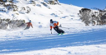
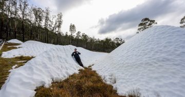
Last weekend saw plenty of fresh snowfalls in the Snowy Mountains, with more than a metre of snow recorded in some places. According to the Snowy Hydro website, which records weekly snow depths, the Spencer’s Creek station above the Charlotte’s Pass ski village recorded 77cms of fresh snow in the week between August 6-13, where snow depths are now more than two metres.
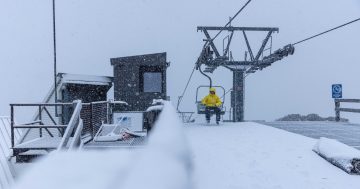
The Bureau of Meteorology forecast for the Snowy Mountains is for snow falling above 1000 metres from Sunday evening. The forecast for the Thredbo Top Station is for very high chance (90 per cent or more) of snow falls from Sunday afternoon through to Wednesday of next week.
Original Article published by Michael Weaver on The RiotACT.