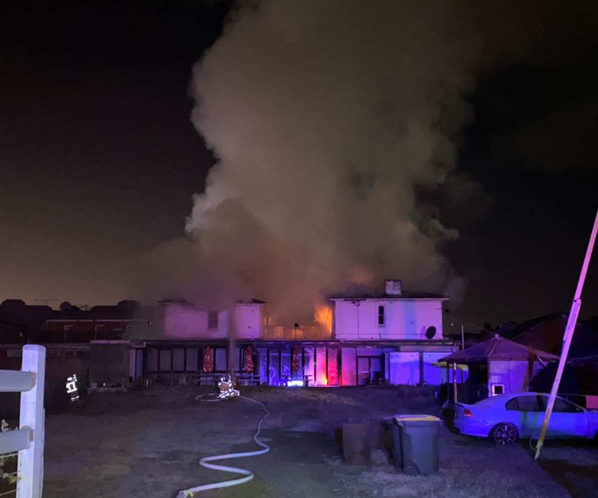
Bombala’s Globe Hotel was ravaged by fire in June this year but the result could have been much worse had thermal imaging and 3D not been provided by the remote RPAS units deployed during the emergency. Photo: Fire and Rescue NSW.
Firefighters in regional areas now have an eye in the sky as state-of-the-art drone technology is rolled out throughout NSW, with a strong presence in the south answering one of the recommendations from the 2020 Bushfires Royal Commission.
Right now, Fire and Rescue NSW (FRNSW) crews across the state are being trained to use the Remotely Piloted Aircraft Systems (RPAS) to assist in firefighting operations and other emergencies.
These drones are being deployed to 25 regional areas, including the southern NSW towns and cities of Young, Jindabyne, Wagga Wagga, Deniliquin, Eden, Hay and Narrandera.
The drones are connected to FRNSW’s wireless and satellite communication networks, allowing images to be viewed and analysed in real time at the scene of an emergency, which helps firefighters make quicker decisions and act faster.
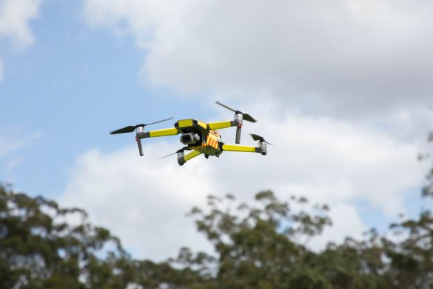
The RPAS are equipped with thermal-imaging cameras and laser technology that can detect variable heat temperatures, identify people or animals under threat in a fire zone and measure the size of an area impacted by fire.
The drones can also be used pre-season to assess bushfire risk, assist in hazard-reduction operations and find people missing in dense bushland.

The drones can be used to find people missing in dense bushland. Photo: Fire and Rescue NSW.
During hazard-reduction operations they can help ensure fires don’t cross containment lines, and after bushfires they can traverse areas that are too dangerous for human visitation to assess property damage and the impact on wildlife and habitat.
FRNSW Bushfire and Aviation Unit Commander Scott Donohoe said the drones could be activated at an emergency scene within minutes.
“The drones are stored in our vehicles and ready for immediate use, providing FRNSW commanders with aerial images that can help determine the safest and most effective places to position fire trucks and crews,” Superintendent Donohoe said.
Region South 1 Acting Superintendent Zone Commander Phillip Eberle is no stranger to the technology, with an RPAS located at Batemans Bay since 2019.
Fully trained and accredited in the use of the drones, he has already experienced what these small machines are capable of, citing a forced landing into Coila Lake at Tuross Heads in August 2021 as a prime example.
“As the plane landed, the crews responding immediately requested the RPAS be deployed so they could start assessing the situation regarding hazardous materials and fuel loss because the plane was 300 metres out into the lake – so by the time you get boats there it is just as quick to get the RPAS up there and flying over the top,” Commander Eberle said.
“The drones are giving us a much better overall perspective of the incident no matter what it is – they give us situational awareness and assistance with our initial insert management decisions so better decisions made earlier, which make for quicker and better outcomes.”
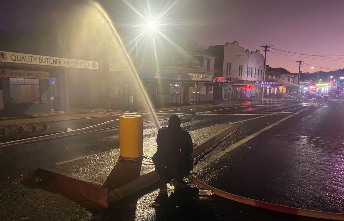
He also cited a hotel fire at Bombala where drone technology allowed fire crews to direct water streams from the fire truck.
But it’s during bushfires that the RPAS will be of substantial assistance.

Firefiighters were able to direct water streams onto hotspots at the Globe Hotel in Bombala in June. Photo: Fire and Rescue NSW.
“They can be flown at night time and in conditions that are not favourable for fixed-winged and rotary-winged aircraft,” Superintendent Eberle said.
This will give firefighters and emergency services workers an immense advantage.
About 200 firefighters are being trained to pilot the drones.
Night flying, situational awareness, ”live” streaming, rapid mapping, aerial incendiary use and 3D panoramic skills are part of the tiered training regimen.
Commander Eberle said there was no limit to the capabilities of the drones.
“The more we work with different agencies during emergency situations, the more ideas for their use are being generated and we’re finding them to be of immense value,” he said.
The drones have already been deployed to the Northern Rivers region to assess flood-damaged infrastructure, identify hazardous materials and find leftover debris.


