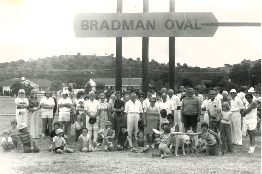
A new look has been proposed for Cootamundra’s historic showpiece, Bradman Oval, with the draft Muttama Creek Masterplan suggesting the oval be enclosed with a traditional picket fence. The masterplan is on public exhibition, with locals encouraged to share their ideas by 29 September. Photo: Visit Cootamundra Facebook.
Cootamundra residents are being invited to help shape the future of Muttama Creek, with a draft masterplan now open for public feedback.
Prepared by Cootamundra-Gundagai Regional Council (CGRC) in partnership with Martens & Associates, the plan focuses on a two km stretch of the creek between Adams Street and Lloyd Conkey Avenue.
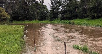
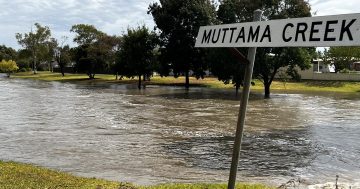
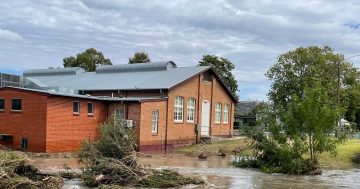
Long prone to localised flooding that has affected nearby properties, the creek is set for a transformation that will make it safer during high flows and more inviting for the community.
Rather than a hidden channel, the masterplan envisions Muttama Creek as a vibrant town asset, featuring walking trails, shaded seating, family-friendly play areas and improved connections to nearby parks and the town centre.
The creek has been divided into four precincts, each with its own focus:
In the Bradman Precinct – two blocks commencing at Adams Street through to Cutler Avenue and extending south to Poole Street – walking trails and signage will link the creek to Bradman’s Birthplace Museum and Bradman’s Oval. There’s also the suggestion the cricket oval could be defined better with a traditional fence and additional trees for shade.
Flood mitigation works will widen the creek, improve access and create a gateway at Adams Road, also acknowledging the area’s cultural and historical significance.
Further along, the Sport and Recreation Precinct comprises two blocks, commencing at Poole Street and extending alongside Clarke Oval to the John Rees Bridge and Wallendoon Street.
Surrounded by Nicholson Park and Fisher Park to the north, residential to the northwest, Jubilee Park to the southwest and the town centre to the east, the master plan provides for upgraded paths linking the town’s many outdoor recreation spaces, plus improved flood management and new landscaping to provide shade and make the area more inviting.
In the Town Centre Precinct – comprising two blocks commencing at John Rees Bridge, Wallendoon Street and extending under the Stratton Bridge to Mackay Street – the plan focuses on integrating the creek into everyday urban life with green corridors, seating and lighting making it an inviting feature for shoppers and pedestrians.
Upgraded crossings and landscaping will connect the waterway to surrounding shops and community areas.
Finally, the Local Community Precinct – the four blocks extending from Mackay Street to the railway line and Lloyd Conkey Avenue – will offer family-friendly amenities, including playgrounds, picnic spots and accessible walking paths.
Enhanced creek edges with trees and plantings will provide shade and a pleasant environment, while better connections to local streets will make the creek easier to enjoy for residents throughout the area.
CGRC Mayor Abb McAlister said the detailed draft master plan was about balancing everyday use with flood protection and environmental care.
“Engineering work is being modelled to reduce flood risk while ecologists are surveying native plants and wildlife to ensure habitats are preserved,” he said.
Some clearing has already started, including trimming cumbungi grass and removing blockages near bridges and culverts, to improve flow during heavy rain.
Cr McAlister said councillors had supported releasing the draft plan so the community could have its say.
“The draft masterplan is a step forward for council to seek external funding for improvements and to undertake controlled activities along the riparian corridor,” he said.
“I urge all residents in the Cootamundra Gundagai Regional Council local government area to have a look over it and make a submission.”
The document and draft civil engineering plans are available on the council’s website and submissions will be accepted until 5 pm, Friday 29 September.