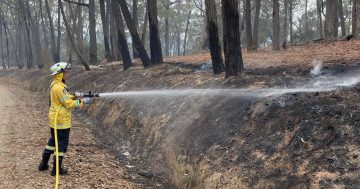
Firefighting crews preparing to spend the night at the Coolagolite fire front. Photo: Facebook, Dalmeny Kianga Rural Fire Brigade.
UPDATE October 4, 7:20 am – A southerly change over the Coolagolite fire front has brought a cool change, increased humidity, rain, and some reprieve for firefighters.
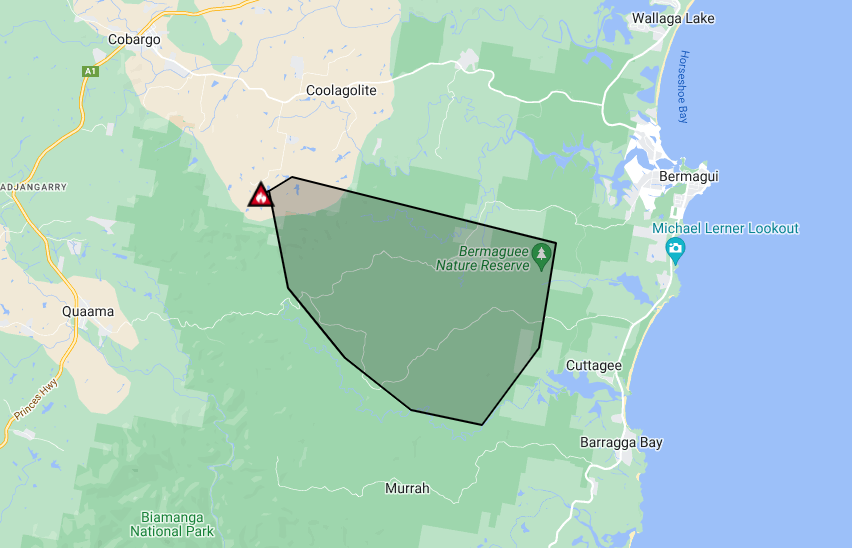
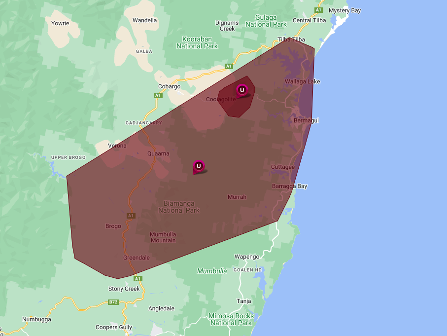
The bushfire has burned through more than 5,200 hectares and is still posing a threat to properties and homes in the Cuttagee, Barragga Bay, Murrah, Bunga and Goalen Head areas.
Firefighters are still on site working to slow the spread of the blaze.
It’s still at Watch and Act status, which means there is still a heightened level of threat and people should start taking action now to protect themselves and their family.
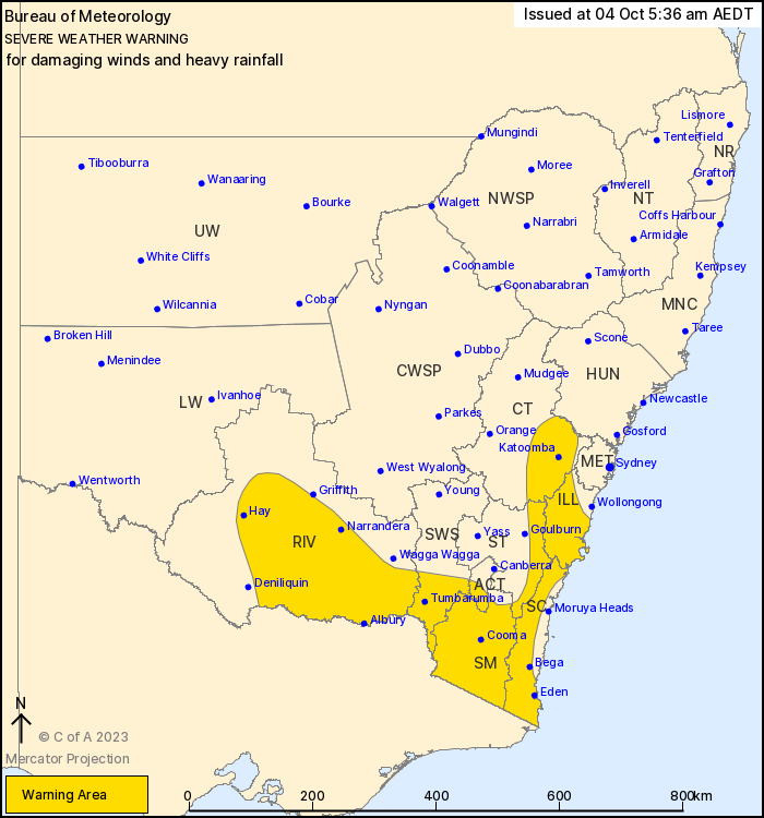
A severe weather warning for heavy rainfall and damaging winds has been issued. Photo: BoM.
It’s as a severe weather warning has been issued for the South Coast, Illawarra, Snowy Mountains and parts of the Southern and Central Tablelands, South West Slopes, Riverina and ACT.
Northwesterly winds will continue to increase over southern NSW ahead of an approaching cold front and upper trough today (Wednesday, 4 October).
This system is expected to develop into a low pressure system over the region and bring broader areas of severe weather during today and tomorrow (Thursday, 5 October).
Peak wind gusts up to 130 km/h are possible in Alpine areas above 1900 metres, while damaging westerly to northwesterly wind gusts in excess of 90 km/h are expected to redevelop across the central and southern ranges – extending over the Illawarra and South Coast – during Thursday morning.
Heavy rainfall, which could lead to flash flooding is forecast for the Riverina throughout the day, moving into the South West Slopes, ACT, Snowy Mountains and South Coast districts this evening.
For most of these districts, six-hourly rainfall totals between 50 and 60 mm are possible, with 24-hourly rainfall totals of 90 to 100 mm possible. Over the South Coast, the six-hourly rainfall total could reach between 70 to 90 mm. Flood watches are current for the southeastern catchments.
Emergency Warning Coolagolite Rd Fire
The fire is threatening properties around Barragga Bay & embers are causing spot fires near Wapego. At 2am conditions should ease as a southerly change hits, but this may push the fire towards Bermagui. For more info: https://t.co/YTZhkP2g27 pic.twitter.com/VO8yej9VwL— NSW RFS (@NSWRFS) October 3, 2023
UPDATE October 3, 7:50 pm – Bermagui residents and visitors have been advised the threat posed by the Coolagolite blaze has eased, but people should remain vigilant.
The inferno has now burned more than 5,100 hectares, with the NSW RFS Far South Coast team posting on social media that it had predominantly spread in a south-easterly direction.
“The threat to Bermagui has eased, however a southerly change is expected to reach the fire ground overnight or in the early hours of Wednesday morning,” a statement read.
“This change will bring cooler temperatures and increase humidity which should ease conditions but does also have the potential to push the fire back towards Bermagui.”
Those in the region who do not feel adequately prepared to defend their properties have been told to consider relocating to a safer place with family and friends outside of the impacted area, such as Bega or Narooma.
Two evacuation centres have been established, one in each town.
Spot fires are still causing issues for firefighters.
“Embers are being blown long distances ahead of the main fire front and starting spot fires in Wapengo to the northeast of Wapengo Creek,” an update from the NSW RFS said.
“These may impact your home earlier than the main fire front.”
The Coolagolite fire as viewed from Bermagui. Photo: Supplied.
UPDATE 5:20 pm – A severe weather warning for damaging winds has been re-issued for the Far South Coast area as the Coolagolite bushfire continues to rage.
A fire weather warning has also been issued for the region, with people urged to prepare their bushfire survival plans now.
Embers are falling ahead of the Coolagolite fire, with spot fires igniting in Barragga Bay on Rikkara Avenue.
The shelter-in-place advice has been updated to now include those in the Murrah area.
“The fire is moving quickly in an easterly direction under strong westerly winds and is impacting on homes in the Cuttagee and Barragga Bay areas,” according to the NSW RFS.
“Under deteriorating conditions, the fire is likely to impact on homes and properties in the areas of Murrah and Bunga.”
The significant southerly change is expected to reach the fireground at about midnight tonight.
“This change will bring cooler temperatures and increase humidity which should ease conditions, but does also have the potential to push the fire back towards Bermagui,” the NSW RFS stated.
“Embers will be blown long distances ahead of the main fire front, starting spot fires. These may impact your home earlier than the main fire front.
“People in Bermagui who do not feel adequately prepared to defend their properties should consider relocating to a safer place such as Bega or Narooma before nightfall.”
Parbery Avenue at Nutleys Creek Road at Bermagui has been closed due to the fire danger.
An emergency evacuation centre is being established at the Bega Showgrounds, Upper Street, Bega.
People have been advised the Bermagui Lifesaving Centre is not a safe place to be.
There are limited stalls at the Bega Evacuation Centre for horses, and limited cages for dogs, cats and birds.
There is capacity for livestock at the Bega Showgrounds – call 0437 922 165 – or Bega Saleyards on Kerrisons Lane – call 0428 712 328.
We request that you remain patient if you elect to attend the Bega Evacuation Centre and should only attend if necessary,” a council statement said.
“If you can safely stay with family or friends instead, you should do so.”
An evacuation centre has also been established at the Narooma Leisure Centre, 100 Bluewater Drive.
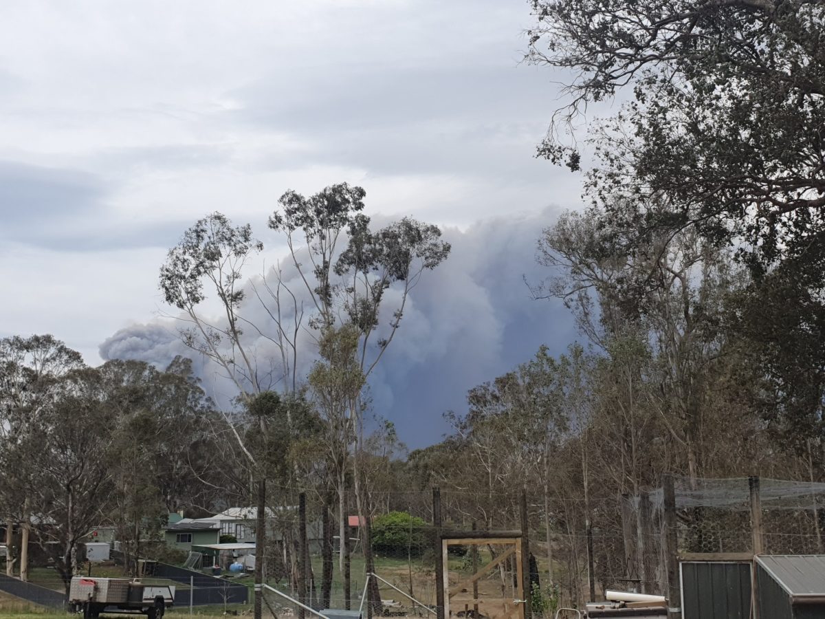
The Coolagolite fire, as seen from Quaama, is heading towards Barragga Bay. Photo: Facebook, Kym Mogridge.
Meanwhile, power has been restored to the majority of homes and businesses impacted by the unplanned power outage in Cobargo, Brogo and the surrounding areas.
An Essential Energy spokesperson said network protection equipment was activated at about midday to isolate supply to 3,409 customers in the area, after it detected a fault on the high voltage electricity network.
“Local crews responded to reports of fallen powerlines on Westrops Road, Coolagolite. Crews were able to isolate the network, re-route power around the network and then back-fed supply to 3,311 customers,” they said.
“Due to the current fire in the area, which is unrelated to the power outage, crews have been unable to access the network to undertake repairs and restore power to the remaining 98 customers.”
The RFS has deemed the area safe for Essential Energy crews to access and undertake repairs, with the estimated time of restoration to the remaining areas expected at about 6 pm.
The Australian Red Cross has opened Register.Find.Reunite for people affected by the Coolagolite bushfire to be able to get in touch with their families and friends.
State Director Kate Miranda said being separated from family and friends is one of the most stressful things a person can experience during an emergency.
“Not knowing where your loved ones are, not being able to contact them by phone or email adds to that anxiety,” she said.
“The service helps find and reunite family, friends and loved ones during a disaster.”
People can register and look for someone through the online service from a computer or any mobile device.
The Register.Find.Reunite. service matches registrations from people affected by an emergency to enquiries made by their loved ones searching for news. Where a match is made, the person who made the enquiry will be notified.
The service also enables other agencies to know you are OK.
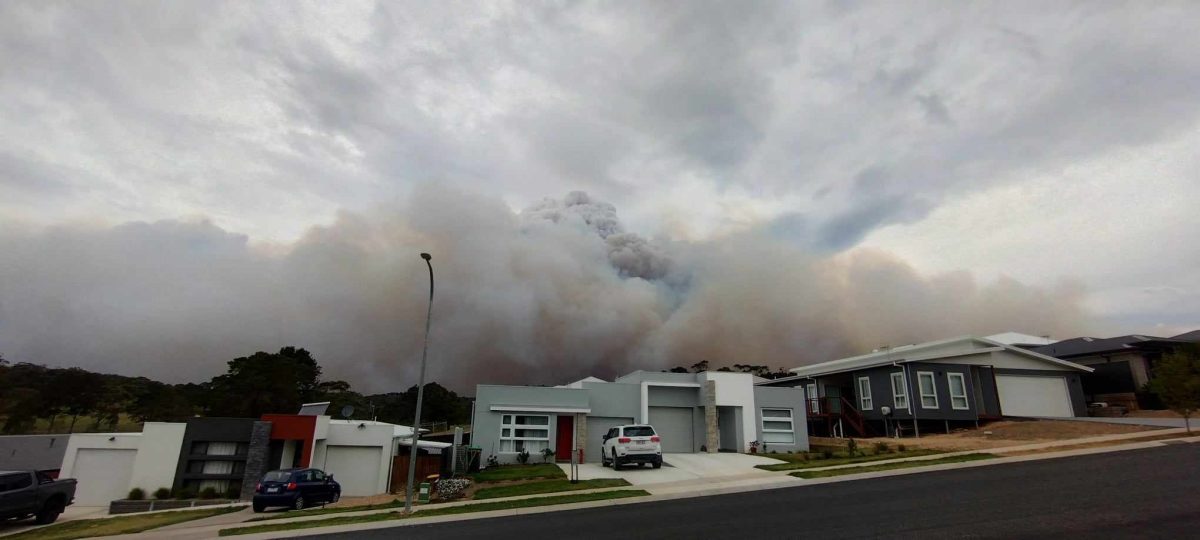
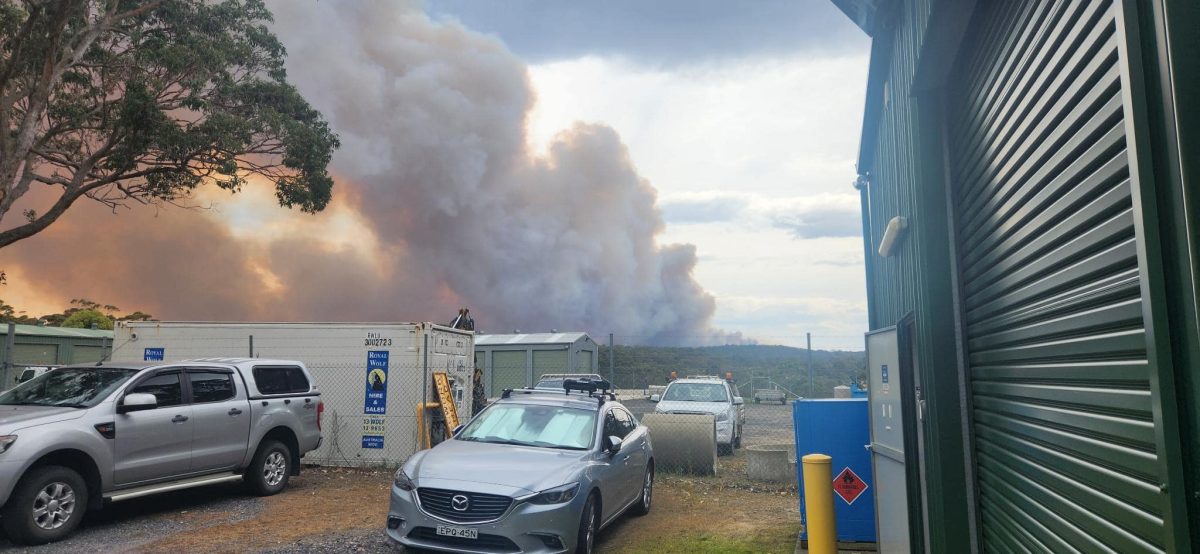
Smoke from the Coolagolite fire. Photo: Facebook, NSW RFS – Tathra Brigade.
UPDATE 3:20 pm – More than 120 firefighters are battling a blaze that started on Coolagolite Road and has since escalated to an Emergency level.
NSW Rural Fire Service public liaison officer Marty Webster said there were more than 40 appliances on scene, along with aerial support from a helicopter and heavy machinery such as bulldozers to create fire breaks.
“It kicked off at about midday under these extreme weather conditions,” he said.
“It has now taken a run from Coolagolite towards Cuttagee, and is threatening properties on the head of Cuttagee Road.”
It’s already reached approximately 4000 hectares in size.
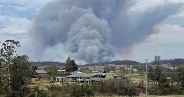
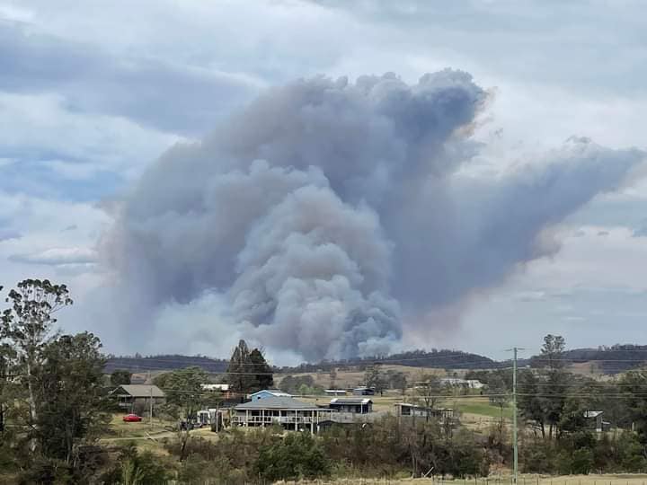
The fire has already burned about 4000 hectares in three hours. Photo: Fires Near Me.
There’s no indication at this stage of how the fire started.
Mr Webster said it was believed downed powerlines were impacting communication efforts in the area.
“We’ve heard people are having trouble receiving text messages, so I’d urge everyone to use multiple forms of communication – radio, social media, as many different sources as you can – to get information,” he said.
“Stay aware of the weather conditions.”
A significant cool change is expected to impact the area in the next few hours, which could bring firefighters some relief.
However, if southerly winds become predominant, the fire could be pushed to the north.
The Cobargo showgrounds are open for those who need to evacuate animals such as horses and cattle.
ABC Local Radio is also providing updates every 15 minutes during regular programming.
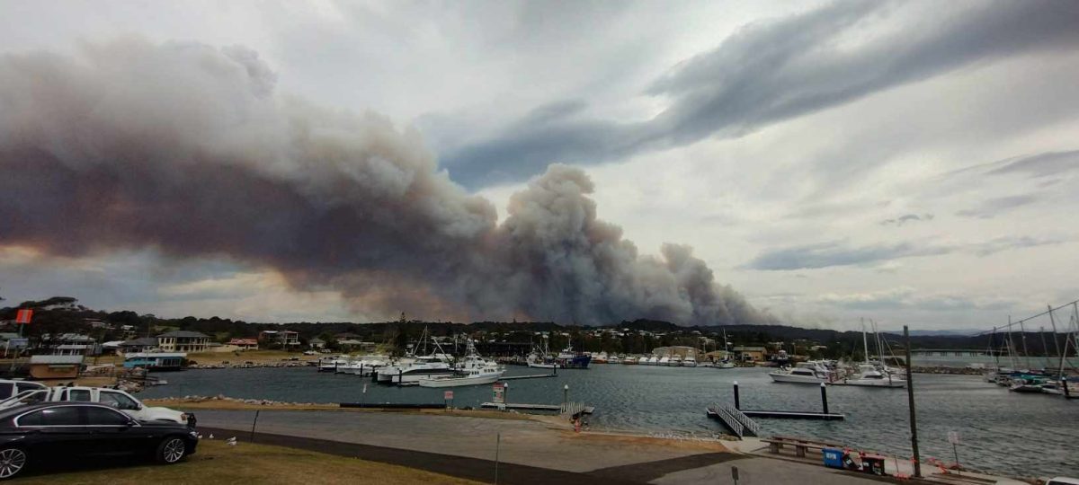
The bushfire as seen from Bermagui harbour. Photo: Supplied.
3:15 pm – An emergency bushfire is burning out of control in the Bega Valley area, with several towns told to shelter in place.
An extreme fire danger and total fire ban was issued for the Far South Coast Rural Fire Service region – which covers the Eurobodalla and Bega Valley council areas – for today (Tuesday, 3 October).
The Coolagolite Road, Coolagolite, blaze was listed as a Watch and Act fire at about 1:45 pm but has since escalated to an Emergency level.
It’s burning in an easterly direction under the influence of strong westerly winds.
It is heading towards Cuttagee, Barragga Bay and Bermagui.
“If you are in the areas of Cuttagee, Barragga Bay and Bermagui, you are in danger,” a NSW RFS statement said.
“Seek shelter as the fire approaches. It is too late to leave.”
The Cobargo Bermagui Road was closed due to the fire danger, while powerlines are down across Westropps Road.
Power has been lost from about Tilba to Bega as a result.
Power has been lost across a large area of the Bega Valley region. Photo: Essential Energy.
The Tathra Brigade has advised people to look out for smoke drift if they choose to evacuate, and urged them not to use the Bermagui to Tathra road.
“With an out of control bushfire currently burning in the area South of Bermagui and expected to impact the localities of Cuttagee and Barragga Bay, if [you’re] travelling north today from Tathra, please use Bega – Tathra Road and the Princes Highway,” a Facebook statement said.
“Keep off the coast road.”
The Tathra-Bermagui Road between Doctor George Mountain Road and Bunga Street has been closed due to the fire danger.
Travellers have been urged to be aware of smoke drift, with this shot taken from the Bermagui RFS shed. Photo: NSW SES Bega Valley Units.
More updates to come.