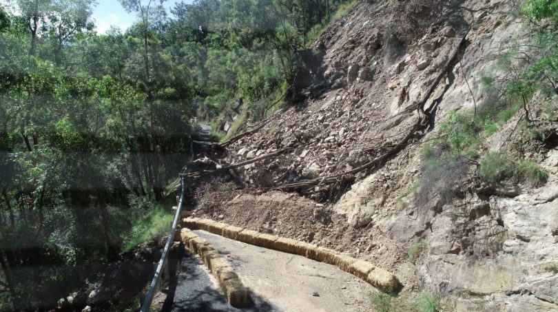
The landslide at Knowles Creek on Araluen Road in Deua National Park. Photo: Supplied by Duncan McLaughlin.
Eight months after a significant landslide at Knowles Creek on Araluen Road in Deua National Park, work has started on a new route that will give residents safe access to Moruya.
The new route begins near Knowles Creek Bridge and avoids the landslide by heading through private land and state forest along the right-hand side of Araluen Road when heading towards Moruya.
Eurobodalla Shire Council has negotiated agreement and funding for the alternate route, which director of infrastructure Warren Sharpe described as “a safer and far more resilient solution for the community into the future”.
“We expect to have sealed the road there by Christmas, with residential traffic allowed through the work site in November. These dates are subject to reasonable weather and to no other significant challenges being identified during construction,” said Mr Sharpe.
“The new route goes through private land and state forest and we thank both landowners and Forestry NSW for their collaboration in helping make this improved outcome possible for the whole community.
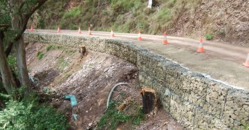
“Despite impacts from ongoing rainfall, we’ve also completed the upgrade of the temporary detour route, including gravel re-sheeting to improve driving conditions for residents.”
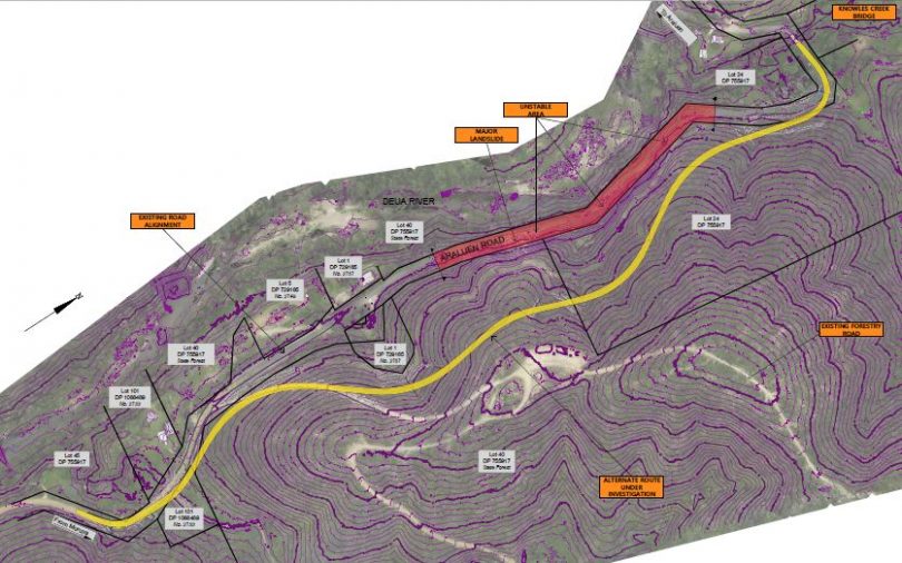
The yellow line shows the new route under construction. Photo: Supplied by Duncan McLaughlin.
The existing detour, which runs through fire trails in the national park, has also been upgraded.
Araluen Road suffered damage on an unprecedented scale following a series of natural disasters.
Mr Sharpe said along with personal, property and environmental impacts, Deua Valley and Merricumbene residents had to deal with access issues arising from damage to the council-maintained road network from the 2019-20 bushfires and a series of storms and flooding with destroyed bridges, collapsed roadside slopes, damaged road surfaces and dangerous fire-affected trees.
“We still have many challenges elsewhere along the length of Araluen Road which remains closed for the foreseeable future around 43 kilometres from Moruya. NSW Public Works Advisory has been engaged to investigate options to restore access at that location,” he said.
“We expect it to take about five months before any decisions about restoring the existing road or routing around the landslide area can be made.”
For more information, visit: https://www.esc.nsw.gov.au/council/major-projects/current-projects/roads-and-bridges/restoring-access-araluen-road