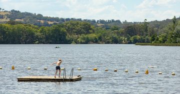
Chilling on the shores of Lake Jindabyne during the summer months. Photo: Jennie Jane, Destination Jindabyne Facebook.
Residents in southern NSW and the ACT can look forward to a mid-week reprieve from the current heatwave and up to 25 millimetres of rain in parts.
Bureau of Meteorology senior forecaster Neale Fraser said a southerly change will bring cooler temperatures to the south between Wednesday and Friday (27 to 29 January) before it moves to the north and temperatures rise again on the weekend.
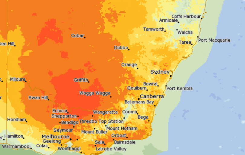
The mercury was set to soar to the high 30s across NSW and the ACT on Monday. Photo: Bureau of Meteorology.
“However, while temperatures will go back up, they won’t be anything like we’ve experienced,” he said.
“The weekend will remain in the 20s and possibly the high 20s, but it won’t be until next week that we get back into the 30s.”
Temperatures are predicted to drop to the low 20s between Wednesday and Friday in Canberra, Goulburn, Batemans Bay, Bega and Tumbarumba.
Yet there’s little reprieve in Young, where the temperature will remain in the high 20s between Wednesday and Friday.
Temperatures on Monday/Tuesday/Wednesday/Thursday/Friday/Saturday/Sunday:
- Canberra – 37/35/23/21/23/27/29
- Goulburn – 35/35/21/20/23/26/28
- Young – 39/36/31/28/27/28/32
- Batemans Bay – 35/33/23/23/25/28/28
- Bega – 38/29/23/21/24/28/27
- Tumbarumba – 37/30/30/26/27/27/30.
There is more good news on its way for the far south, with rainfall of between 10 and 25 millimetres predicted for the ACT, Monaro alpine regions and South Coast on Tuesday, according to Mr Fraser.
However, northern areas around Goulburn and Young are set to receive only a few millimetres.
Showers are also predicted on Thursday and Friday; however, they will only bring a few millimetres to all of southern NSW and the ACT.
Mr Fraser said there is a chance of more rain in the Central West on Friday, but that it’s more likely to fall in the Blue Mountains and Orange rather than those central, southern regions.
Although, the worst isn’t behind us yet, with the heatwave set to continue on Monday and Australia Day.
Tomorrow (26 January), the temperature is forecast to be 35 in Canberra, Goulburn and Batemans Bay; 36 in Young; 38 in Bega; and 37 in Tumbarumba.
These temperatures have elevated fire dangers in parts of the southern inland.
Fire danger rating on Monday/Tuesday:
- ACT – High/High
- Southern Ranges – High/Very High
- Shoalhaven – High/Very High
- Far South Coast – High/High
- Monaro Alpine – Very High/High
- Southern Slopes – Very High/High.
Health officials are urging people to stay inside during the hottest part of the day, stay hydrated with water and look after vulnerable neighbours and relatives during the heatwave.
“Signs of heat-related illness include dizziness, tiredness, irritability, thirst, fainting, muscle pains or cramps, rapid pulse, shallow breathing, vomiting and confusion,” Dr Adi Vyas from NSW Health said.
People showing severe signs of heat-related illness should seek urgent medical attention and, in an emergency, call Triple Zero (000).