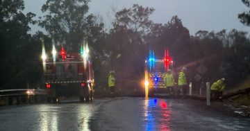
We’re being reminded ‘if it’s flooded, forget it’ as heavy falls block storm drains and push water across the roads. Photo: Claire Fenwicke.
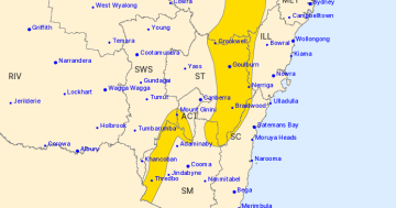
The soggy conditions will continue across southern NSW and the ACT today (4 August), with a severe weather warning still in place for large parts of the region.
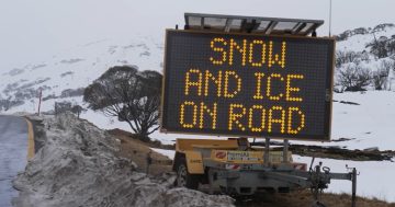
According to the Bureau of Meteorology (BoM), heavy rainfall, which could lead to flash flooding, was expected across the Snowy Mountains and the South Western Slopes.
The BoM expects wet weather until Monday when there’s just a 10 per cent chance of rain.
“Six-hourly rainfall totals between 45 and 60 mm are expected, with localised falls of up to 100 mm possible with embedded shower and thunderstorm activity that may occur over shorter time frames,” the BoM said.
A flood watch has also been issued for the southwest catchments.
It’s all due to a complex low-pressure system moving across the Great Australian Bight, with an associated trough and cold front also causing vigorous north-westerly winds across southeast NSW.
The ACT’s Emergency Services Agency crews had responded to about 55 calls for help by 11:30 this morning.
A spokesperson said most calls were for leaking roofs, water inundation, and large trees falling onto homes and across roads.
ACT Fire and Rescue crews were also alerted to an incident at the National Convention Centre this morning where an external sign appeared to have melted.
“There were reports the sign outside the building had been struck by lightning, but we believe it’s due to water inundation,” an ESA spokesperson said.
“ACTFR attended as it was deemed to be an electrical threat.”
Motorists were warned to take care on the roads and drive to conditions, with blocked storm drains meaning water was flooding roads.
Bungendore SES was providing sandbags to those who needed them and warned water was flowing across the town’s intersection of Kings Highway and Majara Street.
Queanbeyan Palerang Regional Council crews were working to unblock drains across the region.
“There has been a significant amount of rain overnight and this is expected to continue,” a statement on Facebook said.
“Low-level crossings are expected to have water over the road, including at Briars Sharrow, Elmslea crossing and Resches Creek.”
Crossings impacted by water are being updated throughout the day.
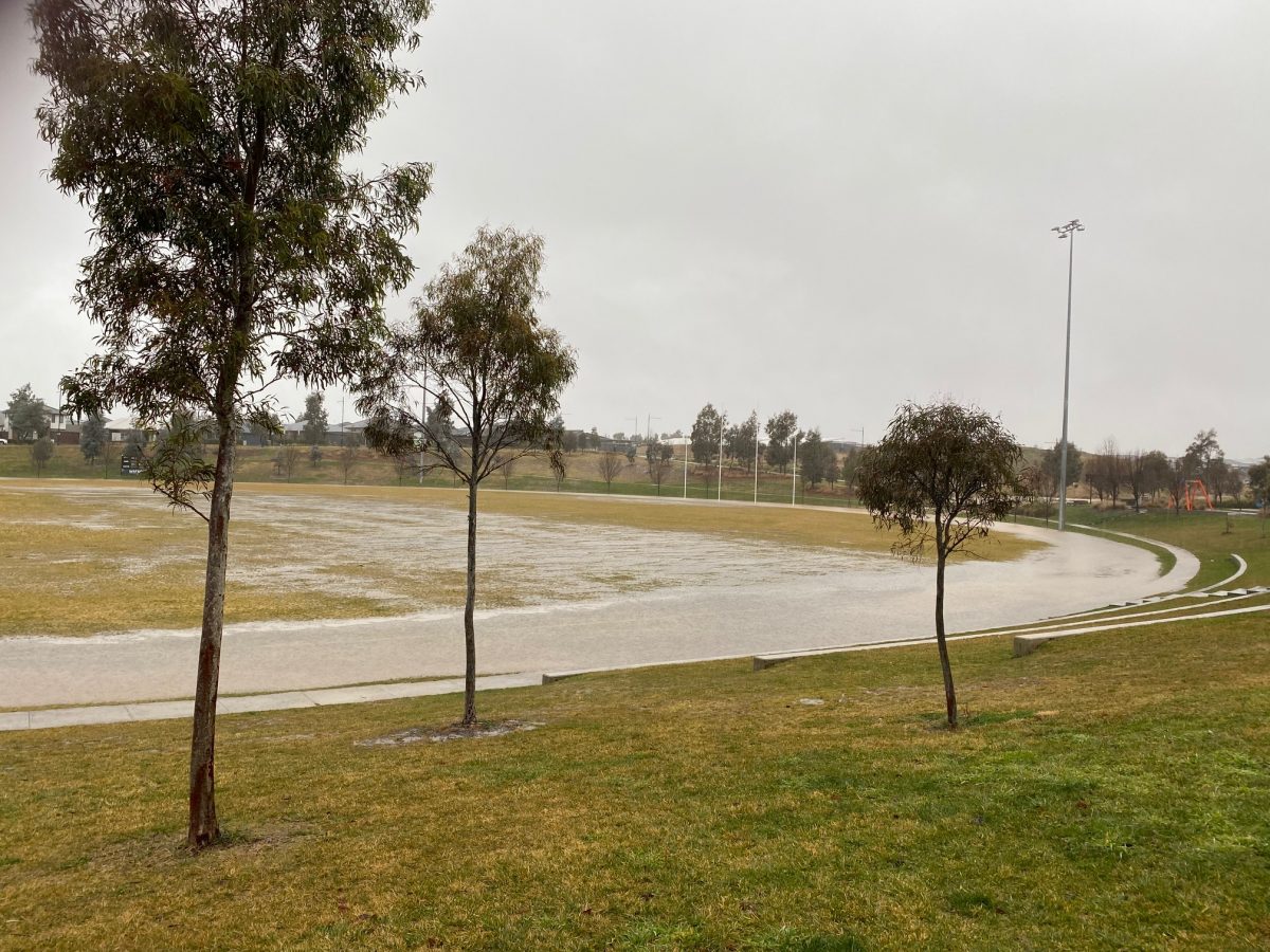
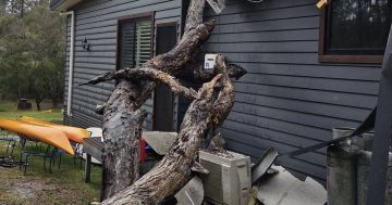
The rain saw minor flooding across the region. Photo: Claire Fenwicke.
Strong wind gusts were also expected throughout the day, with peak gusts of around 90 km/h possible over the ranges west of the ACT, as well as the eastern Great Dividing Range from Bombala to south of Crookwell.
Khancoban recorded a wind gust of 100 km/h at 2:05 this morning, while Cabramurra recorded a gust of 98 km/h at 12:17 am.
Damaging winds averaging 80 to 90 km/h, with peak gusts in excess of 125 km/h, were likely to continue for Alpine areas above 1,900 metres.
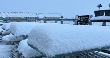
Thredbo Resort announced via social media it had shut for the entire day.
“Given the extreme weather forecast for heavy rain and gale force winds, we have made the decision to not operate any lifts,” it said.
“The safety of our team and guests is paramount.”
While all terrain parks have been closed at Perisher Resort, with several lifts and T-bars also closed or on pause due to the hairy conditions.
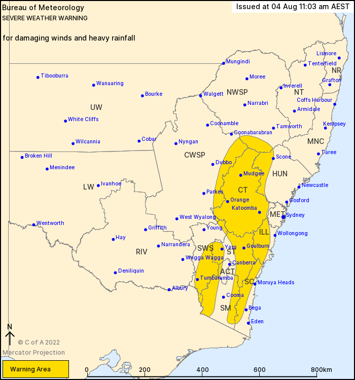
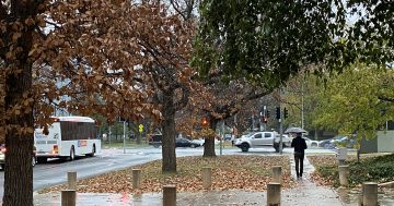
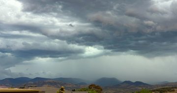
Heavy rainfall and damaging winds were expected to continue across parts of southern NSW today (4 August). Photo: BOM.
This weather system has also contained a lot of warm air (though that’s hard to tell).
Combined with the cloud cover, high minimum temperatures for winter were recorded across the region overnight, according to Weatherzone.
Khancoban only dropped to 10.3 degrees, which was its warmest night since 2007, while Cooma recorded its warmest August night since 2009, dropping to a low of 8 degrees.
“[That’s] remarkable as it registered an overnight low of minus 10 degrees on the weekend,” Weatherzone’s Anthony Sharwood said.
For emergency help in floods and storms, ring your local SES Unit on 132 500.
Original Article published by Claire Fenwicke on Riotact.