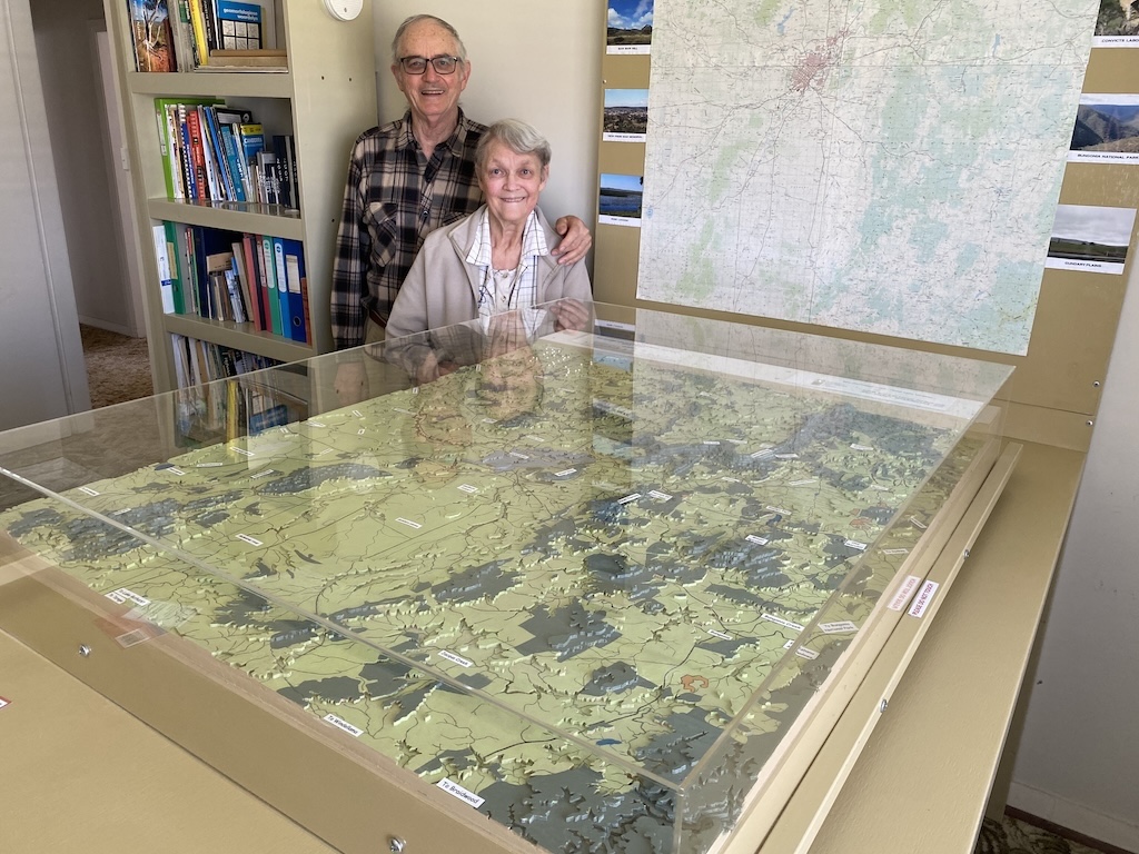
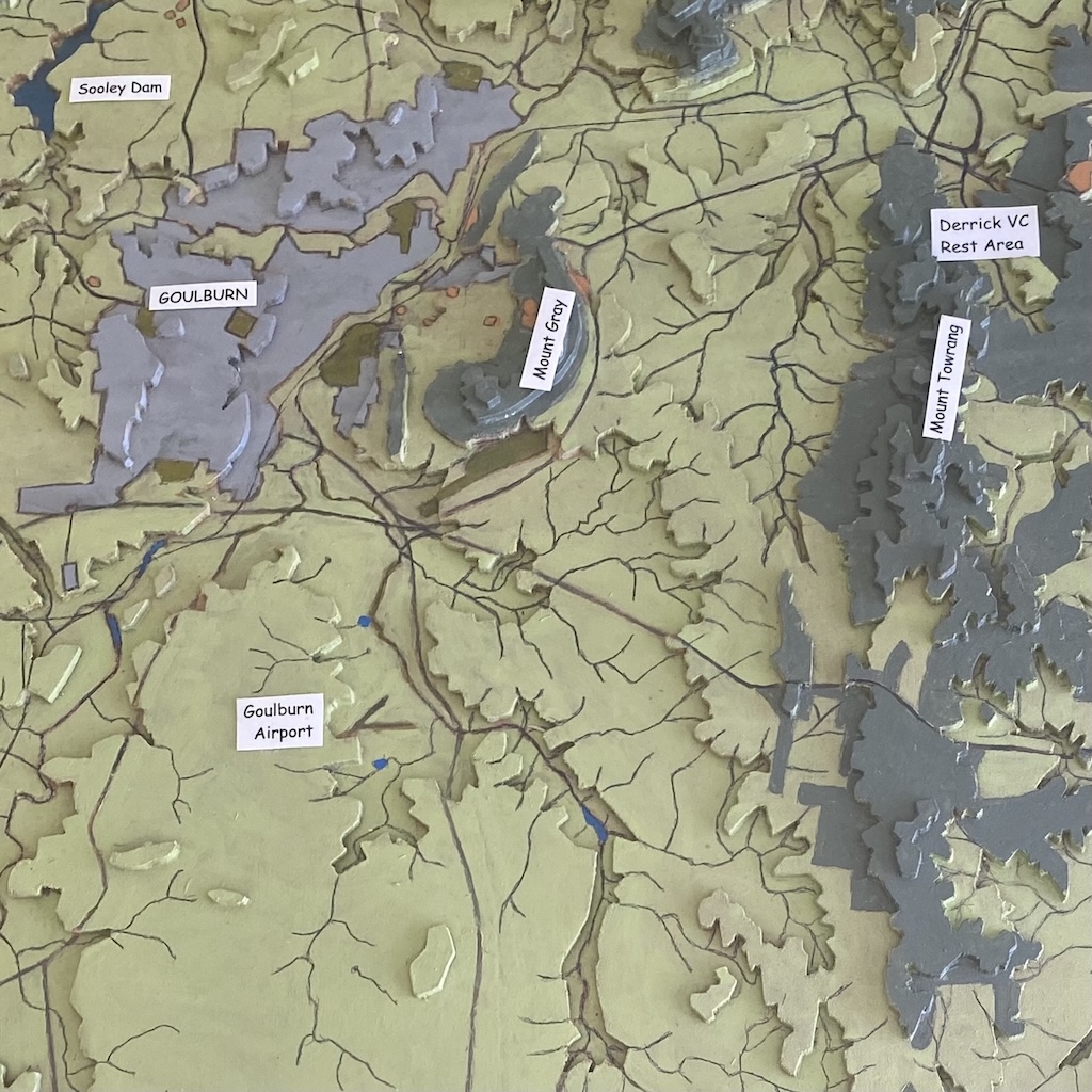
Daniel and Anna Conroy with their 3D landscape model of the Goulburn region, which gives them a thorough understanding of where they live. Below: a section of the landscape model showing Goulburn, Mount Gray, Sooley Dam and other landmarks. Photos: John Thistleton.
Cartographer Daniel Conroy and his wife Anna know the Goulburn region like no-one else does.
For three years, the South African couple painstakingly built a 3D landscape model to the boundaries of Woodhouselee, Towrang, Goulburn and Bungonia.
Using a small jigsaw, Daniel cut layers of multi-density foam (MDF), creating the mountains of the Great Dividing Range and valleys carved by the Wollondilly and Mulwaree river catchments, all covered in a web of major roads and minor tracks, some long redundant, and railway lines.
An ambitious undertaking, it gave them a new direction after they left South Africa in 2016 to escape civil unrest.
“The crime in South Africa is escalating,” Daniel said. “People come and cut the wires, kill the dogs; they collect the whole family in a room, they walk up to the husband and bang [shoot him], turn around and walk away.”
Creating such a comprehensive overview of Goulburn celebrates all that Daniel achieved in Potchefstroom, 120 km south-west of Johannesburg, where the PhD in landscape design lectured university students in cartography and studied landscape architecture in his spare time.
In 1985, the Conroys left Potchefstroom and relocated to Pretoria, where Daniel worked in nature conservation as a landscape architect, planning and designing rest camps.
Born in South Africa, his mapping exploits read like a Wilbur Smith novel.
“I had an old Volkswagen Kombi and made it my office and where I slept in the night,” he said. “You cannot sleep outside. There are lions, they will kill you.
“The biggest killer in South Africa in the game reserves are hippos (hippopotamus),” he said “Hippos, crocodiles and lions. Even the tigers. Killers, killers, killers.
“One of my colleagues, he was at the river and when he decided he would go back, the hippo chased him. When he ran, the hippo bit him like that,” he said, gesturing with a grab. “He broke his back and killed him.”
One night in a tent, Daniel was utterly terrified when a hippo circled, clearly enraged someone was encroaching on its territory.
“In the front of the tent there was a white mosquito cloth and he came to the cloth – between us and an angry hippo,” he said. “He smelled it and thought it was solid and he went away.”
Still, Daniel prevailed. After mapping the land, and recording the terrain and vegetation, he would suggest uses such as research, game viewing, birdwatching, biltong hunting and angling. He designed rest camps for day and overnight visitors and education centres, among many other facilities.
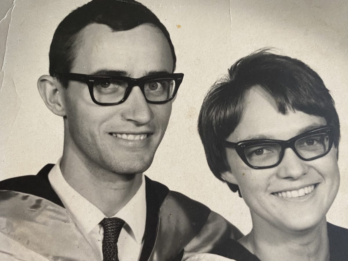
Daniel, 24, and Anna Conroy, 23, on their graduation day. This was in 1970, the year they were married and Daniel graduated in geography, and Anna in psychiatry. Photo: Conroy family collection.
Among his files and maps from South Africa is correspondence from an eastern Transvaal nature reserve client describing his extra work efforts as absolutely outstanding.
Anna has worked alongside him on the Goulburn region landscape model. Acquiring four topographic maps of Woodhouselee, Towrang, Goulburn and Bungonia from Geoscience Australia in Canberra, scaled at 1:50,000, they joined them together and stuck them to a wall.
At the foot of the map sits the 3D model, about the size of a card table, on a wooden base Daniel made.
They gathered satellite images of the region and viewed them through Daniel’s handmade tabletop stereoscope with two mirrors.
The couple drove to reference points all over the region, got out of their vehicle and walked over the land, Anna taking photos from her phone to record features.
Anna studied Governor Lachlan Macquarie’s 1820 diaries, uncovering routes including one across the Cookbundoon Range, which divides into two directions, one heading north to Bathurst and the other south to Goulburn. The history provided a more comprehensive picture of landmark features.
The model shows catchment areas draining west and east on either side of the Great Dividing Range. The Conroys painted the surfaces: grasslands in light green, forest areas in dark green, quarries light brown and lakes and dams blue. Rivers, roads and railway lines cross the landscape.
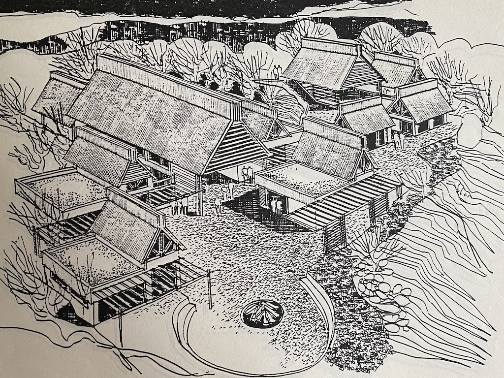
One of Daniel Conroy’s artist impressions of a Pretoria rest camp he designed. Photo: John Thistleton.
Affordable housing drew Daniel and Anna to Goulburn. They were the last in their family to leave South Africa. Their daughter Mari Potgieter and her family live in Canberra. Their son Jaco lives in Adelaide with his family and their other son, Johan, and his family live in America.
Daniel wants to sell the 3D model, provided they can find someone who will use it and conserve it. If you would like to acquire the Goulburn region landscape model, email: [email protected].


