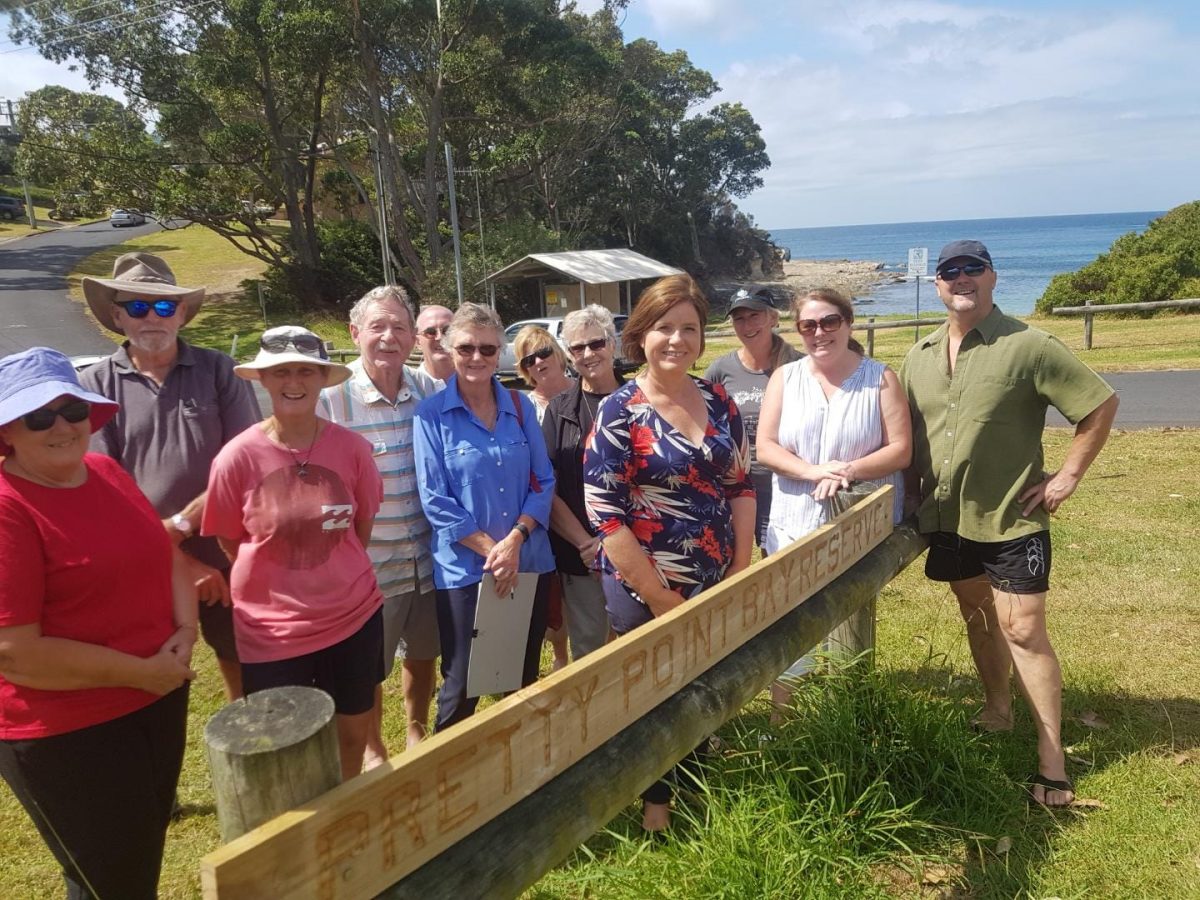
Friends of Pretty Point members with former Bega MP Leanne Atkinson in 2019. Photo: Friends of Pretty Point.
At least seven landowners are likely to be cheering for the Eurobodalla Shire Council’s proposal to reclassify land across the region – but a good many more are less than impressed.
The proposal covers 11 sites, stretching from Dalmeny to South Durras.
Seven of the sites have been requested to be purchased by adjoining landowners: one in Dalmeny, one in Long Beach, two in Catalina and three in Batehaven.
They are all small parcels of land that are already cared for by the adjoining landowner, or would enable improvements to the adjoining property such as road access, drainage, fencing, or slope stabilisation.
One of the remaining four sites proposed for reclassification is bushland around a water reservoir and telecommunications infrastructure off Blairs Road in Long Beach. The proposed reclassification would recognise that the area is used as operational space, rather than the bushland it is currently listed as.
The final three sites are “recommended to be reclassified and sold by Council’s Open Space and Recreation Strategy because they are considered surplus to public need”, according to the council’s proposal.

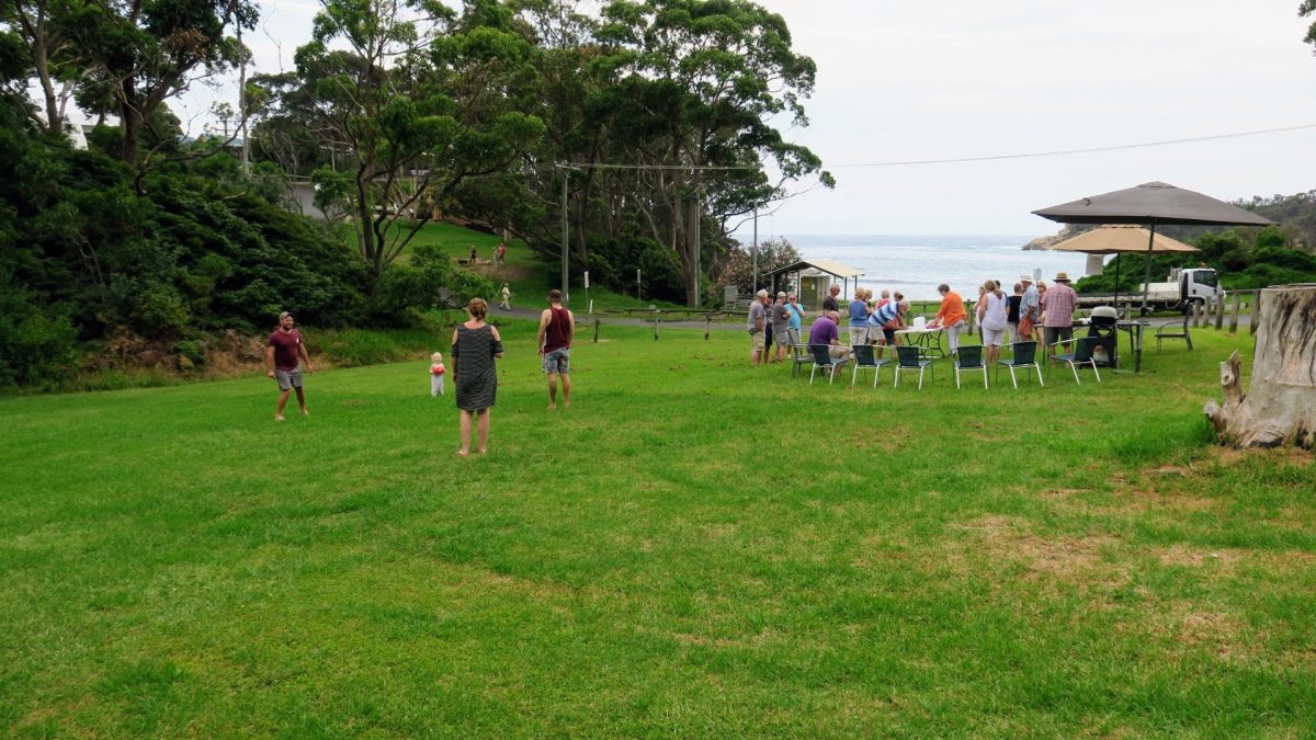
A community barbecue at the green space in Illabunda Drive. Photo: Friends of Pretty Point.
Those include an open grassed space opposite Pretty Beach in Malua Bay, a bushland corridor used by pedestrians between Village Road and Banyandah Street in South Durras, and a similar corridor between Moir Place and Banksia Street in Broulee.
The potential for development of the grassed space in Illabunda Drive at Malua Bay in particular has residents up in arms.
The battle has a long history. In 1966, Malua Bay Pty Ltd and the council entered into an agreement that allowed the company to subdivide the balance of the Malua Bay Estate, leaving Pretty Point and other areas, including the Illabunda Drive lot, for public recreation.
In 1993, the council began the process of rezoning the lot from community use to residential, but backed down in 1995 after community opposition.
The issue came up again in 2005 and it was again decided to keep the reserve for community use.
The potential for rezoning raised its head again in 2019, but bushfires and the pandemic pushed it off the agenda until recently.
Friends of Pretty Point members say the lot is frequently used for informal community gatherings and children’s games, and provides a green space amenity for those living nearby.
“It’s the most tranquil, lovely spot,” resident Cathy Norton said.
“The community gathers on Fridays for happy-hour drinks, it’s used by families with kids and for people to kick a ball around with the dog.
“We love the fact that it’s there for those purposes – once it’s gone, you can’t get it back.”
Cathy and her husband bought in the area in 2016, and said their decision had been influenced by assurances the lot would be left as open space.
The council proposal argues the public open space at Pretty Bay provides a similar recreation opportunity, which Cathy says is inaccurate.
“The forefront of the beach is narrow, sloping and has a bench seat on it – it doesn’t offer the same amenity at all,” she said.
The proposal is on exhibition until 5 April and feedback submissions can be made through the NSW Government Planning Portal: Reclassification of Community Land to Operational Land | Planning Portal – Department of Planning and Environment (nsw.gov.au)
- Part of Lot 1110 DP236653, 35- 37 Illabunda Drive, Malua Bay. Enable Council to sell part of the subject land as the ROSS (2018) identified it as surplus. The current use is grassed open space. Waterway will remain protected.
- Lot 84 in DP 259212, Village Road and Banyandah Street, South Durras. Enable Council to sell the subject land as the ROSS (2018) identified it as surplus. The current use is an informal pedestrian route between Village Road and Banyandah Street.
- Part of Lot 32 DP 618340, 4 Bimbular Street, Dalmeny. Enable Council to sell part of the subject land. Adjoining landholder requested to purchase the land for use as private open space. The current use is grassed open space.
- Part of Lot 2 DP 570760 and Part of Lot 4 DP 572585, Beach Road, Batehaven. Enable Council to sell part of the subject land. Adjoining landholder requested to purchase the land to allow existing cabins to meet legislative requirements. The current use is grassed open space.
- Part of Lot 2 DP1014254, George Bass Drive, Batehaven. Enable Council to sell part of the subject land. Adjoining landholder requested to purchase the land to improve access to the adjoining lot and improve fencing and drainage options. The current use is bushland open space.
- Lot 170 DP 569136, Fauna Ave, Long Beach. Enable Council to sell the subject land. Adjoining landholder requested to purchase the land for private open space. The current use is open space, with one large tree and lawn maintained by adjacent landowner.
- Part of Lot 109 DP 244150, Catalina Drive, Catalina. Enable Council to sell the subject land. Adjoining landholder requested to purchase the land to allow access via an existing driveway. It is and would continue to be used for driveway access.
- Part of Lot 2 DP 1260850, Ridge Street, Catalina. Enable Council to sell the subject land. Adjoining landholder requested to purchase the land for private open space. The current use is grassed open space with gardens maintained by the adjacent landholder.
- Lot 5 DP520413 and Part of Lot C DP 327917, Beach Road, Batehaven. Enable Council to sell the subject land. Adjoining landholder requested to purchase the land to facilitate private slope stabilisation works. The current use is open space but is not accessible due to the slope.
- Part of Lot 56 DP 84895, Blairs Road, Long Beach. To recognise the existing operational use for water reservoir and telecommunications infrastructure. The current use is also bushland open space.
- Broulee – between Moir Place and Banksia Street. Enable Council to sell the subject land to adjoining landholders if requested in the future. The current use is an informal pedestrian route and gardens maintained by adjacent landholders.


