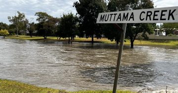
Goulburn’s Lower Sterne Street on 9 August, 2020. More than 83 mm of rain fell that day. Photo: Leon Oberg.
Hard as it is to imagine Goulburn’s main street under two metres of floodwater, recent flooding on Australia’s eastern coastline and inland has reminded planners and government agencies to never say never.
A civil engineer in Goulburn with surveyors and planners Premise, Paul Johnson, has seen a different mindset emerge about flooding because of the amount of unprecedented rainfall recorded these days.
He says across NSW, councils including Goulburn Mulwaree are updating their most recent flood studies because of the bigger emphasis on climate change and climate change drivers, which can influence the frequencies and additional rainfall that we can’t predict.
“If we look at some of the historical rain events of the last five years, we’ve got towns and cities and regional areas that have been flooded that had never been flooded before,” Mr Johnson said. “Whether you are a pundit for climate change or not, that is one of the drivers for the most recent flood studies.”
Those studies indicate that in the extreme of all events, Auburn Street in Goulburn could be inundated with floodwater. Mr Johnson says in all probability, that is greater than a one-in-5000-year event.
Once figures start exceeding extreme rainfall, the accuracy of predicting them is more variable and has more assumptions.
“The (rain event) flooding Auburn Street is called the probable maximum precipitation that generates the probable maximum flood (PMF). That would be Armageddon-type stuff,” Mr Johnson said.
“In those extreme events, yes, parts of the city would go under, according to the flood study, but the likelihood is small. But you never say never.”
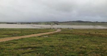
The PMF event shows Auburn Street under two metres of water and large swathes of flooding across Lagoon, Victoria, Union and Wilmot streets, and elsewhere across Clinton and Sloane streets and large areas of Eastgrove. The Mulwaree Ponds and Wollondilly River would be 10 metres deep.
“The reason they map the probable maximum flood is more for planning purposes; it’s about identifying where risks would be in these abnormal, extreme rain events,” he said.
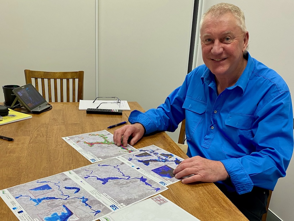
Civil engineer Paul Johnson comparing probable maximum flood peak flood depths with other mapping of rainfall events. Photo: John Thistleton.
Goulburn Mulwaree Council is preparing an overland flows flood study to help with its flood risk planning for future land use, rezonings, development etc., and emergency management planning for the SES and other agencies.
Properties affected by overland flow will be identified through the Flood Study and subsequent Floodplain Risk Management Study and Plan (FRMSP).
But it’s too early for the council to advise whether any overland flow information will be recorded on individual property titles, or how many properties are likely to be affected.
The council says generally, critical overland flooding conditions in Goulburn arise from short, intense storms typically lasting between 60 and 90 minutes.
“Overland flows follow defined pathways and typically do not spread out to inundate expansive areas. Many of these flow paths are trained along roads and grassed channels,” the council said in response to questions.
Engineering and hydrology firm GRC Hydro updated the Goulburn Floodplain Map in 2021/22, which went through drafts and reviews and government agency feedback before it was presented to Goulburn Mulwaree Council and adopted as the Flood Risk Management Plan and Strategy.
The first part of the flood study looks at and predicts flood levels based on a raft of data and information, including historical rainfall and floods, and maps the extent of water over the floodplain. Flooding is either from the rivers or creeks and overland flows, the flows that drain into those rivers, creeks and drainage lines.
Mr Johnson said if more flood events occurred in areas where they had not been recorded before, insurance would be a big issue.
He said these days, the Bureau of Meteorology kept better rainfall data and climate information.
Findings from better data, software modelling and more detailed catchment information received mixed reactions from property owners.
“Some people get very upset about it, some argue it, contest it,” Mr Johnson said. “They say, ‘I’ve been here for 50 years and I’ve never seen a flood come that high’. And that may well be true. But have they been there for an event that these models are predicting?
“The model is a guide, not a gospel, so they have to take it with a little caveat that there could be variations to the model. Other people ask, ‘What’s the impact on me? Is council going to buy my land because I can’t use it, I can’t insure it?’
“Some people don’t give a tinker’s cuss.”