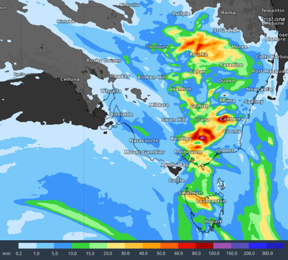
Friday (7 October) is forecast to be the wettest day of the week. Photo: Weatherzone.
About an inch of rain has fallen across Canberra in the past 24 hours, and it appears the wettest day is yet to come.
Point Hut Crossing was the first road to be closed today (6 October) due to soaked conditions, along with Namadgi National Park Visitor Information Centre.
Further closures across the Territory’s parks and reserves are expected.
ACT Conservator of Flora and Fauna Bren Burkevics said the decision was made for the community’s safety.
“We are advising all Canberrans to avoid these areas as we see heavy rain and extreme weather continue over the coming days and weekend,” he said.
“Flood waters can occur suddenly and without much warning, leaving you trapped or stranded if you are unprepared.
“Steer clear of low-lying areas such as creeks, stormwater drains or other causeways.”
Those who still wished to venture out in the wet were asked to take all possible precautions to keep safe.
“This includes telling family or friends where you are going, take extra care around trees and other debris, and steer clear of low-lying areas,” Mr Burkevics said.
All ACT Government turf sports grounds have also been closed for training and match play, with ground suitability to be reassessed tomorrow (7 October).
Melrose synthetic, Nicholls synthetic and Woden Park are unaffected at this stage.
Looking at areas surrounding the ACT, a minor flood watch has been issued for the Queanbeyan and Molonglo Rivers.
NSW SES Queanbeyan Unit advised on its Facebook page that the saturated catchments, soil moisture levels and Googong Dam being at 100 per cent capacity meant minor flooding was possible for the Queanbeyan River.
“A minor flood will close the low-level crossing at Morriset Street, but it is unlikely to impact homes or businesses,” they said.
River levels were elevated along the Snowy River from Lake Jindabyne to McKillops Bridge, with minor flooding possible into the weekend.
The low-level crossing at Elmslea Street in Bungendore was shut, as was Briars Sharrow Crossing.
Half a dozen roads in the Goulburn area have been shut: Murrays Flat Road, Bullspit Road, Mills Road, Stewarts Crossing, Airport Road and Wollondilly Walking Track (Fitzroy St footbridge).
Cautions were also issued for the following roads due to damaged pavement or water over the road: Chinamans Lane, Cullulla Road Causeway, Range Road (at the Causeway at Coopers Lane), Sandy Point Road (Mayfield Road end and Cullulla Road end), Brisbane Grove Road, Carrick Road (Causeway at Brayton Road end) and Lumley Road at Tarago.
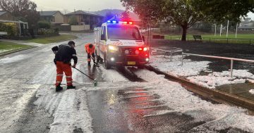
Surprisingly, the Snowy Mountains received a dumping of spring snow overnight, despite temperatures barely reaching zero.
Weatherzone’s Anthony Sharwood said it wasn’t the snow we’re typically used to.
“This stuff was more like wet cement,” he said.
He said it was an “interesting and unusual event” as the airmass which made its way over the region had tropical origins with winds from the northeast.
“That would normally mean rain,” Mr Sharwood explained.
“However, on occasion, precipitation can be so heavy that an unusual phenomenon called the ‘melting effect’ kicks in.
“[Basically] snowflakes, which were frozen at higher levels of the atmosphere, fell through a saturated isothermal layer. As the frozen precipitation fell through this layer and melted, the latent heat of melting cooled the surrounds, lowering the freezing level. So ground-level air that originally wasn’t cool enough for snow was actually made cooler by the action of heavy snow falling through higher levels.”
The Bureau of Meteorology has predicted 15 to 30 millimetres for Canberra tomorrow, with the chance of a thunderstorm.
An ACT ESA spokesperson said they were expecting similar conditions to today.
“We’re not concerned about a massive deluge. We’re expecting consistent showers with a couple of heavy periods,” they said.
Rains were predicted to continue throughout the weekend, before a new high-pressure system was expected to become the dominant weather feature at the start of next week.
Original Article published by Claire Fenwicke on Riotact.


