Flooding along the Molonglo River in 2020 was one of the incidents the local SES unit was involved in. Photo: NSW SES – Captains Flat Unit Facebook.
A new series of sensors could be coming to southeast NSW as part of a flood warning policy guarding a rural township.
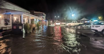
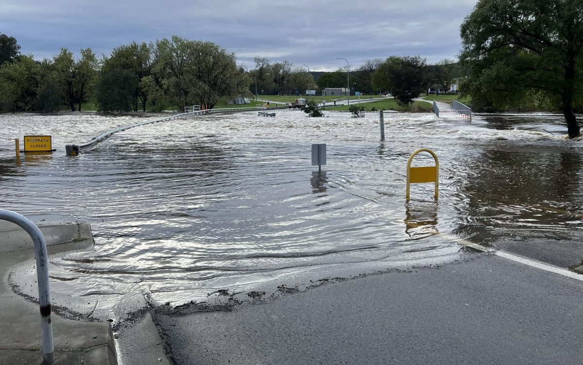
NSW SES Queanbeyan-Palerang Local Commander Robert Cunneen said flooding in the region could be seen as a spectrum, which ranged from minor flooding (triggering road closures) to major (like the 2010 flood that inundated properties).
“It’s definitely something we constantly stay in a state of readiness and preparation for. At the moment, we probably see more flash flooding, as apart from riverine flooding.”
Queanbeyan-Palerang Regional Council (QPRC) has received grant funding from the NSW Department of Climate Change, Energy, the Environment and Water (DCCEEW) as part of its efforts to design a Total Flood Warning System (TFWS) for Captains Flat.
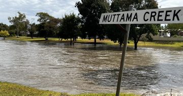
The township is close to the Molonglo River, which discharges through the Captains Flat dam.
The proposal also flags Kerrs Creek, Keatings Collapse and Town Creek as other flood risks.
A TFWS is a series of interconnected components that evaluate an area’s rainfall and river flows to predict the severity of floods and give advance warning to communities.
Its development was a recommendation put forward in the Captains Flat Floodplain Risk Management Study and Plan.
The draft design proposal for the TFWS, which has been released for public feedback, notes there is one radar and five relevant sensors near the township that could be utilised in the system.
Under the proposal, notice would be sent out once water level sensors and rain gauges reached predetermined levels.
It also calls for the installation of two gauges in the Kerrs Creek catchment, with one being used to measure water levels and one for rainfall.
A new rainfall gauge would be installed in the Molonglo catchment (near the Captains Flat radar) and another in the Keatings Collapse catchment.
Radio is also recommended for the transmission of their readings, because of its cheaper cost (compared with other options of satellite or a wired connection) and is seen as more reliable than a cellular connection.
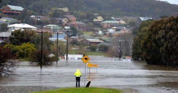
Major and minor floods have occurred across the Queanbeyan-Palerang local government area. Photo: NSW SES Queanbeyan Unit Facebook.
The draft design proposal states installation of the TFWS would be in two phases – one stage would focus on its capacity to generate forecasts of any flooding, while a second would use simulations for spatially varying inundation predictions.
“The gauges [would] provide timely information about current conditions in the system while the weather forecast gives an outlook of whether the situation will worsen,” the document states.
“In phase two, the measured and predicted rainfall are also used to run hydrologic/hydrodynamic models and create a spatially varying forecast of the potential inundation.”
These two stages are stated to have estimated costs of between $182,500 and $215,000 (phase one) and from $75,000 to $145,000 (phase two).
QPRC would consider moving ahead with the second stage after the first one was set up.
According to the project’s page on the council’s website, the finalised design is expected to be presented to councillors by the end of the year.
QPRC will then seek funding to cover the construction of the TFWS once the design is confirmed.
Mr Cunneen said it would become one of the resources emergency services used when planning for disasters (such as when to issue evacuation orders).
“It [flooding] is fairly quick to become an issue, but it’s fairly quick to resolve – the water runs away very quickly, as well.
“That’s why examining the options for notifying people in that valley is important.”
Public consultation on the draft Captains Flat Total Flood Warning System will close on 13 October.
You can see how to give feedback and read the draft design proposal on the Your Voice QPRC website.