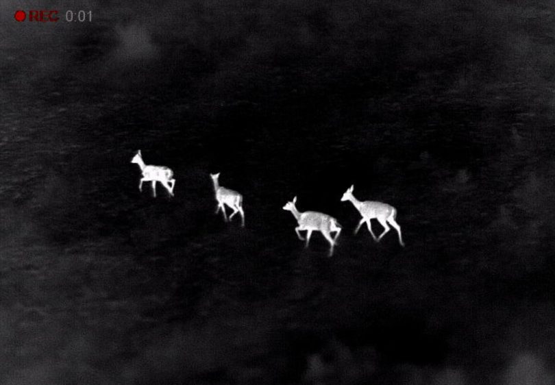
Deer seen through thermal imaging camera. Photo: Supplied.
South East Local Land Services biosecurity teams will use aerial surveillance across south-east NSW in coming months to improve their understanding of feral animals numbers and movements following the southern fires.
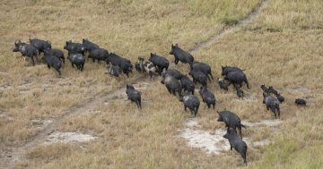
Pests including deer, feral pigs, wild dogs and foxes, are posing a significant challenge to the environment and communities as they move into new areas in search of food.
“This is a unique opportunity for us to get a clear picture of pest numbers and distribution across the region,” said South East Local Land Services Biosecurity Coordinator Kylie Challen.
“The information that we will gather from these surveillance flights will assist us in planning both our short-term reactive measures and our longer-term, more strategic measures and allocation of resources”.
Aerial surveillance for the animals will see helicopters flying set lines at a low altitude in areas identified as pest hot spots. Thermal imaging will be used to assist in accurate species identification and numbers.
“The thermal imaging and aerial surveillance are great tools but they do come with some challenges,” said Ms Challen.
“We need clear weather to fly safely at low altitudes and to be able to see the pests, and we need the ground temperature to be at a suitably low level that it doesn’t impact the clarity of the thermal imaging.
“That’s why we’ve got to make the most of the conditions when they are available and why we want to let the community know about it now.”
South East Local Land Services encouraged land managers and communities to report any sighting, impacts or suspicions of pest animals to their nearest biosecurity team.
“Pests like deer are a real nuisance for producers and the broader public. They increase grazing pressure on pasture, disturb fences, graze, trample and rub against native vegetation and also pose a significant risk to motorists.
“The community plays a really key role in helping us to identify what these pest hot spots might be so we can then go and take a closer look,” said Ms Challen.
To find out more about the aerial surveillance campaign or community-based pest management in your local area contact your nearest Local Land Services office on 1300 795 299.