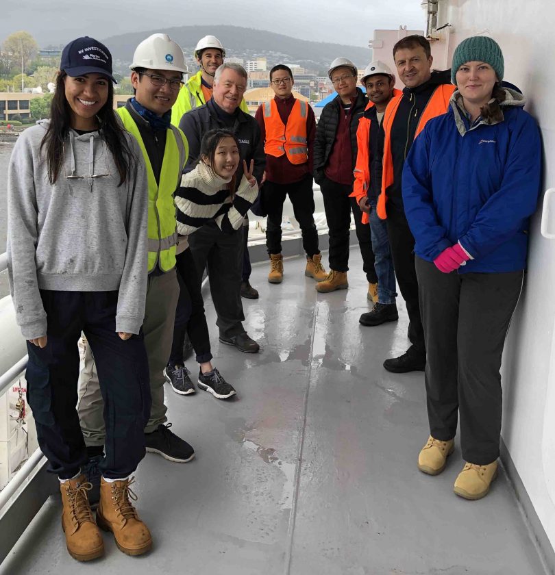
The research team onboard the RV Investigator vessel departing Hobart. Photo: Megan Hartog, CSIRO.
Two researchers from the Australian National University (ANU) are currently onboard a CSIRO marine research vessel that is hoping to crack the secrets at the centre of Earth.
The landmark voyage to discover more about what triggers underwater earthquakes is fittingly being called a ‘groundbreaking’ trip, according to the research team’s chief scientists, Professor Hrvoje Tkalcic and Dr Caroline Eakin.
The team left Hobart on research vessel RV Investigator on Friday, 9 October, and has reported encountering very rough seas in its transit to a remote area known as Macquarie Ridge, halfway between New Zealand and Antarctica. The research team is scheduled to return on 1 November.
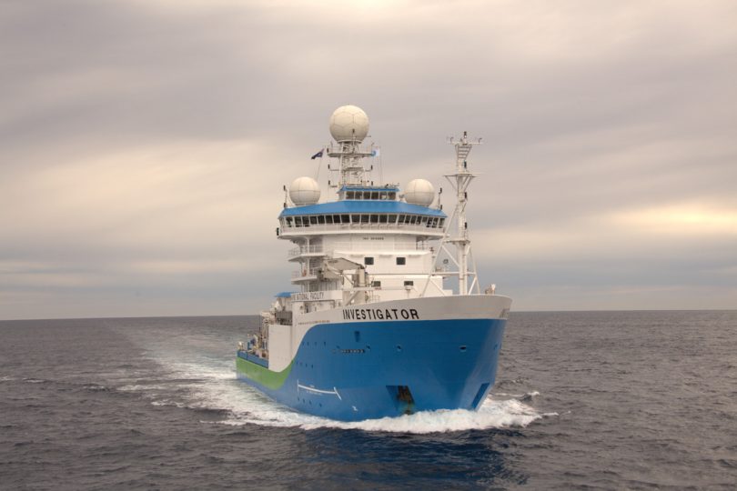
The ship can remain at sea for up to 60 days and cover 10,000 nautical miles.

Australian marine research vessel RV Investigator. Photo: CSIRO.
Croatian-born scientist Professor Tkalcic said this was the first Australian-led voyage of its kind and will place special monitoring equipment on the ocean floor that will provide vital information about some of Earth’s most violent underwater earthquakes.
It could also help scientists understand future earthquakes and tsunamis that might affect coastal populations in Australia and New Zealand.
“We’ll deploy 29 ocean bottom seismometers on the seafloor in total,” said Professor Tkalcic. “These devices record the motion of the ground during earthquakes.
“The instruments will surround Macquarie Island, a region in the Southern Ocean’s Furious Fifties latitudes renowned for extreme seas and weather.”

Professor Hrvoje Tkalcic from ANU. Photo: Supplied.
Professor Tkalcic said the seismometers will not only provide clues about major earthquakes, but also add to our understanding of everything from oceanic storms to glacial dynamics and whale migration.
“The particular area where we’ll be deploying them is really interesting because it produced one of the largest underwater earthquakes of the 20th century,” he said. “It is in the area where the Australian plate meets the Pacific plate, but it’s not known as an active subduction zone so these earthquakes are still a mystery to us.
“Earthquakes in this region present significant tsunami hazards and are a threat to a massive coastal population.
“The seismometers will act like a giant telescope, but instead of pointing towards the sky, they’ll be pointing towards the Earth’s centre.”
According to Professor Tkalcic, seismometers have been set up in some of the most remote corners of the earth, but oceans make even distribution difficult.
“It’s like if a medical doctor has receivers on just one side of a patient’s body and is trying to figure out what is happening,” he said.
“This will give us a much more complete picture. It will ensure Australian researchers are at the forefront of the world’s efforts in this field.”
At the same time, scientists from the University of Tasmania, led by Professor Mike Coffin, will conduct research that will allow them to produce the first high-resolution maps of the seafloor surrounding Macquarie Island.
Professor Coffin says the creation of seafloor maps identifying faults, fracture zones and seafloor spreading centres will shed light on how and why Macquarie Island, which formed around 2500m below sea level, was thrust above sea level.
“Macquarie Island is world heritage listed because of its unique geological exposures of both crustal and mantle rocks, and the island hosts Australia’s only sub-Antarctic research station,” said Professor Coffin.
The ANU team will return to the same spot next year to retrieve the seismometers and the data they’ve recorded.
The project is an international collaboration with researchers from the University of Cambridge, in the UK, and the California Institute of Technology, in the US. It is supported by a grant of sea time on RV Investigator from the CSIRO Marine National Facility, as well as an Australian Research Council Discovery Project grant.
Original Article published by Michael Weaver on The RiotACT.


