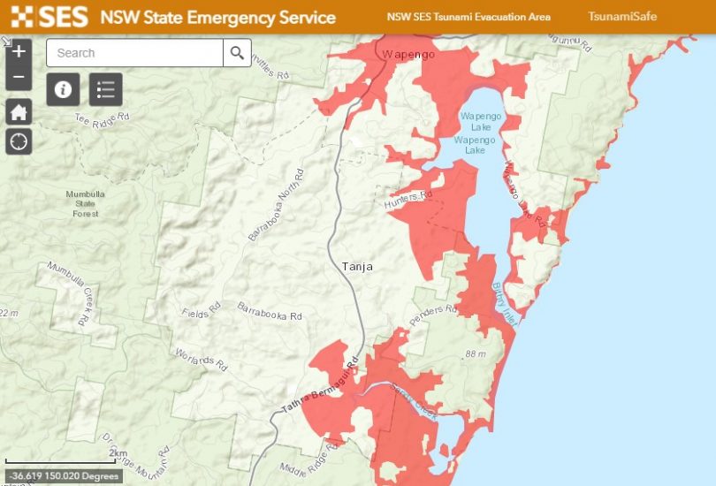
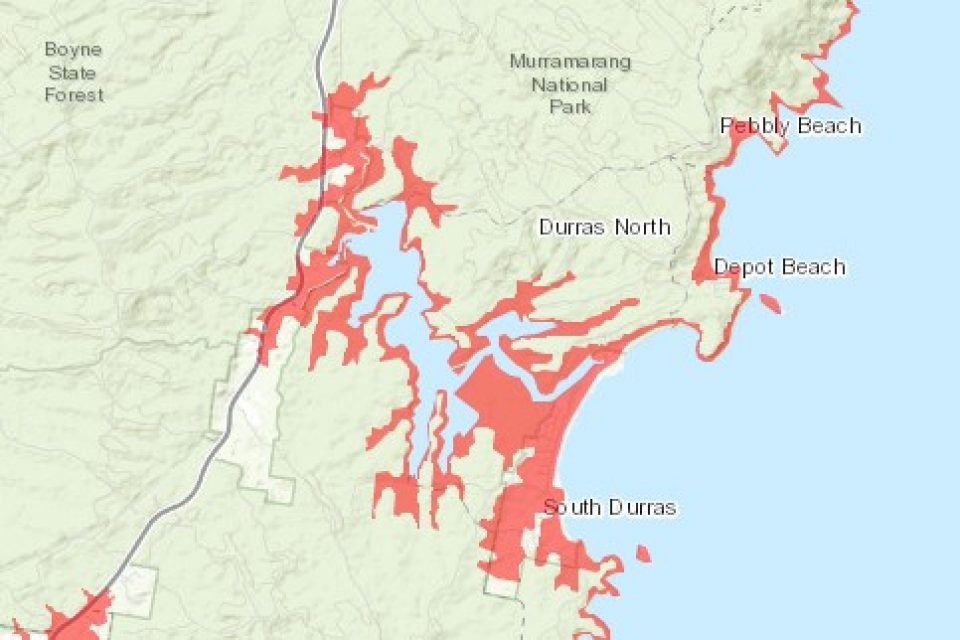
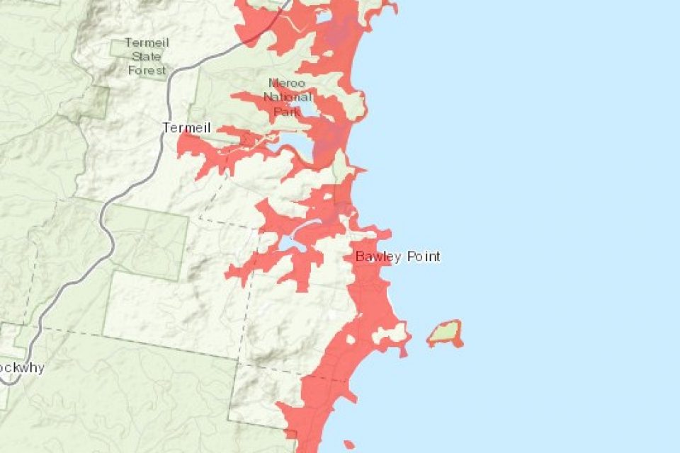
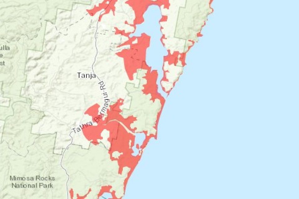
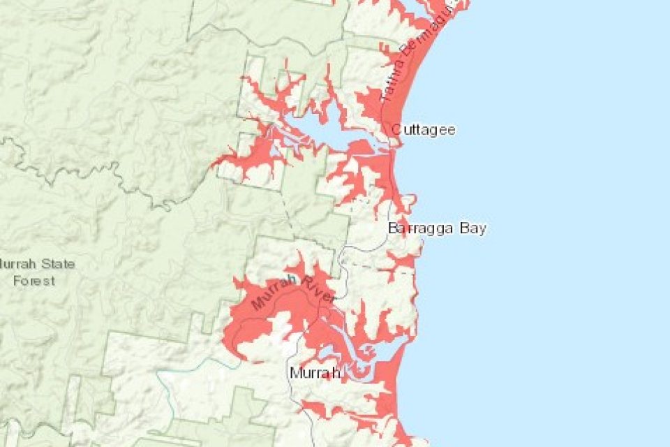
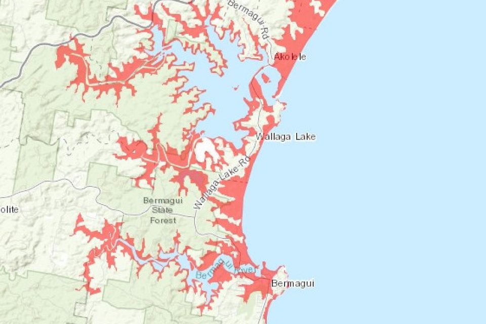
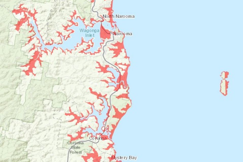
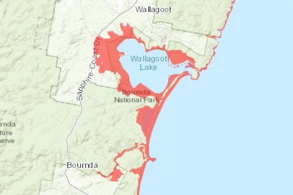
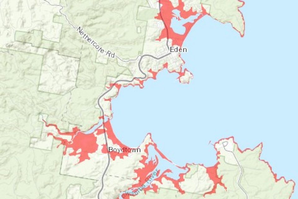
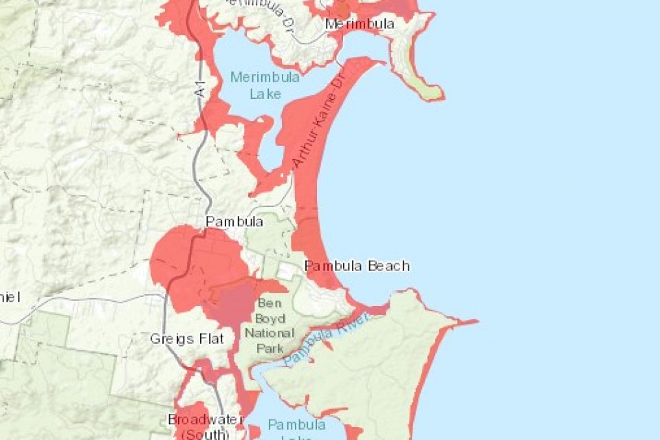
The NSW State Emergency Service tsunami evacuation map shows South Coast areas of high risk in the case of a tsunami of the Australian east coast. Image: NSW State Emergency Service.
We’ve had bushfires, floods, a mouse plague, an earthquake and the global COVID-19 pandemic – should we be worried about a tsunami?
New maps released by the NSW State Emergency Service (NSW SES) show evacuation areas along the NSW South Coast in the event of a land-threat tsunami.
While the NSW SES says the likelihood of a land-threat tsunami on the east coast of Australia is low, the maps show the areas where residents and workers would have to move to higher ground in the event one occurred.
Marine-threat tsunamis occur about once every six years, but are usually only dangerous to swimmers and boaters because of dangerous currents.
There is no record of a land-threat tsunami in Australia since European settlement.
The new map shows coastal areas around Batemans Bay, Moruya, Narooma, Tuross Head, Pambula and Bermagui are most at risk of inundation.
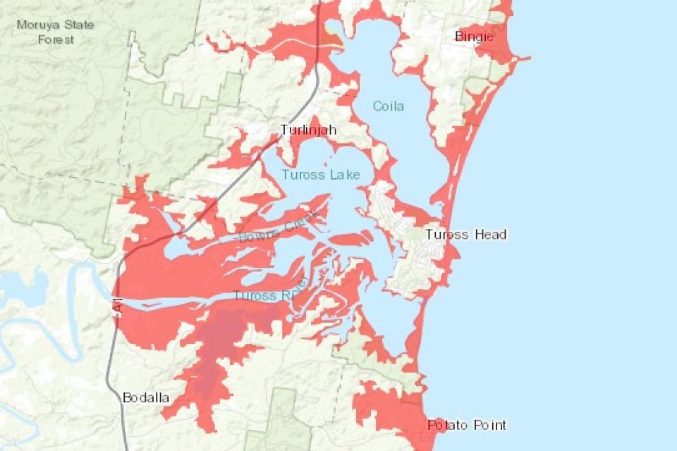
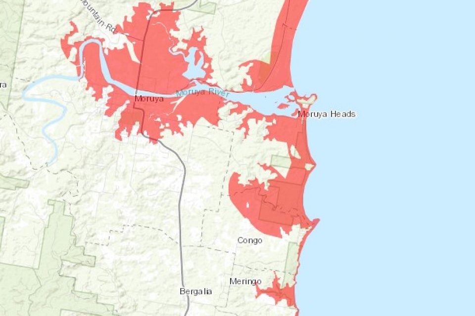
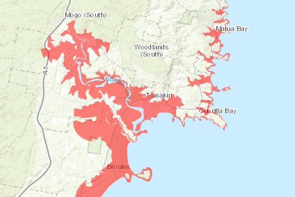
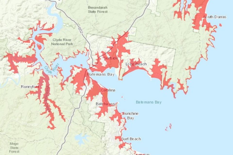
If there is a threat of land inundation from a tsunami, the advice for residents in risk areas is to move to higher ground, at least 10 metres above sea level or 1km away from the coast and rivers.
Be sure to listen to your local radio station for information, warnings and advice.
The NSW SES says knowing your tsunami risk means knowing what a tsunami is and if where you live, work or travel to may be a place where a tsunami can impact.
The frequency of tsunami in NSW is very low, but the consequences of a tsunami can be devastating as witnessed in Indonesia in 2004 and Japan in 2011.
A tsunami is a series of waves generated by a number of causes, including vertical movement of the sea floor as the result of a large earthquake; submarine or coastal volcanic eruptions; meteor impacts; and coastal landslides and slumps, either land-based or submarine.
The Joint Australian Tsunami Warning Centre monitors earthquakes that could potentially cause a tsunami that could affect Australia by operating an enhanced network of seismic stations nationally. It also has access to data from international monitoring networks.
The centre determines the magnitude, location and characteristics of a seismic event which has the potential to generate a tsunami.
Based on this seismic information, the centre runs a tsunami model to generate a first estimate of the tsunami size, arrival time and potential impact locations.
The centre verifies the existence of a tsunami using information from an enhanced sea level monitoring network of buoys positioned strategically between the key earthquake zones and the NSW coastline.
The centre then sends advice and warnings on any possible tsunami threat to state and territory emergency management services, media and the public.
You can get more information and view the tsunami risk map here.