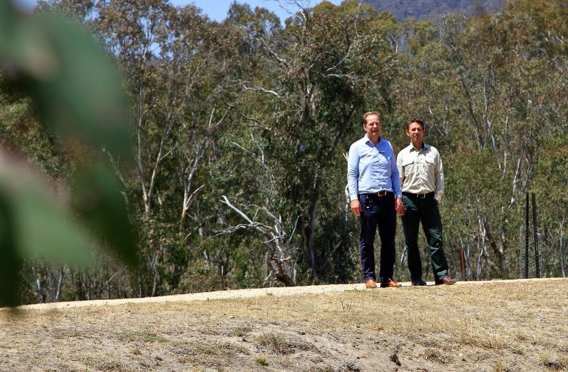
ACT conservator of flora and fauna Ian Walker (left) with operations manager of ACT southern parks and reserves Peter Cotsell at the Namadgi Visitors’ Centre. Photos: Michael Weaver, Region Media.
The entire Namadgi National Park may be closed before Christmas if the current dry conditions continue.
This was the opinion of ACT Conservator of Flora and Fauna Ian Walker who on Thursday (12 December) closed the Bimberi Wilderness area due to significant fire risk in remote regions of the Namadgi National Park. The closure will remain in place until the end of March 2020.
The Bimberi Wilderness area is a 28,900-hectare area and makes up 27 per cent of Namadgi National Park.
It is also a popular destination for many back-country bushwalkers and users of the Australian Alps Walking Track.
Water also stopped flowing in the adjacent Murrumbidgee River at Tharwa a week ago, and Mr Walker said that if the current conditions prevail, a decision will have to be made as to whether the entire 106,095 hectares of the Namadgi National Park remains open.
Mr Walker said he expects that decision will be made before Christmas.
“The closure of further areas of the Park is a consideration that will have to be monitored going forward,” Mr Walker said while fronting the media at the Namadgi Visitors’ Centre.
“Our monitoring will help us determine whether we do that, and it will also show this continued elevated risk. If we don’t get rain, there is a probability that we will make further closures.”
Mr Walker also said that if a lightning strike were to hit in the Namadgi National Park, he was confident their strategies would ensure it could be contained despite there being limited water in the Murrumbidgee River and dams in the area.
“Lightning strikes are the most common cause of bushfires, so we will always monitor that risk. We have aircraft and our spotters out assessing whether a fire takes off.
“As the conditions continue to dry, there is a likelihood that the fires will take off fairly quickly and that’s one of the reasons we’re putting this closure in place to help avoid people getting caught in dangerous circumstances,” Mr Walker said.
He also said the remoteness of the area and access significantly limits their ability to control fire and respond to people caught in a fire.
Assessments made in the area indicate that conditions are currently drier than they were the last time the decision was made to close the Bimberi Wilderness in December 2002.
Mr Walker said the moisture level in areas they have monitored is in the 6 per cent range, which makes the ground extremely dry and highly vulnerable to fire.

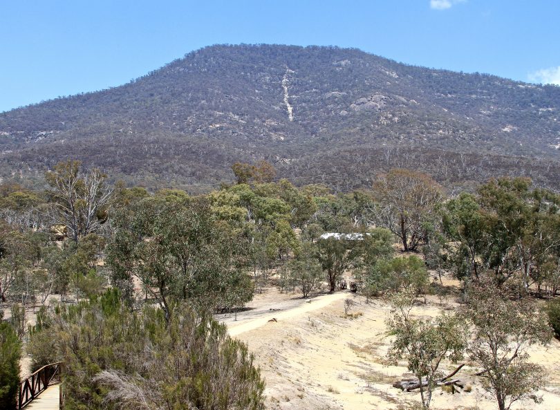
Mt Tennent as seen from the Namadgi Visitors’ Centre.
The operations manager of ACT’s southern parks and reserves, Peter Cotsell, said conditions are the driest he has seen and that large logs in the Bimberi area pose a significant risk given how dry they have become.
He said most of the rivers in the area stopped running “a few weeks ago”, which poses a further problem should firefighters require quick access to water.
“We’ve had water monitoring stations that used to be in the rivers. Now they are in dry land and can’t be measured because there’s no flow,” Mr Cotsell said.
“We do have a few dams with some capacity for fire submission if we need them. Obviously, we’ll need to monitor that when the time comes, but there are appropriate measures for helicopters with buckets, so we’ve got water out there in the catchments if we need it.”
The news is also not good according to the Bureau of Meteorology, with temperatures forecast to go into the high 30s from Monday next week, with a zero chance of rain. Next Wednesday (18 December) has a current forecast top temperature of 38 degrees.
Mr Walker said signage of the closure of the Bimberi Wilderness will be placed at all locations impacted.
“Selected roads within Namadgi National Park will also be closed when a total fire ban is declared in the ACT,” Mr Walker said.
“Mandatory closures and restricted access during a total fire ban include Corin Road, Old Mill Road, Warks Road and the Mount Franklin Road at Piccadilly Circus.”
Specific locations impacted include:
- The ACT section of the Australian Alps walking track
- Pryors Hut
- Mt Gingera
- Mt Bimberi
- Cotter Hut
- Upper Cotter, Namadgi National Park.
Public access to the Bimberi Wilderness area will be closed at:
- Ginini Carpark, Mt Franklin Road
- Stockyard Spur, via Corin Dam Road
- Smokers trail, via Corin Hub
- Cotter Hut road, via Orroral Valley
- Leura gap
- Murray gap
- Yaouk gap.
Further information on the Bimberi Wilderness closure can be obtained by contacting Access Canberra on 13 22 81 or by visiting the Bimberi closure page on the ACT Government website.

The Bimberi Wilderness area in the Namadgi National Park that has been closed. Image: Supplied.
Original Article published by Michael Weaver on The RiotACT.


