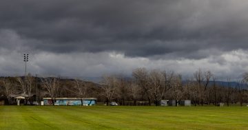
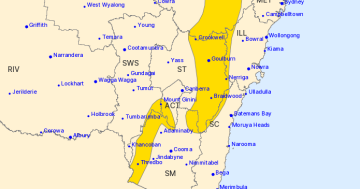
Nimmitabel saw a dusting of snow – and it wasn’t the only place to feel the chill. Photo: Nimmitabel Royal Arms Hotel/Facebook.
A cold snap has brought a dusting of snow and gusty winds to southeast Australia, but warmer weather is on the horizon.
Bureau of Meteorology senior meteorologist Angus Hines told Region the system arrived late on Tuesday and overnight.
“It had been a pretty warm spell across the southeast of the country, but those temperatures have fallen away pretty sharply,” he said.
“Some places saw temperatures around about 6 degrees or so below their averages for the time of year.”
He described the system as a “textbook” cold front, although “they do become less and less frequent throughout spring”.
“But I would say, particularly in the first half of the season … we still very commonly do see these cold fronts.”
The current cold snap brought a dusting of snow, including small snowfalls in the Snowy Mountains.
Off the mainland, Tasmanians saw a “pretty noteworthy” estimated 5 cm of snow.
But Mr Hines ruled out a snowy start to spring.
“There’s nothing really too optimistic on that front in terms of more snowfall.
“Today is certainly cold enough that snow would be possible in the mountains, but most of the rain, and therefore the snow, has already fallen.”
The system follows a disappointing snow season. Selwyn Snow Resort closed early in late August after a warm winter and rainfall.
Earlier this month, Thredbo Resort also confirmed that it would shut its skiing and snowboarding operations on 13 September.
Mr Hines said winter jackets will come in handy today and Thursday, but relief will arrive soon.
Canberrans are shivering through a high of 13 degrees today and battling wind gusts up to 40 km/h.
“Given that gusty southerly wind, the ‘feels like’ temperature is expected to fall to between 8 and 10 degrees,” he said.
“It’s really feeling like quite a fresh day if you’re out in an area that is exposed to that southerly wind. I can’t completely rule out the chance of a quick passing shower or two, but certainly no significant rainfall in the forecast.”
The weekend’s looking pretty good, though.
The mercury will rise to 23 degrees by Friday, then reach 25 degrees over the weekend.
He also said southern NSW is seeing similar conditions, with temperatures in the low-30s.
Coastal communities should expect rough seas.
“If anyone’s on or near the water, it’d certainly be pretty blustery out there with some choppy seas and some pretty large waves as well,” Mr Hines said.
In Wollongong, temperatures will reach the high-20s in the coming days, peaking at 28 degrees on Sunday.
Further south, Batemans Bay will hit a high of 32 degrees on Sunday, while Moruya will also hover around that temperature.
It’s a similar story in the Riverina, with Wagga Wagga reaching 27 degrees on Sunday and Griffith expected to reach 31 degrees.
Original Article published by Claire Sams on Region Canberra.