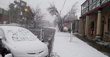
Light snow fell overnight in Goulburn, with heavier falls across Crookwell and the Tablelands. Photo: M. Weston.
The earliest snowfall that old-timers can remember has fallen on the Southern Tablelands overnight, closing the Goulburn to Crookwell and Taralga to Laggan roads and filling social media with photographs of cars covered in snow. Light snow also fell in Goulburn.
“I don’t think I can remember it ever snowing around May, and I’ve spent 50 years farming in the district,” retired Breadalbane district farmer Tony Morrison said. “We usually see the snowfalls much later in the seasons, between August and September.
“There’s some early lambing in June around the district and the snow will be knocking them around, but it was all over pretty quickly. The real damage for livestock is done when it goes on for two or three days.
“It’s never too late to get moisture at any time of the year. The effect will be a bit slow because the conditions have cooled down, but there are crops and pastures that desperately need a drink. There’s a real worry that it’s been so dry that they won’t survive.”
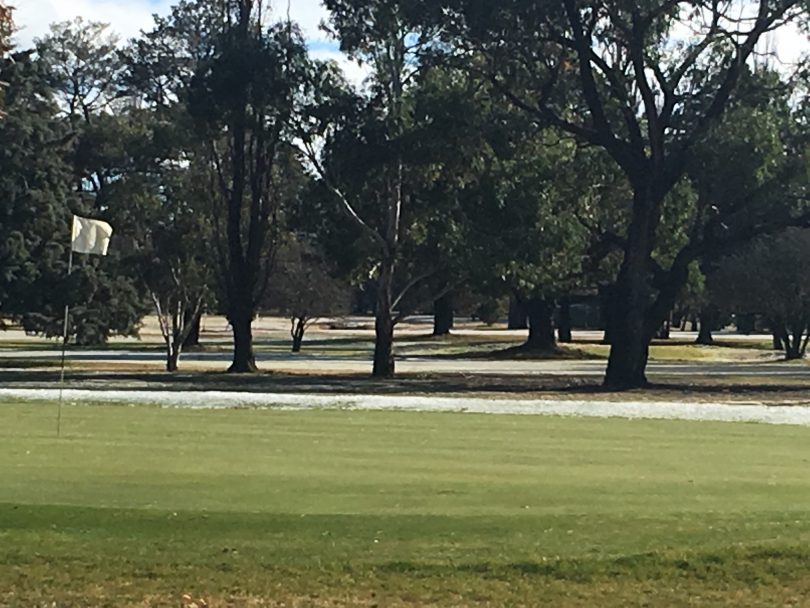
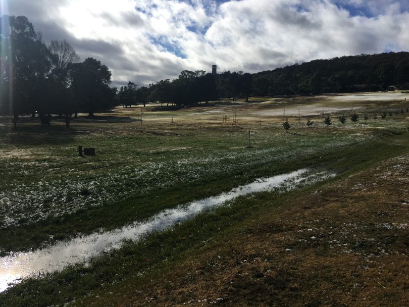
Snow on the Goulburn golf course. Photo: M. Weston.
Around 36mm of rain fell immediately after the snow and the Bureau of Meteorology measured temperatures below zero at the Goulburn Airport with an apparent temperature low of minus 3.3 at 4 am.
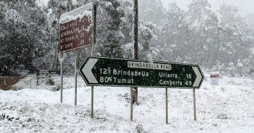
Snow also fell in some parts of the Yass Valley and the Blue Mountains. None is predicted for the ACT, although the freezing weather system comes on the back of unusually early falls of snow in the high country just before the official start of the ski season.
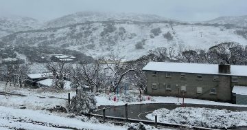
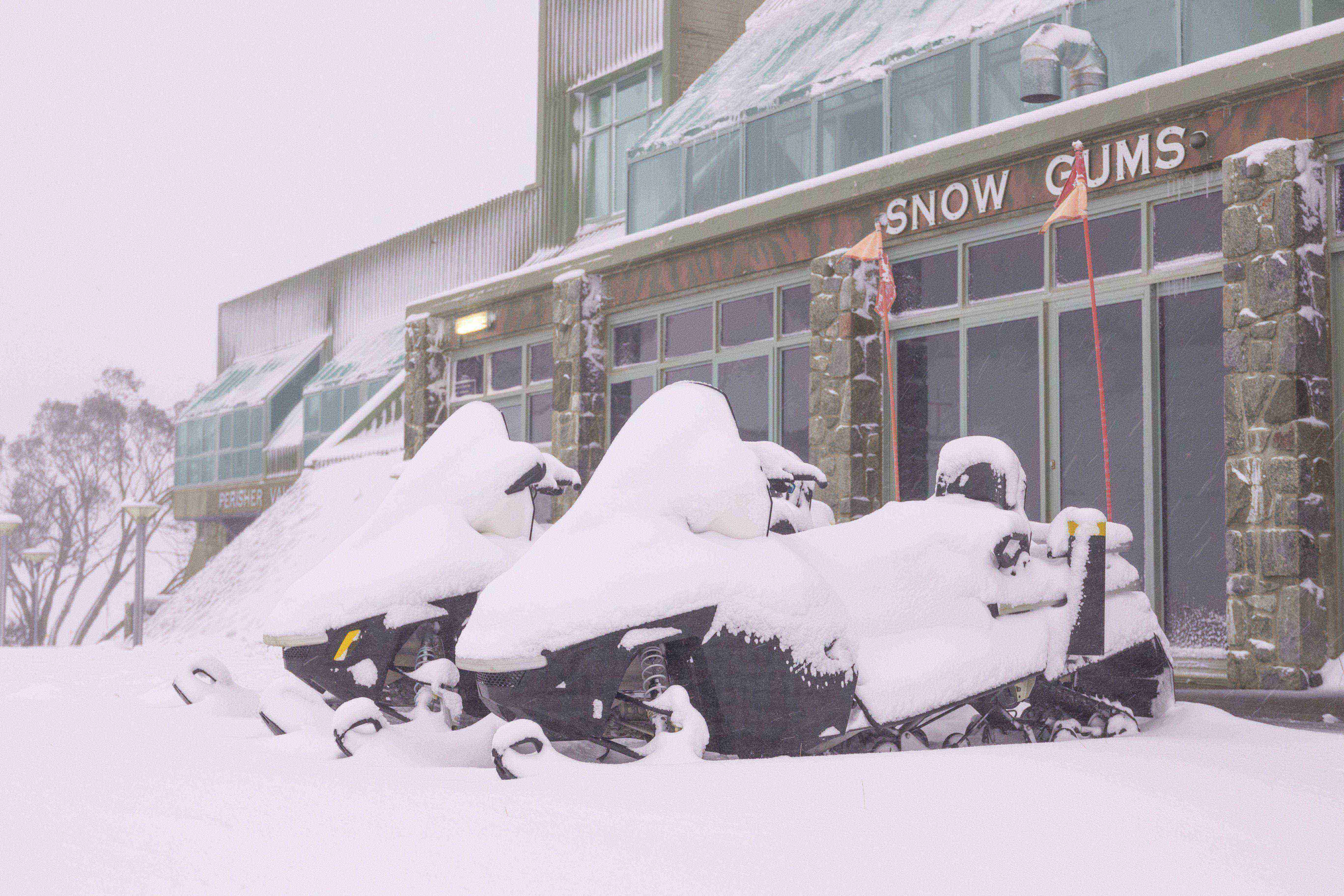
Perisher enjoyed more than 75 centimetres of snow, enabling the ski resort to open one week earlier than the traditional June long weekend start.
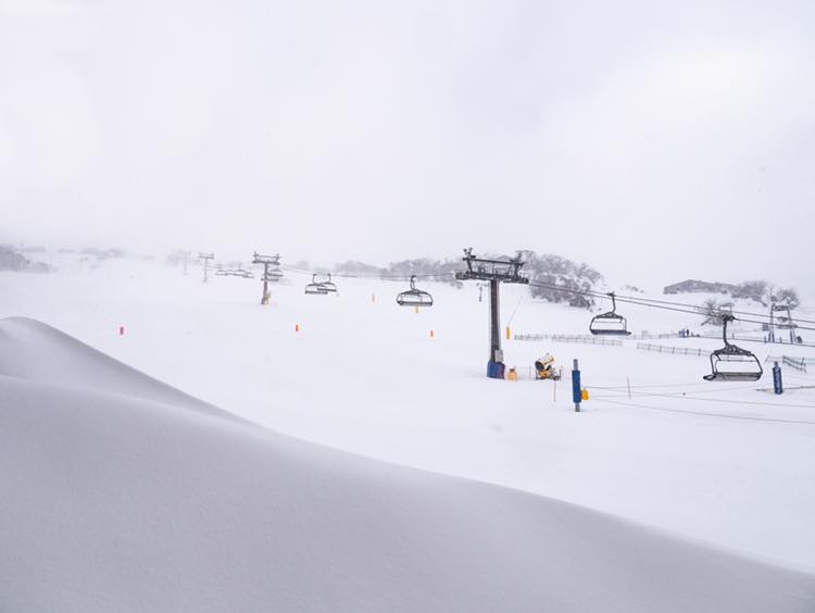
“15cm of fresh snow overnight & still coming down!” the Perisher Facebook page says. Photo: Facebook.
Veteran meteorologist Clem Davis says the snow results from a pool of cold air from the south which means that “an early winter has set in. The high-pressure system in the Bight has a ridge to the south, which is bringing up this cold air that’s produced these conditions for the last week or so.
“It was cold enough to produce rainfall that fell as snow,” Clem says. But while the early snow is unusual, he adds that it’s not without precedent. “I can remember snow falling here in Canberra on May 28, 2000, and it was heavy enough to be on the ground during a Raiders game, which was the first time many of them had played in snow,” he said.
Chilly waking up in Canberra today? Spare a thought for our friends up near Goulburn who woke to a mix of heavy rain and snow flurries. Pic via Taylor Allcock pic.twitter.com/eTutITZVfL
— Tim the Yowie Man (@TimYowie) June 3, 2019
Clem says the snow will usually fall overnight when temperatures drop to their lowest. It needs to be less than two degrees for the moisture in the weather system to turn into snow, and that’s most likely at the highest elevations.
Clem adds that these kinds of weather patterns from the south also tend to follow the ranges, falling most heavily in places like Crookwell which are elevated and exposed. The same systems will often produce snow in Orange and Bathurst as they move northwards.
Original Article published by Genevieve Jacobs on The RiotACT.