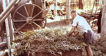
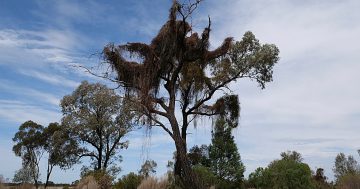
Bland Shire Council will take its concerns about NSW Government environmental mapping to councils across the state. Photo: Bland Shire Council.
Bland Shire Council is taking local farmers’ concerns about the NSW Government’s controversial “pink maps” to councils across the state, after voting unanimously last month to submit a motion to the Local Government NSW annual conference in Wollongong in November.
Councillors recently backed the motion calling on the State Government to speed up its review and reform of the Biodiversity Values Map – which they refer to as “pink maps” – and to establish an oversight committee with equal rural and government representation, backed by legal oversight, to progress that review as a matter of urgency.
In practical terms, Bland Shire wants landholders to have a greater say in how environmentally sensitive land is identified, and a clearer, faster way to challenge mapping it believes is wrong.
If the motion is carried at the November conference, Local Government NSW would be asked to take the issue up with the NSW Government on behalf of councils across NSW – adding Bland Shire’s voice to a growing chorus of rural bodies pushing for reform.
Bland Shire Mayor Brian Monaghan said the mapping was creating significant challenges for local landholders, some of whom were concerned about their ability to carry out normal farming activities on their own properties.
“Rural people must have a genuine say in decisions that directly affect their land, livelihoods and communities,” Cr Monaghan said.
“The current process does not provide a clear, timely or effective review pathway for affected landholders. An oversight committee would give the process the transparency and accountability it currently lacks.”
The council’s intervention follows almost two years of campaigning by farmers around West Wyalong and Tallimba after they began receiving notices about draft mapping in October 2024.
They have argued ever since that some areas identified as environmentally sensitive don’t reflect what’s actually on the ground, with pink boundaries, they say, extending across long-worked paddocks, introduced trees, farm tracks and other established infrastructure.
Much of the dispute centres on land identified as containing a critically endangered ecological community dominated by mallee and broombush – a classification with real consequences for two industries that have operated around West Wyalong for generations.
Blue mallee has been harvested and distilled for eucalyptus oil since the early 1900s, while broombush is used to make brushwood fencing and both have traditionally been harvested through coppicing, where plants are cut near the base and left to regrow rather than being permanently removed.
But cutting native vegetation can legally be treated as clearing, and farmers argue a pink classification can stop them from continuing that commercial harvesting without obtaining a separate approval – effects that ripple out to harvesting crews, truck drivers, processors and fencing businesses well beyond the individual landholder.

Landholders’ Right to Farm is highlighting what it believes are mistakes in NSW Government vegetation mapping through its “Pink Map Error of the Week” campaign. Photo: Landholders’ Right to Farm/Facebook.
Local representatives carried the issue to the NSW Farmers annual conference in July, where delegates supported a motion – moved by Landholders’ Right to Farm president Annabelle Davis – seeking urgent completion of an independent scientific review of the mallee and broombush listing.
“The committee has now had this independent scientific evidence before it for 10 months, yet there has been no timeline provided for completing the review,” Ms Davis said.
The West Wyalong-based Landholders’ Right to Farm group has since begun publishing what it says are concrete examples of mapping errors, through a “Pink Map Error of the Week” campaign.
Highlights so far include an urban roundabout and a property’s driveway, swimming pool and tennis court, all appearing within areas mapped as native vegetation.
The campaign has since widened to cover bushfire preparation.
Yalgogrin Bush Fire Brigade captain Jack Jones has warned that restrictions on pink-mapped land could leave some properties with firebreaks too narrow for crews to enter or turn a truck around safely during a fire.
“There is no way I will send crews into land mapped pink,” Mr Jones said.
“Try turning a fire truck around in three metres. With vegetation on either side, thick smoke, the fire running and the wind changing, this isn’t a desk exercise.”
A spokesperson for NSW Environment Minister Penny Sharpe said emergency firefighting and bushfire hazard reduction work was exempt from offences under native vegetation laws – though the brigade argues that doesn’t give landholders a clear, practical way to prepare properties before a fire actually starts.
The government is reconsidering whether the mallee and broombush vegetation around West Wyalong and Tallimba should keep the highest level of environmental protection with Ms Sharpe committing additional resources to the Threatened Species Scientific Committee to help it finish its review and Agriculture Minister Tara Moriarty agreeing to personally inspect affected properties.
The committee says it is considering all relevant information and has prioritised the review, but has not announced a completion date.
Until it reports, the disputed pink classifications and restrictions remain in place.
That unresolved review is also why Bland and Temora shires were left out when the government finalised its Native Vegetation Regulatory Map across most of rural NSW on 31 August, ending transitional arrangements that had been in place since 2017.
For farmers elsewhere, that final map now provides the official colour-coded record of which native vegetation rules apply to different parts of their properties: blue generally marks land where clearing is less restricted, yellow shows regulated land where eligible clearing can proceed under the Native Vegetation Code, and pink marks sensitive land where that code cannot be used at all.
The government says finalising the map didn’t introduce new clearing restrictions, though landholders doing eligible clearing on yellow land must now notify Local Land Services at least 14 days beforehand.
The council has been asked to clarify whether its LGNSW motion is intended to cover both maps or just one.
Local state MP Steph Cooke, Member for Cootamundra, was consulted while the council developed its motion, and has been visible on the ground throughout.
She recently accompanied the state’s Shadow Environment Minister Jacqui Munro to Bland Shire to meet farmers, businesses and council representatives affected by the mapping.
“The people we met are good farmers who have been carrying out responsible land management practices for generations,” Ms Cooke said afterwards.
“What they’re facing now is uncertainty because the rules have changed around them.”
Landholders can check the Biodiversity Values Map and Threshold Tool and the Native Vegetation Regulatory Map online. Information about Native Vegetation Regulatory Map categories and the free review process is available through NSW Environment and Heritage.