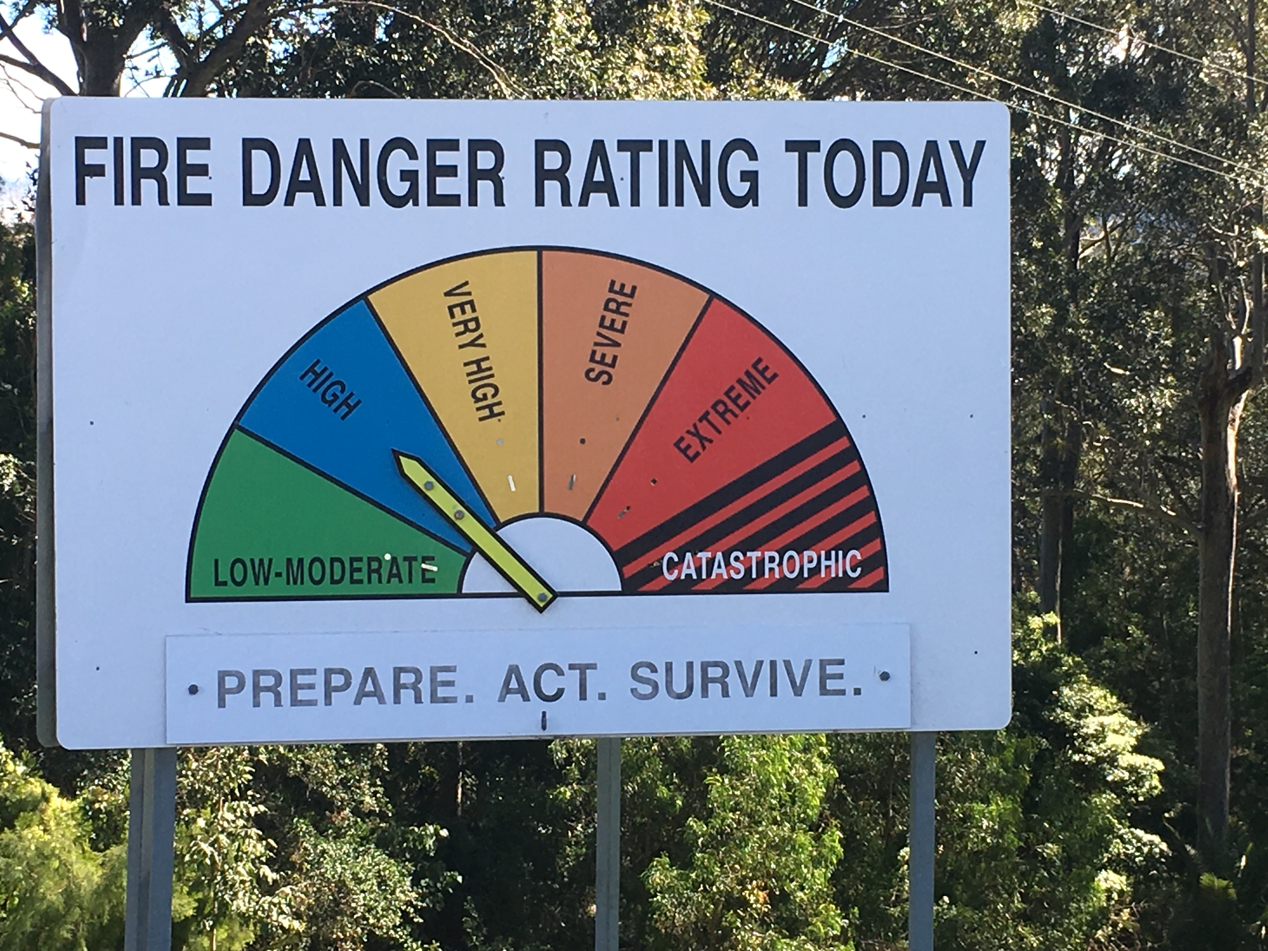
Fire Danger Rating signs, part of the landscape in South East NSW. Photo: Ian Campbell
The truth behind the workings of the region’s ‘Fire Danger Rating Signs‘ isn’t as colourful as I’d hoped.
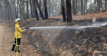
However, it is another indicator of the commitment and dedication of the Rural Fire Service in South East NSW and a reminder of the devastating potential that exists in the environment we live in.
Where ever I travel these signs of green, blue, orange, and red catch my eye, a marker of dry times and wet times, and different geography. There is something universal about them, like a pot hole on the main street – every town has one.
And so simple, clear, effective – survivors in a high tech age.
When I started to see their arrows change and move up a notch or two with the changing season I was reminded of a long held mystery. Who changes them? How do they change? Never have I seen one being changed.
Asking that question of locals on Facebook prompted a range of creative answers.
Mixed with obvious affection for this service, it was suggested different mythical creatures, along with squads of ninjas, and ‘invisible people of the dark’ were all responsible for this very public but seldom seen work.
After at first suggesting goblins, trolls, and pixies changed the signs, one of the region’s fire chiefs revealed the secret.
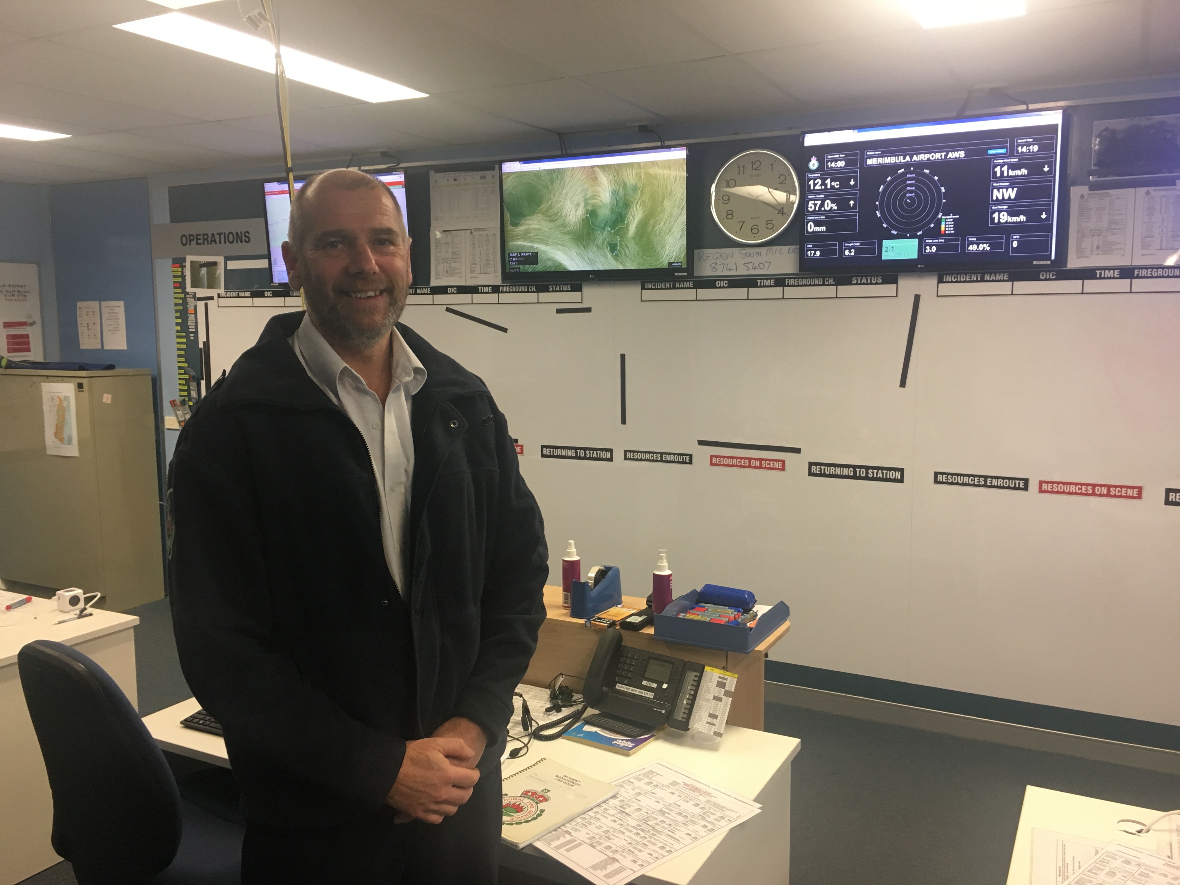
Community Safety Officer, Marty Webster. Photo Ian Campbell
Marty Webster is the Community Safety Officer with Far South Coast Rural Fire Service, he told About Regional that the signs change as a result of information from the Bureau of Meteorology.
“We get the ratings through and then we hit the pagers and one of our dedicated volunteers goes out and makes the change to the sign,” Marty explains.
“It happens when ever there is a change to the rating, typically over the winter months they’ll stay on low – moderate, moving into spring is when they start fluctuating, and over summer they can change daily.”
Marty says each RFS brigade is responsible for the signs in their patch, and often it’s the volunteer that lives closest to the sign who will go out, undo the padlock at the back of the pointer and move the sign accordingly.

Behind the Fire Danger Rating signs. Photo: Ian Campbell
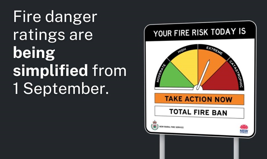
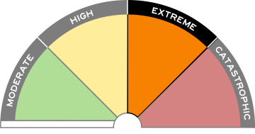
When it comes to working out which of the six fire danger ratings the arrow will be stuck to, a range of factors are taken into account.
“Humidity, wind speed, temperature, and the state of the fuel – quite a complex algorithm that the Bureau does for us,” Marty says.
Each step along the way points to the predicted intensity of a bushfire if one was to start on that day.
“So at Low – Moderate, fires under those conditions will be fairly easy to contain,” Marty explains.
“At Very High, fires can be really unpredictable and there is a significant risk of house losses.
“Severe is where we hit Total Fire Ban, and then we move up to Extreme and Catastrophic, by the time we get to Catastrophic we are basically saying – no houses are designed or prepared well enough to withstand fire under those conditions,” he says.
What is of some comfort is that those days at the high end don’t come out of the blue and tend to be forecast days ahead.
“Certainly at Very High I’d be really encouraging people to look at their level of preparation,” Marty says.
The Community Safety Officer suggests that people use the fire danger rating signs as part of a Bush Fire Survival Plan.
“They are really valuable trigger points, so for example on a day of High Fire Danger people should start monitoring the RFS website more closely and as the fire danger rating increases or the situation changes other actions and decisions can be initiated,” Marty says.
The official bushfire season started on September 1 through the Bega Valley and Eurobodalla meaning fire permits are now needed. Landholders on the Monaro and in the Snowy Mountains have until October 1 before permits are needed.
Call your Local Fire Control Centre for advice.
*Another local story made with the contribution of About Regional members, thanks to Maria Linkenbagh, Tabitha Bilaniwskyi-Zarins, Jeanette Westmore, Fiona Cullen, and Kiah Wilderness Tours.